Directions to J & J Graphics, Llc. (Salem) with public transportation
The following transit lines have routes that pass near J & J Graphics, Llc.
 Bus: 455, 441.
- Train: NEWBURYPORT/ROCKPORT.
How to get to J & J Graphics, Llc. by bus?
Click on the bus route to see step by step directions with maps, line arrival times and updated time schedules.
From Market Basket, Revere
53 minFrom Four Points by Sheraton Boston Logan Airport, Revere
59 minFrom Kowloon Restaurant, Saugus
75 minFrom Saugus, MA, Saugus
56 minFrom Cummings Center - Beverly, Beverly
44 minFrom Comfort Inn & Suites Logan International Airport, Revere
51 minFrom Walmart, Lynn
35 minFrom 7F Everett Street, Revere
61 min
How to get to J & J Graphics, Llc. by train?
Click on the train route to see step by step directions with maps, line arrival times and updated time schedules.
Bus stops near J & J Graphics, Llc. in Salem
Train station near J & J Graphics, Llc. in Salem
- Lynn Interim, 26 min walk,VIEW
Bus lines to J & J Graphics, Llc. in Salem
What are the closest stations to J & J Graphics, Llc.?
The closest stations to J & J Graphics, Llc. are:
- Loring Ave @ Vinnin St is 87 yards away, 2 min walk.
- 1000 Paradise Rd is 383 yards away, 5 min walk.
- Lynn Interim is 2151 yards away, 26 min walk.
Which bus line stops near J & J Graphics, Llc.?
455 (Salem Depot Via Central Square)
Which train line stops near J & J Graphics, Llc.?
NEWBURYPORT/ROCKPORT (#120 | North Station)
What’s the nearest train station to J & J Graphics, Llc. in Salem?
The nearest train station to J & J Graphics, Llc. in Salem is Lynn Interim. It’s a 26 min walk away.
What’s the nearest bus station to J & J Graphics, Llc. in Salem?
The nearest bus station to J & J Graphics, Llc. in Salem is Loring Ave @ Vinnin St. It’s a 2 min walk away.
What time is the first train to J & J Graphics, Llc. in Salem?
The NEWBURYPORT/ROCKPORT is the first train that goes to J & J Graphics, Llc. in Salem. It stops nearby at 5:27 AM.
What time is the last train to J & J Graphics, Llc. in Salem?
The NEWBURYPORT/ROCKPORT is the last train that goes to J & J Graphics, Llc. in Salem. It stops nearby at 12:20 AM.
What time is the first bus to J & J Graphics, Llc. in Salem?
The 455 is the first bus that goes to J & J Graphics, Llc. in Salem. It stops nearby at 5:10 AM.
What time is the last bus to J & J Graphics, Llc. in Salem?
The 455 is the last bus that goes to J & J Graphics, Llc. in Salem. It stops nearby at 12:58 AM.
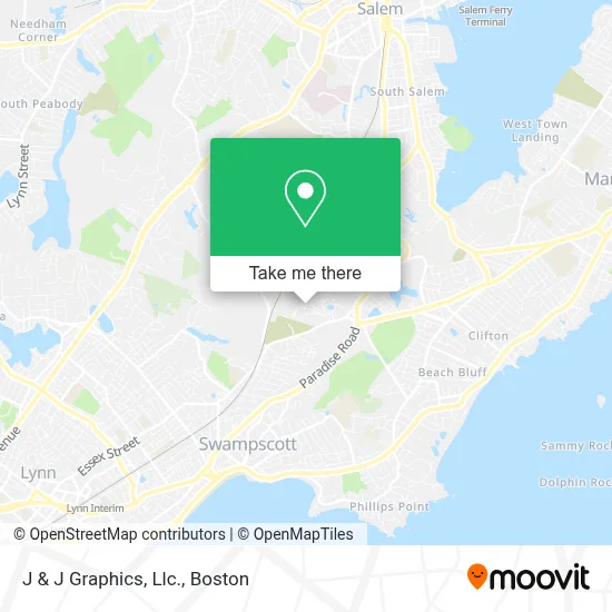
See J & J Graphics, Llc., Salem, on the map
Public Transit to J & J Graphics, Llc. in Salem
Wondering how to get to J & J Graphics, Llc. in Salem? Moovit helps you find the best way to get to J & J Graphics, Llc. with step-by-step directions from the nearest public transit station.
Moovit provides free maps and live directions to help you navigate through your city. View schedules, routes, timetables, and find out how long does it take to get to J & J Graphics, Llc. in real time.
Looking for the nearest stop or station to J & J Graphics, Llc.? Check out this list of stops closest to your destination: Loring Ave @ Vinnin St; 1000 Paradise Rd; Lynn Interim.
Bus: 455, 441.Train: NEWBURYPORT/ROCKPORT.
Want to see if there’s another route that gets you there at an earlier time? Moovit helps you find alternative routes or times. Get directions from and directions to J & J Graphics, Llc. easily from the Moovit App or Website.
We make riding to J & J Graphics, Llc. easy, which is why over 1.7 million users, including users in Salem, trust Moovit as the best app for public transit. You don’t need to download an individual bus app or train app, Moovit is your all-in-one transit app that helps you find the best bus time or train time available.
For information on prices of bus and train, costs and ride fares to J & J Graphics, Llc., please check the Moovit app.
Use the app to navigate to popular places including to the airport, hospital, stadium, grocery store, mall, coffee shop, school, college, and university.
J & J Graphics, Llc. Address: 42 Weatherly Dr street in Salem
- Sutherland Painting & Construction,
- The Village at Vinnin Square,
- Village Vinnin Sq II,
- Gloria 50 Freedom Hallow,
- Adviniacare at Vinnin Square,
- Coinme,
- Eagle Rock Apartments at Swampscott,
- Chemical Applications Company,
- Super Stop and Shop,
- Arrowhead Consulting,
- Hawthorne's Crossing,
- Broad Smiles Pediatric Dentistry,
- Dilisio Brothers Garden Center,
- Spirit Wellness Massage (Massage Therapy and Reiki Energy Work),
- Stop & Shop #015,
- Tyga Bites,
- Shaken And Served,
- Beach Chiropractic,
- Verizon Wireless,
- Calix Books
Places Near J & J Graphics, Llc. (Salem)
- Seaport District, Boston,
- Boston Medical Center, Boston,
- Boston Children's Hospital, Boston,
- Quincy Market, Boston,
- Mgm Music Hall, Boston,
- Cheers, Boston,
- House Of Blues, Boston,
- Leader Bank Pavilion (Leader Bank Pavillion), Boston,
- Massachusetts General Hospital, Boston,
- Castle Island, Boston,
- Museum Of Science, Boston,
- Boston Common, Boston,
- Faneuil Hall, Boston,
- North End, Boston,
- Isabella Stewart Gardner Museum, Boston,
- Boston Convention & Exhibition Center, Boston,
- Wang Theater, Boston,
- Prudential Center, Boston,
- Td Garden, Boston,
- Wilbur Theatre, Boston
How to get to popular places in Boston with public transit
Get around Salem by public transit!
Traveling around Salem has never been so easy. See step by step directions as you travel to any attraction, street or major public transit station. View bus and train schedules, arrival times, service alerts and detailed routes on a map, so you know exactly how to get to anywhere in Salem.
When traveling to any destination around Salem use Moovit's Live Directions with Get Off Notifications to know exactly where and how far to walk, how long to wait for your line, and how many stops are left. Moovit will alert you when it's time to get off — no need to constantly re-check whether yours is the next stop.
Wondering how to use public transit in Salem or how to pay for public transit in Salem? Moovit public transit app can help you navigate your way with public transit easily, and at minimum cost. It includes public transit fees, ticket prices, and costs. Looking for a map of Salem public transit lines? Moovit public transit app shows all public transit maps in Salem with all Bus, Train, Subway and Ferry routes and stops on an interactive map.
Boston has 4 transit type(s), including: Bus, Train, Subway and Ferry, operated by several transit agencies, including MBTA, Southeastern Regional Transit Authority, MetroWest Regional Transit Authority, Rhode Island Public Transit Authority, WRTA, Lowell Regional Transit Authority, Merrimack Valley Transit, Montachusett Regional Transit Authority, Cape Cod Regional Transit Authority, Brockton Area Transit Authority, Martha's Vineyard Transit Authority, the WAVE - Nantucket Regional Transit Authority, GATRA, Cape Ann Transportation Authority and Massport