Directions to J.Q. Louise (Boston) with public transportation
The following transit lines have routes that pass near J.Q. Louise
 Bus: 111, 354, 43, 504, EZRIDE.
- Train: FITCHBURG, GREENBUSH, NEWBURYPORT/ROCKPORT.
- Subway: GREEN LINE B, GREEN LINE D, GREEN LINE E, RED LINE, ORANGE LINE.
How to get to J.Q. Louise by bus?
Click on the bus route to see step by step directions with maps, line arrival times and updated time schedules.
From Revere Beach, Revere
74 minFrom John F. Kennedy Presidential Library And Museum, Boston
64 minFrom Heartbreak Hill, Newton
48 minFrom Hyatt Place Medford, Medford
34 minFrom Arlington, MA, Arlington
87 minFrom Canobie Lake Park, Chelsea
47 minFrom Danehy Park, Cambridge
78 minFrom Qea, Quincy
100 minFrom Porter Square, Cambridge
57 minFrom Newton, MA, Newton
48 min
How to get to J.Q. Louise by train?
Click on the train route to see step by step directions with maps, line arrival times and updated time schedules.
How to get to J.Q. Louise by subway?
Click on the subway route to see step by step directions with maps, line arrival times and updated time schedules.
Bus stops near J.Q. Louise in Boston
- Downtown Crossing - Franklin St @ Washington St, 4 min walk,VIEW
- Tremont St @ Beacon St, 4 min walk,VIEW
- Washington St @ Essex St, 5 min walk,VIEW
- Tremont St Opp Temple Pl, 6 min walk,VIEW
- Stuart St @ Charles St S, 7 min walk,VIEW
- Park Street - Tremont St @ Winter St, 7 min walk,VIEW
- Park Street - Tremont St Opp Hamilton Pl, 9 min walk,VIEW
Subway stations near J.Q. Louise in Boston
Bus lines to J.Q. Louise in Boston
- RED LINE SHUTTLE, Ashmont - Park Street via Post Office,VIEW
- RED LINE SHUTTLE, JFK/UMass - Park Street via Post Office,VIEW
- RED LINE SHUTTLE, JFK/UMass - Park Street,VIEW
- 15, Haymarket Via Fields Corner & Nubian,VIEW
- 39, Haymarket Via Forest Hills,VIEW
- 57, Haymarket Via Kenmore,VIEW
- 11, Chauncy & Summer,VIEW
- SL4, South Station,VIEW
- SL5, Downtown,VIEW
- 43, Park St & Tremont St - Ruggles,VIEW
- GREEN LINE E SHUTTLE, Heath Street - Park Street,VIEW
- GREEN LINE SHUTTLE, Boston University East - Park Street,VIEW
- RED LINE SHUTTLE, Harvard - South Station,VIEW
- 501, Brighton Via Copley (Express),VIEW
- 504, Watertown Via Copley And Newton Corner (Express),VIEW
- RED LINE SHUTTLE, Kendall/MIT - Park Street,VIEW
- RED LINE SHUTTLE, Kendall/MIT - Broadway via Pearl Street,VIEW
- RED LINE SHUTTLE, Kendall/MIT - Broadway via Downtown Crossing,VIEW
- RED LINE SHUTTLE, Alewife (Shuttle),VIEW
- RED LINE SHUTTLE, Park Street (Shuttle),VIEW
What are the closest stations to J.Q. Louise?
The closest stations to J.Q. Louise are:
- Downtown Crossing - Franklin St @ Washington St is 243 yards away, 4 min walk.
- Downtown Crossing is 279 yards away, 4 min walk.
- Tremont St @ Beacon St is 296 yards away, 4 min walk.
- Government Center is 343 yards away, 5 min walk.
- Washington St @ Essex St is 344 yards away, 5 min walk.
- Tremont St Opp Temple Pl is 469 yards away, 6 min walk.
- Stuart St @ Charles St S is 525 yards away, 7 min walk.
- Park Street - Tremont St @ Winter St is 547 yards away, 7 min walk.
- Park Street - Tremont St Opp Hamilton Pl is 752 yards away, 9 min walk.
Which bus lines stop near J.Q. Louise?
These bus lines stop near J.Q. Louise: 111, 354, 43, 504, EZRIDE, SL4, SL5.
Which train lines stop near J.Q. Louise?
These train lines stop near J.Q. Louise: FITCHBURG, GREENBUSH, NEWBURYPORT/ROCKPORT.
Which subway lines stop near J.Q. Louise?
These subway lines stop near J.Q. Louise: GREEN LINE B, GREEN LINE D, GREEN LINE E, RED LINE.
What’s the nearest subway station to J.Q. Louise in Boston?
The nearest subway station to J.Q. Louise in Boston is Downtown Crossing. It’s a 4 min walk away.
What’s the nearest bus station to J.Q. Louise in Boston?
The nearest bus stations to J.Q. Louise in Boston are Downtown Crossing - Franklin St @ Washington St and Tremont St @ Beacon St. The closest one is a 4 min walk away.
What time is the first subway to J.Q. Louise in Boston?
The GREEN LINE E is the first subway that goes to J.Q. Louise in Boston. It stops nearby at 5:05 AM.
What time is the last subway to J.Q. Louise in Boston?
The GREEN LINE E is the last subway that goes to J.Q. Louise in Boston. It stops nearby at 2:20 AM.
What time is the first bus to J.Q. Louise in Boston?
The 57 is the first bus that goes to J.Q. Louise in Boston. It stops nearby at 5:00 AM.
What time is the last bus to J.Q. Louise in Boston?
The 11 is the last bus that goes to J.Q. Louise in Boston. It stops nearby at 1:15 AM.
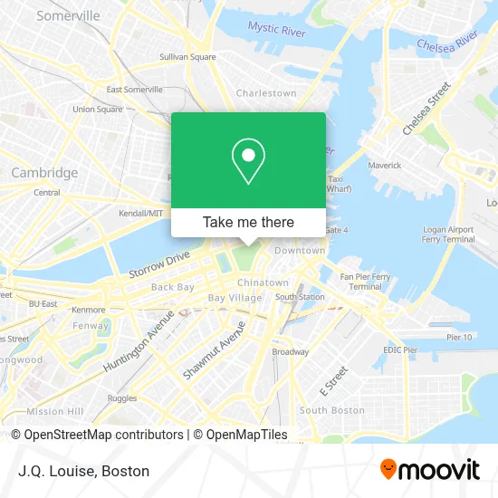
See J.Q. Louise, Boston, on the map
Public Transit to J.Q. Louise in Boston
Wondering how to get to J.Q. Louise in Boston? Moovit helps you find the best way to get to J.Q. Louise with step-by-step directions from the nearest public transit station.
Moovit provides free maps and live directions to help you navigate through your city. View schedules, routes, timetables, and find out how long does it take to get to J.Q. Louise in real time.
Looking for the nearest stop or station to J.Q. Louise? Check out this list of stops closest to your destination: Downtown Crossing - Franklin St @ Washington St; Downtown Crossing; Tremont St @ Beacon St; Government Center; Washington St @ Essex St; Tremont St Opp Temple Pl; Stuart St @ Charles St S; Park Street - Tremont St @ Winter St; Park Street - Tremont St Opp Hamilton Pl.
Bus: 111, 354, 43, 504, EZRIDE, SL4, SL5, RED LINE SHUTTLE, RED LINE SHUTTLE, RED LINE SHUTTLE, 15, 39, 57, 11.Train: FITCHBURG, GREENBUSH, NEWBURYPORT/ROCKPORT.Subway: GREEN LINE B, GREEN LINE D, GREEN LINE E, RED LINE, ORANGE LINE, BLUE LINE, GREEN LINE C.
Want to see if there’s another route that gets you there at an earlier time? Moovit helps you find alternative routes or times. Get directions from and directions to J.Q. Louise easily from the Moovit App or Website.
We make riding to J.Q. Louise easy, which is why over 1.7 million users, including users in Boston, trust Moovit as the best app for public transit. You don’t need to download an individual bus app or train app, Moovit is your all-in-one transit app that helps you find the best bus time or train time available.
For information on prices of subway, bus and train, costs and ride fares to J.Q. Louise, please check the Moovit app.
Use the app to navigate to popular places including to the airport, hospital, stadium, grocery store, mall, coffee shop, school, college, and university.
Location: Boston
- Frog Pond (The Boston Common Frog Pond),
- Frog Pond,
- The Tadpole Playground and the Frog Pond,
- Boston Common,
- Freedom Trail (Pirates & Patriots Freedom Trl Tour),
- Visitor Information Center at Boston Common,
- Alcohol Treatment Center 24 Hour Help Line,
- Boston Common Visitor Center,
- Somerset Club,
- Fran's Cleaning,
- Masonry Guys Boston,
- Psychic Readings by Lolita,
- Hub Town Tours,
- Block Renovation,
- Tremont Street subway,
- Southbound Platform (Track 5),
- Parkman Bandstand,
- Boston Common,
- John F. Kennedy Statue,
- Southbound / Northbound Platform (Tracks 5 & 6)
Places Near J.Q. Louise (Boston)
- House Of Blues, Boston,
- Isabella Stewart Gardner Museum, Boston,
- North End, Boston,
- Prudential Center, Boston,
- Td Garden, Boston,
- Mgm Music Hall, Boston,
- Wilbur Theatre, Boston,
- Boston Common, Boston,
- Boston Medical Center, Boston,
- Boston Children's Hospital, Boston,
- Wang Theater, Boston,
- Massachusetts General Hospital, Boston,
- Castle Island, Boston,
- Faneuil Hall, Boston,
- Boston Convention & Exhibition Center, Boston,
- Seaport District, Boston,
- Cheers, Boston,
- Museum Of Science, Boston,
- Quincy Market, Boston,
- Leader Bank Pavilion (Leader Bank Pavillion), Boston
How to get to popular places in Boston with public transit
Get around Boston by public transit!
Traveling around Boston has never been so easy. See step by step directions as you travel to any attraction, street or major public transit station. View bus and train schedules, arrival times, service alerts and detailed routes on a map, so you know exactly how to get to anywhere in Boston.
When traveling to any destination around Boston use Moovit's Live Directions with Get Off Notifications to know exactly where and how far to walk, how long to wait for your line, and how many stops are left. Moovit will alert you when it's time to get off — no need to constantly re-check whether yours is the next stop.
Wondering how to use public transit in Boston or how to pay for public transit in Boston? Moovit public transit app can help you navigate your way with public transit easily, and at minimum cost. It includes public transit fees, ticket prices, and costs. Looking for a map of Boston public transit lines? Moovit public transit app shows all public transit maps in Boston with all Bus, Train, Subway and Ferry routes and stops on an interactive map.
Boston has 4 transit type(s), including: Bus, Train, Subway and Ferry, operated by several transit agencies, including MBTA, Southeastern Regional Transit Authority, MetroWest Regional Transit Authority, Rhode Island Public Transit Authority, WRTA, Lowell Regional Transit Authority, Merrimack Valley Transit, Montachusett Regional Transit Authority, Cape Cod Regional Transit Authority, Brockton Area Transit Authority, Martha's Vineyard Transit Authority, the WAVE - Nantucket Regional Transit Authority, GATRA, Cape Ann Transportation Authority and Massport