Directions to Jackson Tower (Portland) with public transportation
The following transit lines have routes that pass near Jackson Tower
How to get to Jackson Tower by bus?
Click on the bus route to see step by step directions with maps, line arrival times and updated time schedules.
Light Rail stations near Jackson Tower in Portland
- Pioneer Square South, 1 min walk,
Bus stations near Jackson Tower in Portland
- Sw 6th & Yamhill (North), 2 min walk,
- Pioneer Courthouse/SW 6th Avenue, 2 min walk,
Bus lines to Jackson Tower in Portland
- 63, SW 6th & Yamhill (North),
- GREEN, Clackamas Town Center TC Max Station (North),
- ORANGE, Union Station/NW 6th & Hoyt Max Stn (North),
- YELLOW, Expo Center Max Station (South),
- YELLOW, Delta Park/Vanport (South),
What are the closest stations to Jackson Tower?
The closest stations to Jackson Tower are:
- Pioneer Square South is 50 yards away, 1 min walk.
- Sw 6th & Yamhill (North) is 97 yards away, 2 min walk.
- Pioneer Courthouse/SW 6th Avenue is 138 yards away, 2 min walk.
Which bus lines stop near Jackson Tower?
These bus lines stop near Jackson Tower: 15, 19, 35, 8.
Which light rail lines stop near Jackson Tower?
These light rail lines stop near Jackson Tower: MAX GREEN LINE, MAX RED LINE.
What’s the nearest light rail station to Jackson Tower in Portland?
The nearest light rail station to Jackson Tower in Portland is Pioneer Square South. It’s a 1 min walk away.
What’s the nearest bus stop to Jackson Tower in Portland?
The nearest bus stops to Jackson Tower in Portland are Sw 6th & Yamhill (North) and Pioneer Courthouse/SW 6th Avenue. The closest one is a 2 min walk away.
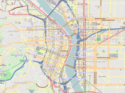
See Jackson Tower, Portland, on the map
Public Transit to Jackson Tower in Portland
Wondering how to get to Jackson Tower in Portland, United States? Moovit helps you find the best way to get to Jackson Tower with step-by-step directions from the nearest public transit station.
Moovit provides free maps and live directions to help you navigate through your city. View schedules, routes, timetables, and find out how long does it take to get to Jackson Tower in real time.
Looking for the nearest stop or station to Jackson Tower? Check out this list of stops closest to your destination: Pioneer Square South; Sw 6th & Yamhill (North); Pioneer Courthouse/SW 6th Avenue.
Bus: 15, 19, 35, 8, 63, GREEN, ORANGE, YELLOW, YELLOW.Light Rail: MAX GREEN LINE, MAX RED LINE.
Want to see if there’s another route that gets you there at an earlier time? Moovit helps you find alternative routes or times. Get directions from and directions to Jackson Tower easily from the Moovit App or Website.
We make riding to Jackson Tower easy, which is why over 1.5 million users, including users in Portland, trust Moovit as the best app for public transit. You don’t need to download an individual bus app or train app, Moovit is your all-in-one transit app that helps you find the best bus time or train time available.
For information on prices of bus and light rail, costs and ride fares to Jackson Tower, please check the Moovit app.
Use the app to navigate to popular places including to the airport, hospital, stadium, grocery store, mall, coffee shop, school, college, and university.
Location: Portland, Portland, OR
Attractions near Jackson Tower
Pittock Mansion And Acres,Oregon Holocaust Memorial,Adelle Apartments,Park Lane Inn & Suites,Jim Fisher Volvo,Pittock Mansion,Pay To Park,Westover Dental,23hoyt,Lucky Brand,Loyal B. Stearns Memorial,Washington Mutual,Uptown Shopping Center,Chase Bank,Usps,Zupan's,Limo,World Cup Coffee & Tea,Starbucks,Macleay ParkHow to get to popular attractions in Portland with public transit
S Longview Way Building 200, Oregon City,Keller Williams, Hillsboro,Me Time Spa, Forest Grove,Illuminati Tattoo Parlor, Hazel Dell,Dave's Hot Chicken,Libertyx Bitcoin ATM, Cedar Mill,Hana Apartments, Hillsboro,Kat Kocurek, Portland,QUALITY INN Pool, Gresham,Minerva Plaza, Portland,SE Creighton Ave Building 2570, Oak Grove,Aitech Horizons, Gresham,Liquid Metal Woodworking, Vancouver,The Mark Spencer Hotel Portland, Portland,SE 136th Ave Building 3101, Portland,Beth Schwenk, MS, Rd, Cdces, Seaside,Kaiser Permanente Parking Lot, Tualatin,Vwf1206, Vancouver,Vancouver, Salmon Creek,The Naturally Beautiful Project, PortlandGet around Portland, OR by public transit!
Traveling around Portland, OR has never been so easy. See step by step directions as you travel to any attraction, street or major public transit station. View bus and train schedules, arrival times, service alerts and detailed routes on a map, so you know exactly how to get to anywhere in Portland, OR.
When traveling to any destination around Portland, OR use Moovit's Live Directions with Get Off Notifications to know exactly where and how far to walk, how long to wait for your line, and how many stops are left. Moovit will alert you when it's time to get off — no need to constantly re-check whether yours is the next stop.
Wondering how to use public transit in Portland, OR or how to pay for public transit in Portland, OR? Moovit public transit app can help you navigate your way with public transit easily, and at minimum cost. It includes public transit fees, ticket prices, and costs. Looking for a map of Portland, OR public transit lines? Moovit public transit app shows all public transit maps in Portland, OR with all Bus, Train, Light Rail, Ferry, Streetcar and Gondola routes and stops on an interactive map.
Portland, OR has 6 transit type(s), including: Bus, Train, Light Rail, Ferry, Streetcar and Gondola, operated by several transit agencies, including Mount Adams Transportation Service, RiverCities Transit, TriMet , TriMet , TriMet, Portland Streetcar, Portland Aerial Tram, C-TRAN, Multnomah County Job Connector Shuttles, Washington Park Shuttle, SMART, Canby Area Transit, South Clackamas Transportation District, The Wave, Lincoln County Transit