Directions to Jacob Riis Park (Queens) with public transportation
The following transit lines have routes that pass near Jacob Riis Park
How to get to Jacob Riis Park by bus?
Click on the bus route to see step by step directions with maps, line arrival times and updated time schedules.
How to get to Jacob Riis Park by subway?
Click on the subway route to see step by step directions with maps, line arrival times and updated time schedules.
Bus stations near Jacob Riis Park in Queens
- Jacob Riis Pk Rd/Bath House Stop #1, 16 min walk,
Bus lines to Jacob Riis Park in Queens
- RWS, Rockaway West,
- QM16, Neponsit Riis Park Via Cross Bay Bl Via Rock Bch Bl,
What are the closest stations to Jacob Riis Park?
The closest stations to Jacob Riis Park are:
- Jacob Riis Pk Rd/Bath House Stop #1 is 1290 yards away, 16 min walk.
Which bus lines stop near Jacob Riis Park?
These bus lines stop near Jacob Riis Park: Q22, Q35.
Which subway line stops near Jacob Riis Park?
S
See Jacob Riis Park, Queens, on the map
Public Transit to Jacob Riis Park in Queens
Wondering how to get to Jacob Riis Park in Queens, United States? Moovit helps you find the best way to get to Jacob Riis Park with step-by-step directions from the nearest public transit station.
Moovit provides free maps and live directions to help you navigate through your city. View schedules, routes, timetables, and find out how long does it take to get to Jacob Riis Park in real time.
Looking for the nearest stop or station to Jacob Riis Park? Check out this list of stops closest to your destination: Jacob Riis Pk Rd/Bath House Stop #1.
Bus: Q22, Q35, RWS, QM16.Subway: S.
Want to see if there’s another route that gets you there at an earlier time? Moovit helps you find alternative routes or times. Get directions from and directions to Jacob Riis Park easily from the Moovit App or Website.
We make riding to Jacob Riis Park easy, which is why over 1.5 million users, including users in Queens, trust Moovit as the best app for public transit. You don’t need to download an individual bus app or train app, Moovit is your all-in-one transit app that helps you find the best bus time or train time available.
For information on prices of bus and subway, costs and ride fares to Jacob Riis Park, please check the Moovit app.
Use the app to navigate to popular places including to the airport, hospital, stadium, grocery store, mall, coffee shop, school, college, and university.
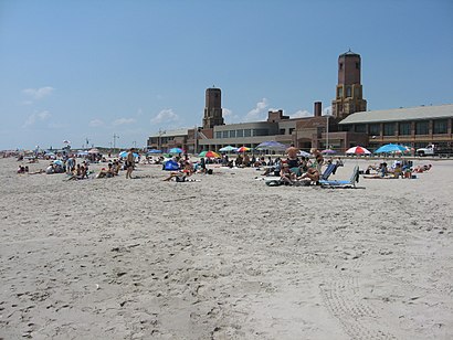
Jacob Riis Park Address: 148-99 Beach Channel Dr Rockaway Park, NY 11694 street in Queens
Attractions near Jacob Riis Park
Newport Beach 149th St,Newport Ave and Beach 149th St,Newport Beach,149th Rabbi Ave,Beach Channel Rock Beach,New Ave Beach 148th St,WW Weight Watchers,391 Beach 148th St,Channel Dr Rockaway,Rockaway Beach Channel,Rockaway Rockaway Beach Blvd Beach Channel Dr,Rockaway Beach Beach Blvd at Beach Channel Dr,Newport Ave Beach,149th St Nepo,149th St Neponsit,149-01 Neponsit Ave,Beach 148 Neponsit,P.S. 114,Re M A,Newport BeachHow to get to popular attractions in Queens with public transit
Walmart, Secaucus, Nj,Wall Street, New York, Manhattan,Paramount Hotel Times Square New York, Manhattan,Orchard St, Manhattan,P.S 248 - MTA NYCT Learning Center,Edge NYC, Manhattan,Newark Liberty International Airport (EWR), Newark, Nj,711 12th Avenue, Manhattan,Jamaica Ave, Queens,Westchester Mall, White Plains, Ny,Uniondale, NY, Uniondale, Ny,Consulado General del Perú en Nueva York, Manhattan,W 44th St (44th street and broadway), Manhattan,Kings County Hospital Center,Pier 17, Manhattan,David H. Koch Center for Cancer Care at Memorial Sloan Kettering Cancer Center, Manhattan,299 Broadway, Manhattan,Hudson Yards, Manhattan,Long Island City, Queens,Jake's 58 Casino, Islandia, NyGet around New York - New Jersey by public transit!
Traveling around New York - New Jersey has never been so easy. See step by step directions as you travel to any attraction, street or major public transit station. View bus and train schedules, arrival times, service alerts and detailed routes on a map, so you know exactly how to get to anywhere in New York - New Jersey.
When traveling to any destination around New York - New Jersey use Moovit's Live Directions with Get Off Notifications to know exactly where and how far to walk, how long to wait for your line, and how many stops are left. Moovit will alert you when it's time to get off — no need to constantly re-check whether yours is the next stop.
Wondering how to use public transit in New York - New Jersey or how to pay for public transit in New York - New Jersey? Moovit public transit app can help you navigate your way with public transit easily, and at minimum cost. It includes public transit fees, ticket prices, and costs. Looking for a map of New York - New Jersey public transit lines? Moovit public transit app shows all public transit maps in New York - New Jersey with all Bus, Train, Subway, Light Rail, Ferry and Cable Car routes and stops on an interactive map.
New York - New Jersey has 6 transit type(s), including: Bus, Train, Subway, Light Rail, Ferry and Cable Car, operated by several transit agencies, including MTA Subway, Metro-North Railroad, LIRR, PATH, Shore Line East, MTA Bus Company, MTA New York City Transit - Express routes, MTA Bus, NJ Transit, NYC Ferry, NICE bus, Bee-Line Bus, NJ Transit Rail, Norwalk Transit District, CTTransit - Waterbury-Meriden