How to get to Jacqueline Tattoo by bus?
Click on the bus route to see step by step directions with maps, line arrival times and updated time schedules.
From The Freedom Trail, Boston
33 minFrom Sommerville Theatre, Somerville
76 minFrom Fire & Ice (Fire Ice Restaurant), Boston
51 minFrom Davis Sq, Somerville
76 minFrom Cheers, Boston
51 minFrom Boston Omni Parker House Hotel, Boston
33 minFrom Park Plaza Castle, Boston
55 minFrom Fire + Ice, Boston
51 minFrom Moxy Hotel, Boston
49 minFrom Nahant Beach, Nahant
47 min
How to get to Jacqueline Tattoo by subway?
Click on the subway route to see step by step directions with maps, line arrival times and updated time schedules.
From The Freedom Trail, Boston
58 minFrom Sommerville Theatre, Somerville
80 minFrom Fire & Ice (Fire Ice Restaurant), Boston
67 minFrom Davis Sq, Somerville
81 minFrom Cheers, Boston
72 minFrom Boston Omni Parker House Hotel, Boston
57 minFrom Park Plaza Castle, Boston
67 minFrom Fire + Ice, Boston
67 minFrom Moxy Hotel, Boston
64 min
Bus stops near Jacqueline Tattoo in Revere
Subway station near Jacqueline Tattoo in Revere
- Wonderland, 26 min walk,VIEW
Bus lines to Jacqueline Tattoo in Revere
What are the closest stations to Jacqueline Tattoo?
The closest stations to Jacqueline Tattoo are:
- Charger St @ Squire Rd is 374 yards away, 5 min walk.
- Broadway @ Ward St is 829 yards away, 10 min walk.
- Brown Circle Rotary is 1056 yards away, 13 min walk.
- Wonderland is 2135 yards away, 26 min walk.
Which bus lines stop near Jacqueline Tattoo?
These bus lines stop near Jacqueline Tattoo: 429, 450, 455.
Which subway line stops near Jacqueline Tattoo?
BLUE LINE (Wonderland)
What’s the nearest subway station to Jacqueline Tattoo in Revere?
The nearest subway station to Jacqueline Tattoo in Revere is Wonderland. It’s a 26 min walk away.
What’s the nearest bus station to Jacqueline Tattoo in Revere?
The nearest bus station to Jacqueline Tattoo in Revere is Charger St @ Squire Rd. It’s a 5 min walk away.
What time is the first subway to Jacqueline Tattoo in Revere?
The BLUE LINE is the first subway that goes to Jacqueline Tattoo in Revere. It stops nearby at 5:12 AM.
What time is the last subway to Jacqueline Tattoo in Revere?
The BLUE LINE is the last subway that goes to Jacqueline Tattoo in Revere. It stops nearby at 2:10 AM.
What time is the first bus to Jacqueline Tattoo in Revere?
The 116 is the first bus that goes to Jacqueline Tattoo in Revere. It stops nearby at 4:23 AM.
What time is the last bus to Jacqueline Tattoo in Revere?
The 455 is the last bus that goes to Jacqueline Tattoo in Revere. It stops nearby at 1:00 AM.
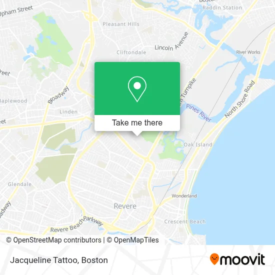
See Jacqueline Tattoo, Revere, on the map
Public Transit to Jacqueline Tattoo in Revere
Wondering how to get to Jacqueline Tattoo in Revere? Moovit helps you find the best way to get to Jacqueline Tattoo with step-by-step directions from the nearest public transit station.
Moovit provides free maps and live directions to help you navigate through your city. View schedules, routes, timetables, and find out how long does it take to get to Jacqueline Tattoo in real time.
Looking for the nearest stop or station to Jacqueline Tattoo? Check out this list of stops closest to your destination: Charger St @ Squire Rd; Broadway @ Ward St; Brown Circle Rotary; Wonderland.
Bus: 429, 450, 455, 119, 411, 116, 424, 426.Subway: BLUE LINE.
Want to see if there’s another route that gets you there at an earlier time? Moovit helps you find alternative routes or times. Get directions from and directions to Jacqueline Tattoo easily from the Moovit App or Website.
We make riding to Jacqueline Tattoo easy, which is why over 1.7 million users, including users in Revere, trust Moovit as the best app for public transit. You don’t need to download an individual bus app or train app, Moovit is your all-in-one transit app that helps you find the best bus time or train time available.
For information on prices of bus and subway, costs and ride fares to Jacqueline Tattoo, please check the Moovit app.
Use the app to navigate to popular places including to the airport, hospital, stadium, grocery store, mall, coffee shop, school, college, and university.
Jacqueline Tattoo Address: 315 Charger St street in Revere
- Haas Health and Wellness Center,
- Bumper 2 Bumper,
- Revere Department Of Public Works,
- Extra Space Storage,
- Boston Car Service,
- Nanas Service,
- Nardely Remodeling,
- Corefix Repairing Store,
- H&J Multiservices,
- Rumney Flats,
- Daniel Webster Commercial Leasing,
- Diversified Funding Inc,
- Cerably Palsey,
- Quick Fix Corporation,
- Osa General Contractor,
- Planning with A SC,
- Blink Charging,
- Demoulas Market Basket #74 Revere,
- Boston Vapor,
- Health Insurance Brokers Revere
Places Near Jacqueline Tattoo (Revere)
- Castle Island, Boston,
- Boston Medical Center, Boston,
- Massachusetts General Hospital, Boston,
- Boston Convention & Exhibition Center, Boston,
- Wang Theater, Boston,
- Mgm Music Hall, Boston,
- Leader Bank Pavilion (Leader Bank Pavillion), Boston,
- Td Garden, Boston,
- Wilbur Theatre, Boston,
- Quincy Market, Boston,
- Museum Of Science, Boston,
- House Of Blues, Boston,
- Faneuil Hall, Boston,
- North End, Boston,
- Boston Children's Hospital, Boston,
- Cheers, Boston,
- Seaport District, Boston,
- Boston Common, Boston,
- Isabella Stewart Gardner Museum, Boston,
- Prudential Center, Boston
How to get to popular places in Boston with public transit
Get around Revere by public transit!
Traveling around Revere has never been so easy. See step by step directions as you travel to any attraction, street or major public transit station. View bus and train schedules, arrival times, service alerts and detailed routes on a map, so you know exactly how to get to anywhere in Revere.
When traveling to any destination around Revere use Moovit's Live Directions with Get Off Notifications to know exactly where and how far to walk, how long to wait for your line, and how many stops are left. Moovit will alert you when it's time to get off — no need to constantly re-check whether yours is the next stop.
Wondering how to use public transit in Revere or how to pay for public transit in Revere? Moovit public transit app can help you navigate your way with public transit easily, and at minimum cost. It includes public transit fees, ticket prices, and costs. Looking for a map of Revere public transit lines? Moovit public transit app shows all public transit maps in Revere with all Bus, Train, Subway and Ferry routes and stops on an interactive map.
Boston has 4 transit type(s), including: Bus, Train, Subway and Ferry, operated by several transit agencies, including MBTA, Southeastern Regional Transit Authority, MetroWest Regional Transit Authority, Rhode Island Public Transit Authority, WRTA, Lowell Regional Transit Authority, Merrimack Valley Transit, Montachusett Regional Transit Authority, Cape Cod Regional Transit Authority, Brockton Area Transit Authority, Martha's Vineyard Transit Authority, the WAVE - Nantucket Regional Transit Authority, GATRA, Cape Ann Transportation Authority and Massport