Directions to Jacques Underground (Boston) with public transportation
The following transit lines have routes that pass near Jacques Underground
 Bus: 501, 504, SL4, SL5, 9.
- Train: FAIRMOUNT, FITCHBURG, NEEDHAM, FOXBORO EVENT SERVICE, FRAMINGHAM/WORCESTER.
- Subway: GREEN LINE B, GREEN LINE D, ORANGE LINE, GREEN LINE C, GREEN LINE E.
How to get to Jacques Underground by bus?
Click on the bus route to see step by step directions with maps, line arrival times and updated time schedules.
From Alumni Stadium, Boston
63 minFrom Dorchester District Court, Boston
54 minFrom La Quinta, Somerville
68 minFrom La Quinta Inn & Suites Boston Somerville, Somerville
67 minFrom Harvard Museum Of Natural History, Cambridge
57 minFrom Heartbreak Hill, Newton
45 minFrom Newton, MA, Newton
45 minFrom Newton, MA, Newton
57 minFrom Milton Academy, Milton
93 minFrom West Roxbury, Boston
58 min
How to get to Jacques Underground by train?
Click on the train route to see step by step directions with maps, line arrival times and updated time schedules.
How to get to Jacques Underground by subway?
Click on the subway route to see step by step directions with maps, line arrival times and updated time schedules.
From Alumni Stadium, Boston
58 minFrom Dorchester District Court, Boston
41 minFrom La Quinta, Somerville
29 minFrom La Quinta Inn & Suites Boston Somerville, Somerville
28 minFrom Harvard Museum Of Natural History, Cambridge
33 minFrom Heartbreak Hill, Newton
51 minFrom Newton, MA, Newton
50 minFrom Newton, MA, Newton
45 minFrom Milton Academy, Milton
63 min
Bus stops near Jacques Underground in Boston
Subway stations near Jacques Underground in Boston
Train station near Jacques Underground in Boston
- Back Bay - South End, 7 min walk,VIEW
Bus lines to Jacques Underground in Boston
- 9, Kenmore Via Boston Latin,VIEW
- 43, Ruggles,VIEW
- 501, Downtown Via Cambridge St And Copley (Express),VIEW
- 504, Downtown Via Copley (Express),VIEW
- 10, Arlington via South Bay Center - City Point via South Bay Center,VIEW
- 39, Back Bay - Forest Hills,VIEW
- 55, Arlington - West Fenway,VIEW
- 57, Kenmore - Watertown Yard,VIEW
- GREEN LINE E SHUTTLE, Heath Street - Park Street,VIEW
- GREEN LINE SHUTTLE, Boston University East - Park Street,VIEW
- 11, Chauncy & Summer - City Point,VIEW
- 15, Ruggles - Fields Corner,VIEW
- SL4, South Station - Nubian,VIEW
- SL5, Downtown - Nubian,VIEW
What are the closest stations to Jacques Underground?
The closest stations to Jacques Underground are:
- Arlington St @ Isabella St is 168 yards away, 3 min walk.
- Tremont St @ Marginal St is 294 yards away, 4 min walk.
- Kneeland St @ Washington St is 311 yards away, 4 min walk.
- Saint James Ave @ Arlington St is 329 yards away, 4 min walk.
- Arlington is 390 yards away, 5 min walk.
- Washington St @ Tufts Med Ctr is 411 yards away, 6 min walk.
- Tufts Medical Center is 474 yards away, 6 min walk.
- Back Bay - South End is 534 yards away, 7 min walk.
Which bus lines stop near Jacques Underground?
These bus lines stop near Jacques Underground: 501, 504, SL4, SL5.
Which train lines stop near Jacques Underground?
These train lines stop near Jacques Underground: FAIRMOUNT, FITCHBURG, NEEDHAM.
Which subway lines stop near Jacques Underground?
These subway lines stop near Jacques Underground: GREEN LINE B, GREEN LINE D, ORANGE LINE.
What’s the nearest subway station to Jacques Underground in Boston?
The nearest subway station to Jacques Underground in Boston is Arlington. It’s a 5 min walk away.
What’s the nearest train station to Jacques Underground in Boston?
The nearest train station to Jacques Underground in Boston is Back Bay - South End. It’s a 7 min walk away.
What’s the nearest bus station to Jacques Underground in Boston?
The nearest bus station to Jacques Underground in Boston is Arlington St @ Isabella St. It’s a 3 min walk away.
What time is the first subway to Jacques Underground in Boston?
The GREEN LINE D is the first subway that goes to Jacques Underground in Boston. It stops nearby at 5:07 AM.
What time is the last subway to Jacques Underground in Boston?
The GREEN LINE E is the last subway that goes to Jacques Underground in Boston. It stops nearby at 2:16 AM.
What time is the first train to Jacques Underground in Boston?
The PROVIDENCE/STOUGHTON is the first train that goes to Jacques Underground in Boston. It stops nearby at 4:25 AM.
What time is the last train to Jacques Underground in Boston?
The LAKE SHORE LIMITED is the last train that goes to Jacques Underground in Boston. It stops nearby at 8:26 PM.
What time is the first bus to Jacques Underground in Boston?
The 43 is the first bus that goes to Jacques Underground in Boston. It stops nearby at 5:06 AM.
What time is the last bus to Jacques Underground in Boston?
The 10 is the last bus that goes to Jacques Underground in Boston. It stops nearby at 1:19 AM.
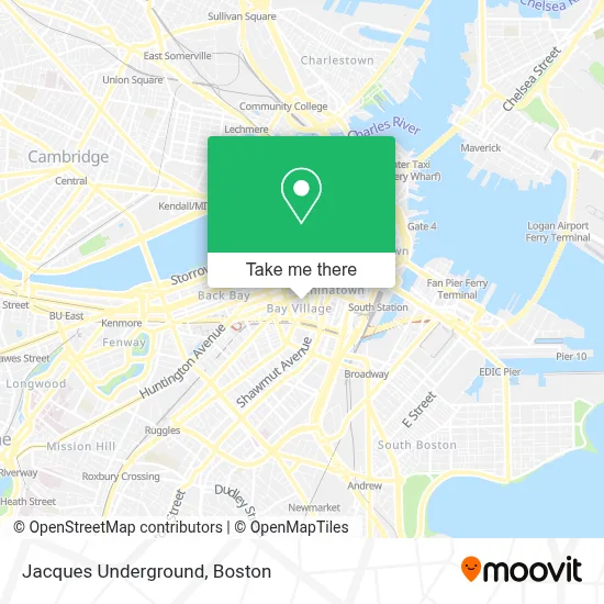
See Jacques Underground, Boston, on the map
Public Transit to Jacques Underground in Boston
Wondering how to get to Jacques Underground in Boston? Moovit helps you find the best way to get to Jacques Underground with step-by-step directions from the nearest public transit station.
Moovit provides free maps and live directions to help you navigate through your city. View schedules, routes, timetables, and find out how long does it take to get to Jacques Underground in real time.
Looking for the nearest stop or station to Jacques Underground? Check out this list of stops closest to your destination: Arlington St @ Isabella St; Tremont St @ Marginal St; Kneeland St @ Washington St; Saint James Ave @ Arlington St; Arlington; Washington St @ Tufts Med Ctr; Tufts Medical Center; Back Bay - South End.
Bus: 501, 504, SL4, SL5, 9, 43.Train: FAIRMOUNT, FITCHBURG, NEEDHAM, FOXBORO EVENT SERVICE, FRAMINGHAM/WORCESTER, FRANKLIN/FOXBORO, PROVIDENCE/STOUGHTON.Subway: GREEN LINE B, GREEN LINE D, ORANGE LINE, GREEN LINE C, GREEN LINE E.
Want to see if there’s another route that gets you there at an earlier time? Moovit helps you find alternative routes or times. Get directions from and directions to Jacques Underground easily from the Moovit App or Website.
We make riding to Jacques Underground easy, which is why over 1.7 million users, including users in Boston, trust Moovit as the best app for public transit. You don’t need to download an individual bus app or train app, Moovit is your all-in-one transit app that helps you find the best bus time or train time available.
For information on prices of bus, subway and train, costs and ride fares to Jacques Underground, please check the Moovit app.
Use the app to navigate to popular places including to the airport, hospital, stadium, grocery store, mall, coffee shop, school, college, and university.
Jacques Underground Address: 79 Broadway St street in Boston
- Haynes WM S Co (Haynes Flute & Piccolo Co.),
- Revere Hotel Boston Common,
- Rooftop at Revere (Rooftop Lounge),
- Milner Hotel,
- Matthew E. Ryan Square,
- Found Hotel Boston Common ,
- Bay Village Park,
- Found Hotel Boston Common,
- Moot Court Room,
- Plymouth Brockton Bus Park Plaza Stop,
- South Cove Plaza,
- Charles Playhouse,
- New England Law l Boston Library,
- Charles Playhouse Lounge,
- Icon Nightclub,
- Nick's Comedy Stop,
- Legacy,
- Venu,
- Blacklist Boston,
- Nick's Comedy Stop (Nick From Nick's)
Places Near Jacques Underground (Boston)
- Boston Convention & Exhibition Center, Boston,
- Wilbur Theatre, Boston,
- House Of Blues, Boston,
- North End, Boston,
- Isabella Stewart Gardner Museum, Boston,
- Mgm Music Hall, Boston,
- Boston Medical Center, Boston,
- Castle Island, Boston,
- Td Garden, Boston,
- Quincy Market, Boston,
- Leader Bank Pavilion (Leader Bank Pavillion), Boston,
- Museum Of Science, Boston,
- Prudential Center, Boston,
- Boston Children's Hospital, Boston,
- Faneuil Hall, Boston,
- Massachusetts General Hospital, Boston,
- Wang Theater, Boston,
- Seaport District, Boston,
- Boston Common, Boston,
- Cheers, Boston
How to get to popular places in Boston with public transit
Get around Boston by public transit!
Traveling around Boston has never been so easy. See step by step directions as you travel to any attraction, street or major public transit station. View bus and train schedules, arrival times, service alerts and detailed routes on a map, so you know exactly how to get to anywhere in Boston.
When traveling to any destination around Boston use Moovit's Live Directions with Get Off Notifications to know exactly where and how far to walk, how long to wait for your line, and how many stops are left. Moovit will alert you when it's time to get off — no need to constantly re-check whether yours is the next stop.
Wondering how to use public transit in Boston or how to pay for public transit in Boston? Moovit public transit app can help you navigate your way with public transit easily, and at minimum cost. It includes public transit fees, ticket prices, and costs. Looking for a map of Boston public transit lines? Moovit public transit app shows all public transit maps in Boston with all Bus, Train, Subway and Ferry routes and stops on an interactive map.
Boston has 4 transit type(s), including: Bus, Train, Subway and Ferry, operated by several transit agencies, including MBTA, Southeastern Regional Transit Authority, MetroWest Regional Transit Authority, Rhode Island Public Transit Authority, WRTA, Lowell Regional Transit Authority, Merrimack Valley Transit, Montachusett Regional Transit Authority, Cape Cod Regional Transit Authority, Brockton Area Transit Authority, Martha's Vineyard Transit Authority, the WAVE - Nantucket Regional Transit Authority, GATRA, Cape Ann Transportation Authority and Massport