How to get to Jaed by bus?
Click on the bus route to see step by step directions with maps, line arrival times and updated time schedules.
From Beth Israel Deaconess Medical Center (Shapiro Garage), Boston
77 minFrom Aloft-Boston Seaport Dist, Boston
35 minFrom Samuel Adams Brewery, Boston
86 minFrom Brighton Music Hall, Boston
81 minFrom Belmont, MA, Belmont
74 minFrom new hampshire!, Boston
61 minFrom Sam Adams Boston Brewery Tour, Boston
86 minFrom Christian A Herter Park, Boston
83 min
How to get to Jaed by subway?
Click on the subway route to see step by step directions with maps, line arrival times and updated time schedules.
Bus stops near Jaed in Chelsea
Subway station near Jaed in Chelsea
- Wood Island, 27 min walk,VIEW
Train station near Jaed in Chelsea
- Chelsea, 35 min walk,VIEW
Bus lines to Jaed in Chelsea
What are the closest stations to Jaed?
The closest stations to Jaed are:
- Central Ave @ Shawmut St is 220 yards away, 3 min walk.
- Hawthorne St @ Broadway is 322 yards away, 4 min walk.
- Wood Island is 2241 yards away, 27 min walk.
- Chelsea is 2899 yards away, 35 min walk.
Which bus lines stop near Jaed?
These bus lines stop near Jaed: 104, 111, 112, SL3.
Which subway line stops near Jaed?
BLUE LINE (Wonderland)
What’s the nearest subway station to Jaed in Chelsea?
The nearest subway station to Jaed in Chelsea is Wood Island. It’s a 27 min walk away.
What’s the nearest bus station to Jaed in Chelsea?
The nearest bus station to Jaed in Chelsea is Central Ave @ Shawmut St. It’s a 3 min walk away.
What time is the first subway to Jaed in Chelsea?
The BLUE LINE is the first subway that goes to Jaed in Chelsea. It stops nearby at 5:10 AM.
What time is the last subway to Jaed in Chelsea?
The BLUE LINE is the last subway that goes to Jaed in Chelsea. It stops nearby at 2:01 AM.
What time is the first train to Jaed in Chelsea?
The NEWBURYPORT/ROCKPORT is the first train that goes to Jaed in Chelsea. It stops nearby at 5:40 AM.
What time is the last train to Jaed in Chelsea?
The NEWBURYPORT/ROCKPORT is the last train that goes to Jaed in Chelsea. It stops nearby at 12:06 AM.
What time is the first bus to Jaed in Chelsea?
The 104 is the first bus that goes to Jaed in Chelsea. It stops nearby at 4:31 AM.
What time is the last bus to Jaed in Chelsea?
The 111 is the last bus that goes to Jaed in Chelsea. It stops nearby at 2:27 AM.
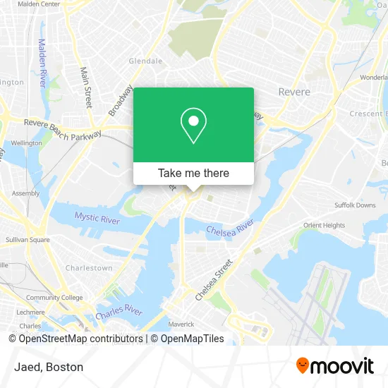
See Jaed, Chelsea, on the map
Public Transit to Jaed in Chelsea
Wondering how to get to Jaed in Chelsea? Moovit helps you find the best way to get to Jaed with step-by-step directions from the nearest public transit station.
Moovit provides free maps and live directions to help you navigate through your city. View schedules, routes, timetables, and find out how long does it take to get to Jaed in real time.
Looking for the nearest stop or station to Jaed? Check out this list of stops closest to your destination: Central Ave @ Shawmut St; Hawthorne St @ Broadway; Wood Island; Chelsea.
Bus: 104, 111, 112, SL3, 114, 116.Train: NEWBURYPORT/ROCKPORT.Subway: BLUE LINE.
Want to see if there’s another route that gets you there at an earlier time? Moovit helps you find alternative routes or times. Get directions from and directions to Jaed easily from the Moovit App or Website.
We make riding to Jaed easy, which is why over 1.7 million users, including users in Chelsea, trust Moovit as the best app for public transit. You don’t need to download an individual bus app or train app, Moovit is your all-in-one transit app that helps you find the best bus time or train time available.
For information on prices of bus, subway and ferry, costs and ride fares to Jaed, please check the Moovit app.
Use the app to navigate to popular places including to the airport, hospital, stadium, grocery store, mall, coffee shop, school, college, and university.
Jaed Address: 307 Broadway street in Chelsea
- Flavorfulz,
- Montes Jewelry,
- Mision Cristiana El Poderoso de Israel,
- Live Well Nutrition,
- Injury Prevention Physical Therapy,
- Variedades Michelle in,
- CVS,
- Yanira Ventura,
- Harbor Management,
- Expert Staffing,
- Laronde de Marie Claire Early Learning,
- La Colaborativa,
- Kushalasipcoffee Andtapasbar,
- Centro Familiar de Adoracion Chelsea, Ma,
- Business,
- Stone & Cabinets Pro,
- Iglesia Intervencion Divina,
- DF Wireless,
- T-Mobile,
- Colombian Boutique
Places Near Jaed (Chelsea)
- Mgm Music Hall, Boston,
- Td Garden, Boston,
- Prudential Center, Boston,
- Castle Island, Boston,
- Seaport District, Boston,
- Boston Common, Boston,
- Cheers, Boston,
- House Of Blues, Boston,
- Wang Theater, Boston,
- Leader Bank Pavilion (Leader Bank Pavillion), Boston,
- Boston Children's Hospital, Boston,
- Museum Of Science, Boston,
- Massachusetts General Hospital, Boston,
- Wilbur Theatre, Boston,
- Faneuil Hall, Boston,
- Boston Convention & Exhibition Center, Boston,
- Quincy Market, Boston,
- Isabella Stewart Gardner Museum, Boston,
- Boston Medical Center, Boston,
- North End, Boston
How to get to popular places in Boston with public transit
Get around Chelsea by public transit!
Traveling around Chelsea has never been so easy. See step by step directions as you travel to any attraction, street or major public transit station. View bus and train schedules, arrival times, service alerts and detailed routes on a map, so you know exactly how to get to anywhere in Chelsea.
When traveling to any destination around Chelsea use Moovit's Live Directions with Get Off Notifications to know exactly where and how far to walk, how long to wait for your line, and how many stops are left. Moovit will alert you when it's time to get off — no need to constantly re-check whether yours is the next stop.
Wondering how to use public transit in Chelsea or how to pay for public transit in Chelsea? Moovit public transit app can help you navigate your way with public transit easily, and at minimum cost. It includes public transit fees, ticket prices, and costs. Looking for a map of Chelsea public transit lines? Moovit public transit app shows all public transit maps in Chelsea with all Bus, Train, Subway and Ferry routes and stops on an interactive map.
Boston has 4 transit type(s), including: Bus, Train, Subway and Ferry, operated by several transit agencies, including MBTA, Southeastern Regional Transit Authority, MetroWest Regional Transit Authority, Rhode Island Public Transit Authority, WRTA, Lowell Regional Transit Authority, Merrimack Valley Transit, Montachusett Regional Transit Authority, Cape Cod Regional Transit Authority, Brockton Area Transit Authority, Martha's Vineyard Transit Authority, the WAVE - Nantucket Regional Transit Authority, GATRA, Cape Ann Transportation Authority and Massport