How to get to Jakru by bus?
Click on the bus route to see step by step directions with maps, line arrival times and updated time schedules.
Bus stops near Jakru in Worcester
Bus lines to Jakru in Worcester
What are the closest stations to Jakru?
The closest stations to Jakru are:
- Tacoma St + Constitution Ave is 332 yards away, 5 min walk.
- St. Nicholas Ave at Hilda is 375 yards away, 5 min walk.
Which bus lines stop near Jakru?
These bus lines stop near Jakru: 14, 23.
What’s the nearest bus station to Jakru in Worcester?
The nearest bus stations to Jakru in Worcester are Tacoma St + Constitution Ave and St. Nicholas Ave at Hilda. The closest one is a 5 min walk away.
What time is the first bus to Jakru in Worcester?
The 23 is the first bus that goes to Jakru in Worcester. It stops nearby at 5:44 AM.
What time is the last bus to Jakru in Worcester?
The 26 is the last bus that goes to Jakru in Worcester. It stops nearby at 11:46 PM.
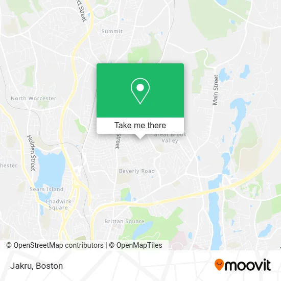
See Jakru, Worcester, on the map
Public Transit to Jakru in Worcester
Wondering how to get to Jakru in Worcester? Moovit helps you find the best way to get to Jakru with step-by-step directions from the nearest public transit station.
Moovit provides free maps and live directions to help you navigate through your city. View schedules, routes, timetables, and find out how long does it take to get to Jakru in real time.
Looking for the nearest stop or station to Jakru? Check out this list of stops closest to your destination: Tacoma St + Constitution Ave; St. Nicholas Ave at Hilda.
Bus: 14, 23, 26, 31.
Want to see if there’s another route that gets you there at an earlier time? Moovit helps you find alternative routes or times. Get directions from and directions to Jakru easily from the Moovit App or Website.
We make riding to Jakru easy, which is why over 1.7 million users, including users in Worcester, trust Moovit as the best app for public transit. You don’t need to download an individual bus app or train app, Moovit is your all-in-one transit app that helps you find the best bus time or train time available.
For information on prices of bus and train, costs and ride fares to Jakru, please check the Moovit app.
Use the app to navigate to popular places including to the airport, hospital, stadium, grocery store, mall, coffee shop, school, college, and university.
Jakru Address: 66 Pocasset Ave street in Worcester
- SJC Core Drilling,
- Learn & Play Child Care,
- The Bing Palace,
- Mike's Backroom Ale House,
- Great Brook Valley Pool,
- Fist Pump Room,
- Ideal Sales Co.,
- Rainbow General Services,
- Lightsplanneractn,
- Paul Doherty,
- Ladrie Painting and Decor,
- Lebow Real Estate,
- Investment,
- Fran Flynn Magician,
- Lisa Obeng RN,
- Lincoln Street Realty,
- GBV Community Center,
- International Brotherhood of Electrical Workers,
- Great Brook Valley Head Start,
- Resilient Being Ma
Places Near Jakru (Worcester)
- Boston Medical Center, Boston,
- Mgm Music Hall, Boston,
- Faneuil Hall, Boston,
- Quincy Market, Boston,
- North End, Boston,
- House Of Blues, Boston,
- Cheers, Boston,
- Massachusetts General Hospital, Boston,
- Castle Island, Boston,
- Boston Convention & Exhibition Center, Boston,
- Td Garden, Boston,
- Isabella Stewart Gardner Museum, Boston,
- Museum Of Science, Boston,
- Prudential Center, Boston,
- Wang Theater, Boston,
- Boston Children's Hospital, Boston,
- Boston Common, Boston,
- Seaport District, Boston,
- Wilbur Theatre, Boston,
- Leader Bank Pavilion (Leader Bank Pavillion), Boston
How to get to popular places in Boston with public transit
Get around Worcester by public transit!
Traveling around Worcester has never been so easy. See step by step directions as you travel to any attraction, street or major public transit station. View bus and train schedules, arrival times, service alerts and detailed routes on a map, so you know exactly how to get to anywhere in Worcester.
When traveling to any destination around Worcester use Moovit's Live Directions with Get Off Notifications to know exactly where and how far to walk, how long to wait for your line, and how many stops are left. Moovit will alert you when it's time to get off — no need to constantly re-check whether yours is the next stop.
Wondering how to use public transit in Worcester or how to pay for public transit in Worcester? Moovit public transit app can help you navigate your way with public transit easily, and at minimum cost. It includes public transit fees, ticket prices, and costs. Looking for a map of Worcester public transit lines? Moovit public transit app shows all public transit maps in Worcester with all Bus, Train, Subway and Ferry routes and stops on an interactive map.
Boston has 4 transit type(s), including: Bus, Train, Subway and Ferry, operated by several transit agencies, including MBTA, Southeastern Regional Transit Authority, MetroWest Regional Transit Authority, Rhode Island Public Transit Authority, WRTA, Lowell Regional Transit Authority, Merrimack Valley Transit, Montachusett Regional Transit Authority, Cape Cod Regional Transit Authority, Brockton Area Transit Authority, Martha's Vineyard Transit Authority, the WAVE - Nantucket Regional Transit Authority, GATRA, Cape Ann Transportation Authority and Massport