Directions to Jam'N Java Open Mic (Arlington) with public transportation
The following transit lines have routes that pass near Jam'N Java Open Mic
 Bus: 67, 77, 95, 80, 350.
- Train: FITCHBURG, LOWELL.
- Subway: RED LINE, GREEN LINE B, GREEN LINE C, GREEN LINE E.
How to get to Jam'N Java Open Mic by bus?
Click on the bus route to see step by step directions with maps, line arrival times and updated time schedules.
From Revere Hotel Boston Common, Boston
61 minFrom Colonial Theatre, Boston
62 minFrom New England Law | Boston, Boston
59 minFrom Christian A Herter Park, Boston
46 minFrom The Ritz-Carlton, Boston, Boston
65 minFrom Faneuil Hall Marketplace, Boston
55 minFrom Park Plaza Hotel Boston, Boston
59 minFrom Charlestown, Boston
44 minFrom Charles W. Eliot Bridge, Boston
39 minFrom 60 State St, Boston
55 min
How to get to Jam'N Java Open Mic by train?
Click on the train route to see step by step directions with maps, line arrival times and updated time schedules.
How to get to Jam'N Java Open Mic by subway?
Click on the subway route to see step by step directions with maps, line arrival times and updated time schedules.
From Revere Hotel Boston Common, Boston
64 minFrom Colonial Theatre, Boston
60 minFrom New England Law | Boston, Boston
63 minFrom The Ritz-Carlton, Boston, Boston
58 minFrom Faneuil Hall Marketplace, Boston
63 minFrom Park Plaza Hotel Boston, Boston
65 minFrom Charlestown, Boston
77 minFrom Charles W. Eliot Bridge, Boston
65 minFrom 60 State St, Boston
63 min
Bus stops near Jam'N Java Open Mic in Arlington
Train stations near Jam'N Java Open Mic in Arlington
Subway stations near Jam'N Java Open Mic in Arlington
Bus lines to Jam'N Java Open Mic in Arlington
What are the closest stations to Jam'N Java Open Mic?
The closest stations to Jam'N Java Open Mic are:
- Medford St @ Massachusetts Ave is 129 yards away, 2 min walk.
- Massachusetts Ave @ Medford St is 175 yards away, 3 min walk.
- Massachusetts Ave @ Mystic St is 180 yards away, 3 min walk.
- Broadway @ Massachusetts Ave is 295 yards away, 4 min walk.
- West Medford is 1954 yards away, 24 min walk.
- Alewife is 2731 yards away, 33 min walk.
- Belmont is 3439 yards away, 41 min walk.
- Medford/Tufts Station is 3875 yards away, 46 min walk.
Which bus lines stop near Jam'N Java Open Mic?
These bus lines stop near Jam'N Java Open Mic: 67, 77, 95.
Which train lines stop near Jam'N Java Open Mic?
These train lines stop near Jam'N Java Open Mic: FITCHBURG, LOWELL.
Which subway line stops near Jam'N Java Open Mic?
RED LINE (Alewife)
What’s the nearest train station to Jam'N Java Open Mic in Arlington?
The nearest train station to Jam'N Java Open Mic in Arlington is West Medford. It’s a 24 min walk away.
What’s the nearest bus station to Jam'N Java Open Mic in Arlington?
The nearest bus station to Jam'N Java Open Mic in Arlington is Medford St @ Massachusetts Ave. It’s a 2 min walk away.
What time is the first subway to Jam'N Java Open Mic in Arlington?
The GREEN LINE E is the first subway that goes to Jam'N Java Open Mic in Arlington. It stops nearby at 4:57 AM.
What time is the last subway to Jam'N Java Open Mic in Arlington?
The GREEN LINE E is the last subway that goes to Jam'N Java Open Mic in Arlington. It stops nearby at 2:41 AM.
What time is the first train to Jam'N Java Open Mic in Arlington?
The LOWELL is the first train that goes to Jam'N Java Open Mic in Arlington. It stops nearby at 5:31 AM.
What time is the last train to Jam'N Java Open Mic in Arlington?
The LOWELL is the last train that goes to Jam'N Java Open Mic in Arlington. It stops nearby at 12:20 AM.
What time is the first bus to Jam'N Java Open Mic in Arlington?
The 77 is the first bus that goes to Jam'N Java Open Mic in Arlington. It stops nearby at 4:53 AM.
What time is the last bus to Jam'N Java Open Mic in Arlington?
The 87 is the last bus that goes to Jam'N Java Open Mic in Arlington. It stops nearby at 1:43 AM.
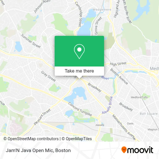
See Jam'N Java Open Mic, Arlington, on the map
Public Transit to Jam'N Java Open Mic in Arlington
Wondering how to get to Jam'N Java Open Mic in Arlington? Moovit helps you find the best way to get to Jam'N Java Open Mic with step-by-step directions from the nearest public transit station.
Moovit provides free maps and live directions to help you navigate through your city. View schedules, routes, timetables, and find out how long does it take to get to Jam'N Java Open Mic in real time.
Looking for the nearest stop or station to Jam'N Java Open Mic? Check out this list of stops closest to your destination: Medford St @ Massachusetts Ave; Massachusetts Ave @ Medford St; Massachusetts Ave @ Mystic St; Broadway @ Massachusetts Ave; West Medford; Alewife; Belmont; Medford/Tufts Station.
Bus: 67, 77, 95, 80, 350.Train: FITCHBURG, LOWELL.Subway: RED LINE, GREEN LINE B, GREEN LINE C, GREEN LINE E.
Want to see if there’s another route that gets you there at an earlier time? Moovit helps you find alternative routes or times. Get directions from and directions to Jam'N Java Open Mic easily from the Moovit App or Website.
We make riding to Jam'N Java Open Mic easy, which is why over 1.7 million users, including users in Arlington, trust Moovit as the best app for public transit. You don’t need to download an individual bus app or train app, Moovit is your all-in-one transit app that helps you find the best bus time or train time available.
For information on prices of bus, subway and train, costs and ride fares to Jam'N Java Open Mic, please check the Moovit app.
Use the app to navigate to popular places including to the airport, hospital, stadium, grocery store, mall, coffee shop, school, college, and university.
Jam'N Java Open Mic Address: Donut Villa, 319 Broadway street in Arlington
- Cricket Garage Doors Service,
- Greek Habits by Eva,
- Mystic Wellness Space,
- Pro Locksmith - Arlington Ma,
- Davis Squared,
- Wireless Zone,
- Cutter Gallery Arlington,
- Uncle Sam Memorial Statue,
- Pasciuto Frank - FFP Realty Corporation,
- Mind's Eye Yarns,
- Law Offices of Susan D Stamps,
- Locksmith Store In Arlington,
- Easy Does It Movements,
- Zomsa,
- Age Against the Machine,
- STARBUCKS,
- Carpet Cleaning,
- The Daily Bloom,
- Brizuela Fitness,
- Home Carpet Cleaning
Places Near Jam'N Java Open Mic (Arlington)
- Td Garden, Boston,
- Prudential Center, Boston,
- Boston Medical Center, Boston,
- Quincy Market, Boston,
- Boston Convention & Exhibition Center, Boston,
- Castle Island, Boston,
- Boston Children's Hospital, Boston,
- Faneuil Hall, Boston,
- Seaport District, Boston,
- Leader Bank Pavilion (Leader Bank Pavillion), Boston,
- North End, Boston,
- Mgm Music Hall, Boston,
- Cheers, Boston,
- Wang Theater, Boston,
- Isabella Stewart Gardner Museum, Boston,
- Boston Common, Boston,
- Wilbur Theatre, Boston,
- Massachusetts General Hospital, Boston,
- House Of Blues, Boston,
- Museum Of Science, Boston
How to get to popular places in Boston with public transit
Get around Arlington by public transit!
Traveling around Arlington has never been so easy. See step by step directions as you travel to any attraction, street or major public transit station. View bus and train schedules, arrival times, service alerts and detailed routes on a map, so you know exactly how to get to anywhere in Arlington.
When traveling to any destination around Arlington use Moovit's Live Directions with Get Off Notifications to know exactly where and how far to walk, how long to wait for your line, and how many stops are left. Moovit will alert you when it's time to get off — no need to constantly re-check whether yours is the next stop.
Wondering how to use public transit in Arlington or how to pay for public transit in Arlington? Moovit public transit app can help you navigate your way with public transit easily, and at minimum cost. It includes public transit fees, ticket prices, and costs. Looking for a map of Arlington public transit lines? Moovit public transit app shows all public transit maps in Arlington with all Bus, Train, Subway and Ferry routes and stops on an interactive map.
Boston has 4 transit type(s), including: Bus, Train, Subway and Ferry, operated by several transit agencies, including MBTA, Southeastern Regional Transit Authority, MetroWest Regional Transit Authority, Rhode Island Public Transit Authority, WRTA, Lowell Regional Transit Authority, Merrimack Valley Transit, Montachusett Regional Transit Authority, Cape Cod Regional Transit Authority, Brockton Area Transit Authority, Martha's Vineyard Transit Authority, the WAVE - Nantucket Regional Transit Authority, GATRA, Cape Ann Transportation Authority and Massport