See James Blake House, Boston, on the map
Directions to James Blake House (Boston) with public transportation
The following transit lines have routes that pass near James Blake House
 Bus:
Bus: - Train:
- Subway:
How to get to James Blake House by bus?
Click on the bus route to see step by step directions with maps, line arrival times and updated time schedules.
How to get to James Blake House by train?
Click on the train route to see step by step directions with maps, line arrival times and updated time schedules.
How to get to James Blake House by subway?
Click on the subway route to see step by step directions with maps, line arrival times and updated time schedules.
Bus stations near James Blake House in Boston
- Columbia Rd @ Massachusetts Ave,2 min walk,
- Massachusetts Ave @ Columbia Rd,2 min walk,
Bus lines to James Blake House in Boston
- 16,Harbor Point Via South Bay Center,
- 17,Andrew,
- 41,Jfk/Umass,
- 8,Harbor Point Via South Bay Center,
What are the closest stations to James Blake House?
The closest stations to James Blake House are:
- Columbia Rd @ Massachusetts Ave is 140 yards away, 2 min walk.
- Massachusetts Ave @ Columbia Rd is 152 yards away, 2 min walk.
Which bus lines stop near James Blake House?
These bus lines stop near James Blake House: 17, 18, 41, 8.
Which train lines stop near James Blake House?
These train lines stop near James Blake House: FAIRMOUNT LINE, KINGSTON/PLYMOUTH LINE.
Which subway line stops near James Blake House?
RED LINE
What’s the nearest bus stop to James Blake House in Boston?
The nearest bus stops to James Blake House in Boston are Columbia Rd @ Massachusetts Ave and Massachusetts Ave @ Columbia Rd. The closest one is a 2 min walk away.
See James Blake House, Boston, on the map
Public Transit to James Blake House in Boston
Wondering how to get to James Blake House in Boston, United States? Moovit helps you find the best way to get to James Blake House with step-by-step directions from the nearest public transit station.
Moovit provides free maps and live directions to help you navigate through your city. View schedules, routes, timetables, and find out how long does it take to get to James Blake House in real time.
Looking for the nearest stop or station to James Blake House? Check out this list of stops closest to your destination: Columbia Rd @ Massachusetts Ave; Massachusetts Ave @ Columbia Rd.
Bus:Train:Subway:
Want to see if there’s another route that gets you there at an earlier time? Moovit helps you find alternative routes or times. Get directions from and directions to James Blake House easily from the Moovit App or Website.
We make riding to James Blake House easy, which is why over 1.5 million users, including users in Boston, trust Moovit as the best app for public transit. You don’t need to download an individual bus app or train app, Moovit is your all-in-one transit app that helps you find the best bus time or train time available.
For information on prices of bus, subway and train, costs and ride fares to James Blake House, please check the Moovit app.
Use the app to navigate to popular places including to the airport, hospital, stadium, grocery store, mall, coffee shop, school, college, and university.
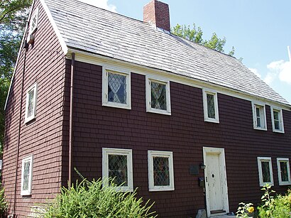
James Blake House Address: East Cottage Street street in Boston
Attractions near James Blake House
Richardson Sq,Edward Everett Park,Thomas J Kane Square,Edward Everett Statue,MBTA Bus Stop – Columbia @ & Opposite Pond,Blakie,Columbia Rd Opp Pond St,11 Pond St,11 Pond Street,220 E Cottage St,Mid Dochester,7 Dawes Ter,7 Dawes Street,William E. Russell Elementary School,7 Dawes St,222,E Cottage St E Cottage St,Richardson Park,Dawes Dynasty,Pine Street Inn,William E RussellHow to get to popular attractions in Boston with public transit
Massachusetts, Medford,Mike's Food and Spirits, Somerville,East Providence, RI,Wilmington, MA, Wilmington,La Famiglia Giorgio's, Boston,Bunker Hill Community College, Boston,The Landing at Long Wharf, Boston,BonChon Chicken, Boston,Newport, RI,Tavern in the Square, Boston,Inman Square, Cambridge,Brown University,Stella, Boston,J.P. Licks Jamaica Plain, Boston,Picco, Boston,McGreevy's, Boston,South Bay Mall, Boston,Staples Corporate HQ, Framingham,California Pizza Kitchen, Boston,Cityside Restaurant & Bar, BostonGet around Boston by public transit!
Traveling around Boston has never been so easy. See step by step directions as you travel to any attraction, street or major public transit station. View bus and train schedules, arrival times, service alerts and detailed routes on a map, so you know exactly how to get to anywhere in Boston.
When traveling to any destination around Boston use Moovit's Live Directions with Get Off Notifications to know exactly where and how far to walk, how long to wait for your line, and how many stops are left. Moovit will alert you when it's time to get off — no need to constantly re-check whether yours is the next stop.
Wondering how to use public transit in Boston or how to pay for public transit in Boston? Moovit public transit app can help you navigate your way with public transit easily, and at minimum cost. It includes public transit fees, ticket prices, and costs. Looking for a map of Boston public transit lines? Moovit public transit app shows all public transit maps in Boston with all bus, subway or train routes and stops on an interactive map.
Boston has 3 transit type(s), including: bus, subway or train, operated by several transit agencies, including MBTA, MBTA, MBTA, Southeastern Regional Transit Authority, MetroWest Regional Transit Authority, Rhode Island Public Transit Authority, WRTA, Lowell Regional Transit Authority, Merrimack Valley Transit, Montachusett Regional Transit Authority, Cape Cod Regional Transit Authority, Brockton Area Transit Authority, Cape Cod Regional Transit Authority, Martha's Vineyard Transit Authority and the WAVE - Nantucket Regional Transit Authority