How to get to James D. Sullivan, Md by bus?
Click on the bus route to see step by step directions with maps, line arrival times and updated time schedules.
From Bedford Industrial Park, New Bedford
112 minFrom RMV New Bedford, New Bedford
110 minFrom Amazon Fulfillment Bos7, Fall River
119 minFrom B.M.C. Durfee High School, Fall River
88 minFrom Lizzy Borden House, Fall River
86 minFrom Walmart Fall River Supercenter, Fall River
102 minFrom Charlton Memorial Hospital, Fall River
107 minFrom Bristol Community College, Fall River
89 minFrom Falmouth MA USA, Falmouth
106 minFrom Mass Maritime Academy, Buzzards Bay
102 min
Bus stops near James D. Sullivan, Md in Boston
Ferry stations near James D. Sullivan, Md in Boston
Bus lines to James D. Sullivan, Md in Boston
What are the closest stations to James D. Sullivan, Md?
The closest stations to James D. Sullivan, Md are:
- Mill Rd And Bridge St is 488 yards away, 7 min walk.
- Fairhaven South Coast Health is 1077 yards away, 13 min walk.
- Health System is 1080 yards away, 14 min walk.
- New Bedford, MA is 4803 yards away, 57 min walk.
- Cuttyhunk Ferry Pier, New Bedford, MA is 4996 yards away, 59 min walk.
Which bus lines stop near James D. Sullivan, Md?
These bus lines stop near James D. Sullivan, Md: 211, WARE.
What’s the nearest bus station to James D. Sullivan, Md in Boston?
The nearest bus station to James D. Sullivan, Md in Boston is Mill Rd And Bridge St. It’s a 7 min walk away.
What time is the first bus to James D. Sullivan, Md in Boston?
The 211 is the first bus that goes to James D. Sullivan, Md in Boston. It stops nearby at 6:23 AM.
What time is the last bus to James D. Sullivan, Md in Boston?
The 211 is the last bus that goes to James D. Sullivan, Md in Boston. It stops nearby at 6:02 PM.
What time is the first ferry to James D. Sullivan, Md in Boston?
The SEASTREAK is the first ferry that goes to James D. Sullivan, Md in Boston. It stops nearby at 8:20 AM.
What time is the last ferry to James D. Sullivan, Md in Boston?
The SEASTREAK is the last ferry that goes to James D. Sullivan, Md in Boston. It stops nearby at 8:40 PM.
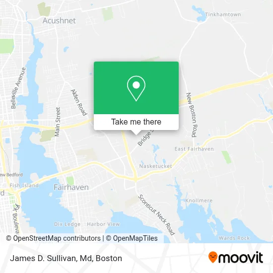
See James D. Sullivan, Md, Boston, on the map
Public Transit to James D. Sullivan, Md in Boston
Wondering how to get to James D. Sullivan, Md in Boston? Moovit helps you find the best way to get to James D. Sullivan, Md with step-by-step directions from the nearest public transit station.
Moovit provides free maps and live directions to help you navigate through your city. View schedules, routes, timetables, and find out how long does it take to get to James D. Sullivan, Md in real time.
Looking for the nearest stop or station to James D. Sullivan, Md? Check out this list of stops closest to your destination: Mill Rd And Bridge St; Fairhaven South Coast Health; Health System; New Bedford; Cuttyhunk Ferry Pier.
Bus: 211, WARE, WNB.Ferry: SEASTREAK, SEASTREAK, CUTTYHUNK FERRY.
Want to see if there’s another route that gets you there at an earlier time? Moovit helps you find alternative routes or times. Get directions from and directions to James D. Sullivan, Md easily from the Moovit App or Website.
We make riding to James D. Sullivan, Md easy, which is why over 1.7 million users, including users in Boston, trust Moovit as the best app for public transit. You don’t need to download an individual bus app or train app, Moovit is your all-in-one transit app that helps you find the best bus time or train time available.
For information on prices of bus, costs and ride fares to James D. Sullivan, Md, please check the Moovit app.
Use the app to navigate to popular places including to the airport, hospital, stadium, grocery store, mall, coffee shop, school, college, and university.
James D. Sullivan, Md Address: 208 Mill Rd street in Boston
- Jennifer Ring, Pa,
- Christopher MD Cheney PHD,
- Nosheen Javed MD,
- Michelle M. McKenney, do,
- Dr. Alexis Pappas MD,
- Othman Edress MD,
- Patrick Gagnon MD,
- Tushar Kumar MD,
- Sonia Seng MD,
- Automotive Windshield Repair Glass Auto,
- Therese Mulvey MD,
- Elizabeth Blanchard MD,
- Mill Road and Bridge Street,
- St Luke's Emergency Associate,
- Devon Self Storage,
- Rosie's Deli,
- David J Dias Plumbing & Htg,
- M.O.L.I.F.E,
- Wayne Fostin Plumbing,
- Alltrust Credit Union
Places Near James D. Sullivan, Md (Boston)
- House Of Blues, Boston,
- Prudential Center, Boston,
- Wang Theater, Boston,
- Boston Convention & Exhibition Center, Boston,
- Wilbur Theatre, Boston,
- Boston Children's Hospital, Boston,
- North End, Boston,
- Boston Medical Center, Boston,
- Boston Common, Boston,
- Museum Of Science, Boston,
- Td Garden, Boston,
- Mgm Music Hall, Boston,
- Massachusetts General Hospital, Boston,
- Faneuil Hall, Boston,
- Seaport District, Boston,
- Quincy Market, Boston,
- Isabella Stewart Gardner Museum, Boston,
- Cheers, Boston,
- Leader Bank Pavilion (Leader Bank Pavillion), Boston,
- Castle Island, Boston
How to get to popular places in Boston with public transit
Get around Boston by public transit!
Traveling around Boston has never been so easy. See step by step directions as you travel to any attraction, street or major public transit station. View bus and train schedules, arrival times, service alerts and detailed routes on a map, so you know exactly how to get to anywhere in Boston.
When traveling to any destination around Boston use Moovit's Live Directions with Get Off Notifications to know exactly where and how far to walk, how long to wait for your line, and how many stops are left. Moovit will alert you when it's time to get off — no need to constantly re-check whether yours is the next stop.
Wondering how to use public transit in Boston or how to pay for public transit in Boston? Moovit public transit app can help you navigate your way with public transit easily, and at minimum cost. It includes public transit fees, ticket prices, and costs. Looking for a map of Boston public transit lines? Moovit public transit app shows all public transit maps in Boston with all Bus, Train, Subway and Ferry routes and stops on an interactive map.
Boston has 4 transit type(s), including: Bus, Train, Subway and Ferry, operated by several transit agencies, including MBTA, Southeastern Regional Transit Authority, MetroWest Regional Transit Authority, Rhode Island Public Transit Authority, WRTA, Lowell Regional Transit Authority, Merrimack Valley Transit, Montachusett Regional Transit Authority, Cape Cod Regional Transit Authority, Brockton Area Transit Authority, Martha's Vineyard Transit Authority, the WAVE - Nantucket Regional Transit Authority, GATRA, Cape Ann Transportation Authority and Massport