See James Dobson School, Philadelphia, on the map
Directions to James Dobson School (Philadelphia) with public transportation
The following transit lines have routes that pass near James Dobson School
 Bus:
Bus: - Train:
How to get to James Dobson School by bus?
Click on the bus route to see step by step directions with maps, line arrival times and updated time schedules.
How to get to James Dobson School by train?
Click on the train route to see step by step directions with maps, line arrival times and updated time schedules.
Bus stations near James Dobson School in Philadelphia
- Umbria St & Hermitage St ,1 min walk,
Bus lines to James Dobson School in Philadelphia
- 35,Manayunk-Roxborough Loop,
- 62,Andorra,
What are the closest stations to James Dobson School?
The closest stations to James Dobson School are:
- Umbria St & Hermitage St is 56 yards away, 1 min walk.
Which bus line stops near James Dobson School?
35
Which train line stops near James Dobson School?
MANAYUNK/NORRISTOWN LINE
What’s the nearest bus stop to James Dobson School in Philadelphia?
The nearest bus stop to James Dobson School in Philadelphia is Umbria St & Hermitage St. It’s a 1 min walk away.
See James Dobson School, Philadelphia, on the map
Public Transit to James Dobson School in Philadelphia
Wondering how to get to James Dobson School in Philadelphia, United States? Moovit helps you find the best way to get to James Dobson School with step-by-step directions from the nearest public transit station.
Moovit provides free maps and live directions to help you navigate through your city. View schedules, routes, timetables, and find out how long does it take to get to James Dobson School in real time.
Looking for the nearest stop or station to James Dobson School? Check out this list of stops closest to your destination: Umbria St & Hermitage St .
Bus:Train:
Want to see if there’s another route that gets you there at an earlier time? Moovit helps you find alternative routes or times. Get directions from and directions to James Dobson School easily from the Moovit App or Website.
We make riding to James Dobson School easy, which is why over 1.5 million users, including users in Philadelphia, trust Moovit as the best app for public transit. You don’t need to download an individual bus app or train app, Moovit is your all-in-one transit app that helps you find the best bus time or train time available.
For information on prices of bus and train, costs and ride fares to James Dobson School, please check the Moovit app.
Use the app to navigate to popular places including to the airport, hospital, stadium, grocery store, mall, coffee shop, school, college, and university.
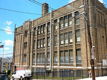
James Dobson School Address: Umbria (Hermitage) street in Philadelphia
Attractions near James Dobson School
My Kitchen,Stellar All-stars,Yim Sayin,Heaven,My Bed <3,Septa Bus Stop Hermitage & Umbria,My Little Loft 🌟,Chew Philly Food Tour,Panda Convenience Store,Marciano's Bakery,Innove Events,Yunk House,SuperDPS.com Office,deutschler pizza kitchen,D4 Creative Group,Canton Street House,KJ'S Hideaway,Canton Dungeon,Salon Masokiss,Adam and Zimmy's ApartmentHow to get to popular attractions in Philadelphia with public transit
West Oak Lane, Philadelphia,Lockheed Martin Rotary and Mission Systems,The Franklin Fountain, Philadelphia,Wegmans,Starbucks, Philadelphia,Community College Of Philadelphia, Philadelphia,Amtrak / SEPTA: Exton Station (EXT), West Whiteland,Hatfield, PA, Hatfield,Fogo De Chão, Philadelphia,Drexel Dragon Route CC Shuttle Stop, Philadelphia,Talula's Garden, Philadelphia,Hamilton Square, NJ, Hamilton Square,Hamilton, NJ, Hamilton Square,Morimoto, Philadelphia,444 N 3rd Street, Philadelphia,Newtown Athletic Club,Three Monkeys Café, Philadelphia,Burlington, NJ, Burlington,NJT - Princeton Junction Station (NEC), Princeton Junction,Spring Valley YMCA, LimerickGet around Philadelphia by public transit!
Traveling around Philadelphia has never been so easy. See step by step directions as you travel to any attraction, street or major public transit station. View bus and train schedules, arrival times, service alerts and detailed routes on a map, so you know exactly how to get to anywhere in Philadelphia.
When traveling to any destination around Philadelphia use Moovit's Live Directions with Get Off Notifications to know exactly where and how far to walk, how long to wait for your line, and how many stops are left. Moovit will alert you when it's time to get off — no need to constantly re-check whether yours is the next stop.
Wondering how to use public transit in Philadelphia or how to pay for public transit in Philadelphia? Moovit public transit app can help you navigate your way with public transit easily, and at minimum cost. It includes public transit fees, ticket prices, and costs. Looking for a map of Philadelphia public transit lines? Moovit public transit app shows all public transit maps in Philadelphia with all bus or train routes and stops on an interactive map.
Philadelphia has 2 transit type(s), including: bus or train, operated by several transit agencies, including SEPTA Subway, SEPTA Trolley, SEPTA Rail, SEPTA, SEPTA, NJ TRANSIT RAIL-Rail, NJ TRANSIT RAIL-Tram, NJ TRANSIT BUS, Port Authority Transit Corporation, Navy Yard, Penn Transit, Drexel University, Pottstown Area Rapid Transit (PART), Fullington Tours and Chescobus