See James M. Bennett High School, Salisbury, on the map
Directions to James M. Bennett High School (Salisbury) with public transportation
The following transit lines have routes that pass near James M. Bennett High School
 Bus:
Bus:
How to get to James M. Bennett High School by bus?
Click on the bus route to see step by step directions with maps, line arrival times and updated time schedules.
Bus stations near James M. Bennett High School in Salisbury
- Calvert Street,39 min walk,
Bus lines to James M. Bennett High School in Salisbury
- 10,Transfer/Calvert St. - Veterans Clinic Cambridge WB,
- 114,Shore Transit Bus Terminal - Shore Transit Bus Terminal,
- 154,Shore Transit Bus Terminal - Shore Transit Bus Terminal,
- 198,Shore Transit Bus Terminal - Shore Transit Bus Terminal,
- 203E,Shore Transit Bus Terminal - Ocean City Transfer Point,
- 203W,Ocean City Transfer Point - Shore Transit Bus Terminal,
- 252,Shore Transit Bus Terminal - Shore Transit Bus Terminal,
What are the closest stations to James M. Bennett High School?
The closest stations to James M. Bennett High School are:
- Calvert Street is 3133 yards away, 39 min walk.
Which bus line stops near James M. Bennett High School?
154
See James M. Bennett High School, Salisbury, on the map
Public Transit to James M. Bennett High School in Salisbury
Wondering how to get to James M. Bennett High School in Salisbury, United States? Moovit helps you find the best way to get to James M. Bennett High School with step-by-step directions from the nearest public transit station.
Moovit provides free maps and live directions to help you navigate through your city. View schedules, routes, timetables, and find out how long does it take to get to James M. Bennett High School in real time.
Looking for the nearest stop or station to James M. Bennett High School? Check out this list of stops closest to your destination: Calvert Street.
Bus:
Want to see if there’s another route that gets you there at an earlier time? Moovit helps you find alternative routes or times. Get directions from and directions to James M. Bennett High School easily from the Moovit App or Website.
We make riding to James M. Bennett High School easy, which is why over 1.5 million users, including users in Salisbury, trust Moovit as the best app for public transit. You don’t need to download an individual bus app or train app, Moovit is your all-in-one transit app that helps you find the best bus time or train time available.
For information on prices of bus, costs and ride fares to James M. Bennett High School, please check the Moovit app.
Use the app to navigate to popular places including to the airport, hospital, stadium, grocery store, mall, coffee shop, school, college, and university.
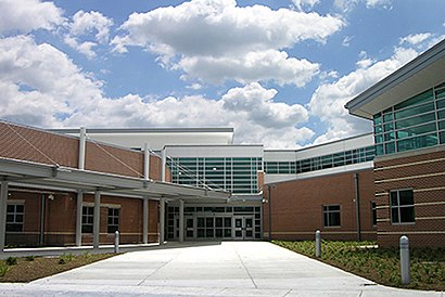
James M. Bennett High School Address: Onley Road street in Salisbury
Attractions near James M. Bennett High School
Premier Lawn Scapes,Millgan,Flatts Salisbury,College Ave Adams,1180 Tyler Ave,1062 Adams Ave,Pierce Ave College,College Ave Pierce Ave,College Pierce,Merrifield Apartments,Dashiell Piano Service,Mona's Place,Eastcoast Masonry,1001 Spring Ave,308 Carrollton Ave,Urban Hall,Wicomico County School District,Monarch Kitchen & Bath,1209 Nimitz Ct,Lincoln Heights (Lincoln Ht)How to get to popular attractions in Salisbury with public transit
Gordon Biersch Brewery Restaurant, Fairfax County,Biergarten Haus, Washington,Mt. Pleasant, Washington,Merritt Downtown Athletic Club, Baltimore,P.J. Clarke's, Washington,Little Havana, Baltimore,Costco Wholesale, Howard County,Towson, MD, Baltimore County,Manassas, VA, Manassas,Dumfries, VA, Prince William County,Smith Commons, Washington,Nordstrom Tysons Corner Center, Fairfax County,I-95 Exit 158: Prince William Pkwy, Prince William County,Bullfeathers, Washington,Intercounty Connector (ICC) / MD 200, Montgomery County,Perry Hall, Maryland, Baltimore County,Herndon, Virginia, Fairfax County,Lyon Hall, Arlington County,Bureau of Engraving and Printing, Washington,Dave & Buster's, Anne Arundel CountyGet around Salisbury by public transit!
Traveling around Salisbury has never been so easy. See step by step directions as you travel to any attraction, street or major public transit station. View bus and train schedules, arrival times, service alerts and detailed routes on a map, so you know exactly how to get to anywhere in Salisbury.
When traveling to any destination around Salisbury use Moovit's Live Directions with Get Off Notifications to know exactly where and how far to walk, how long to wait for your line, and how many stops are left. Moovit will alert you when it's time to get off — no need to constantly re-check whether yours is the next stop.
Wondering how to use public transit in Salisbury or how to pay for public transit in Salisbury? Moovit public transit app can help you navigate your way with public transit easily, and at minimum cost. It includes public transit fees, ticket prices, and costs. Looking for a map of Salisbury public transit lines? Moovit public transit app shows all public transit maps in Salisbury with all bus routes and stops on an interactive map.
Salisbury has 1 transit type(s), including: bus, operated by several transit agencies, including WMATA, WMATA, Montgomery County Ride On, Fairfax Connector, TheBus, DC Circulator, MDOT MTA, Marc, MDOT MTA, MDOT MTA, Virginia Railway Express (VRE), PRTC, DASH - Alexandria, Arlington Transit (ART) and DC Streetcar