How to get to Janelle Chrie by bus?
Click on the bus route to see step by step directions with maps, line arrival times and updated time schedules.
From The Watermark Hotel, Fairfax County
82 minFrom Longworth House Office Building, Washington
69 minFrom Embassy of India, Washington
34 minFrom Us Supreme Court, Washington
73 minFrom Zaytinya, Washington
59 minFrom Gordon Ramsay Hell's Kitchen, Washington
66 minFrom Ted's Bulletin, Washington
51 minFrom Union Station Metro Station, Washington
62 minFrom H St NE (7th & H St NE), Washington
75 minFrom Comfort Inn Downtown DC/Convention Center, Washington
56 min
How to get to Janelle Chrie by metro?
Click on the metro route to see step by step directions with maps, line arrival times and updated time schedules.
From The Watermark Hotel, Fairfax County
70 minFrom Longworth House Office Building, Washington
53 minFrom Embassy of India, Washington
38 minFrom Us Supreme Court, Washington
56 minFrom Zaytinya, Washington
42 minFrom Gordon Ramsay Hell's Kitchen, Washington
58 minFrom Ted's Bulletin, Washington
55 minFrom Union Station Metro Station, Washington
43 minFrom H St NE (7th & H St NE), Washington
54 minFrom Comfort Inn Downtown DC/Convention Center, Washington
50 min
Bus stops near Janelle Chrie in Washington
Metro station near Janelle Chrie in Washington
- Woodley Park-Zoo/Adams Morgan, 48 min walk,VIEW
What are the closest stations to Janelle Chrie?
The closest stations to Janelle Chrie are:
- Massachusetts Av Nw+49 St NW is 154 yards away, 3 min walk.
- Terminal;Westmoreland & Massachusetts is 556 yards away, 7 min walk.
- Woodley Park-Zoo/Adams Morgan is 4028 yards away, 48 min walk.
Which bus line stops near Janelle Chrie?
D96 (South To Potomac Park)
Which metro line stops near Janelle Chrie?
RED (Shady Grove)
What’s the nearest bus station to Janelle Chrie in Washington?
The nearest bus station to Janelle Chrie in Washington is Massachusetts Av Nw+49 St NW. It’s a 3 min walk away.
What time is the first metro to Janelle Chrie in Washington?
The RED is the first metro that goes to Janelle Chrie in Washington. It stops nearby at 5:21 AM.
What time is the last metro to Janelle Chrie in Washington?
The RED is the last metro that goes to Janelle Chrie in Washington. It stops nearby at 12:19 AM.
What time is the first bus to Janelle Chrie in Washington?
The D96 is the first bus that goes to Janelle Chrie in Washington. It stops nearby at 5:43 AM.
What time is the last bus to Janelle Chrie in Washington?
The D96 is the last bus that goes to Janelle Chrie in Washington. It stops nearby at 12:56 AM.
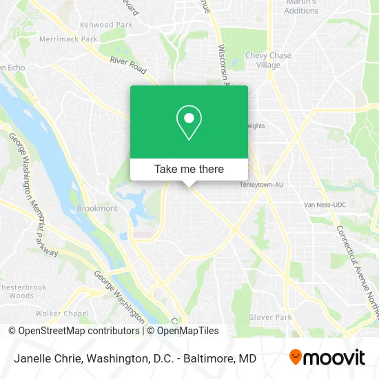
See Janelle Chrie, Washington, on the map
Public Transit to Janelle Chrie in Washington
Wondering how to get to Janelle Chrie in Washington? Moovit helps you find the best way to get to Janelle Chrie with step-by-step directions from the nearest public transit station.
Moovit provides free maps and live directions to help you navigate through your city. View schedules, routes, timetables, and find out how long does it take to get to Janelle Chrie in real time.
Looking for the nearest stop or station to Janelle Chrie? Check out this list of stops closest to your destination: Massachusetts Av Nw+49 St NW; Terminal;Westmoreland & Massachusetts; Woodley Park-Zoo/Adams Morgan.
Bus: D96, 29.Metro: RED.
Want to see if there’s another route that gets you there at an earlier time? Moovit helps you find alternative routes or times. Get directions from and directions to Janelle Chrie easily from the Moovit App or Website.
We make riding to Janelle Chrie easy, which is why over 1.5 million users, including users in Washington, trust Moovit as the best app for public transit. You don’t need to download an individual bus app or train app, Moovit is your all-in-one transit app that helps you find the best bus time or train time available.
For information on prices of bus and metro, costs and ride fares to Janelle Chrie, please check the Moovit app.
Use the app to navigate to popular places including to the airport, hospital, stadium, grocery store, mall, coffee shop, school, college, and university.
Janelle Chrie Address: 4900 Massachusetts Ave NW Washington, DC 20016 street in Washington
- Massachusetts Ave and 49th,
- Medstar,
- Woods & Poole Economics,
- Arcpoint Labs,
- Bluestone Lane Spring Valley Café,
- Lot 746,
- Hygiene Carpet Cleaning,
- Dalton Psychiatric Services,
- Washington Interventional Psychiatry,
- Shell Recharge,
- Patch Testing for Contact Dermatitis,
- Lasik Cataract Oculoplastics,
- Idemia TSA Precheck,
- DC Smile Studio,
- Emily Porter Gerson MD,
- Alex Cooper Auctioneers,
- Blue Skye Construction,
- Joan Fallows,
- Kathy Braun,
- DMV Spirits
Places Near Janelle Chrie (Washington)
- M&T Bank Stadium, Baltimore,
- National Museum of African American History and Culture, Washington,
- Georgetown, Washington,
- Washington National Cathedral, Washington,
- Pennsylvania Ave NW (3rd st and pennsylvania), Washington,
- PG Mall, Prince George's County,
- Camden Yards, Baltimore,
- Sibley Memorial Hospital, Washington,
- Basilica of the National Shrine, Washington,
- Warner Theatre, Washington,
- Museum Of The Bible, Washington,
- Westfield Montgomery Mall, Montgomery County,
- Rock Creek Tennis Center, Washington,
- Amazon Hq2, Arlington County,
- Washington DC VA Medical Center, Washington,
- The Anthem, Washington,
- National Zoo, Washington,
- Marriott Marquis Washington, DC, Washington,
- Capital One Arena, Washington,
- National Mall, Washington
How to get to popular places in Washington, D.C. - Baltimore, MD with public transit
Get around Washington by public transit!
Traveling around Washington has never been so easy. See step by step directions as you travel to any attraction, street or major public transit station. View bus and train schedules, arrival times, service alerts and detailed routes on a map, so you know exactly how to get to anywhere in Washington.
When traveling to any destination around Washington use Moovit's Live Directions with Get Off Notifications to know exactly where and how far to walk, how long to wait for your line, and how many stops are left. Moovit will alert you when it's time to get off — no need to constantly re-check whether yours is the next stop.
Wondering how to use public transit in Washington or how to pay for public transit in Washington? Moovit public transit app can help you navigate your way with public transit easily, and at minimum cost. It includes public transit fees, ticket prices, and costs. Looking for a map of Washington public transit lines? Moovit public transit app shows all public transit maps in Washington with all Bus, Train, Metro, Light Rail and Ferry routes and stops on an interactive map.
Washington, D.C. - Baltimore, MD has 5 transit type(s), including: Bus, Train, Metro, Light Rail and Ferry, operated by several transit agencies, including WMATA, Montgomery County Ride On, Fairfax Connector, TheBus, PRTC, DASH - Alexandria, Arlington Transit (ART), RTA of Central Maryland, MDOT MTA, MDOT MTA Light RailLink, MDOT MTA Commuter Bus, MDOT MTA Local Bus, FXBGO!, Virginia Railway Express (VRE) and MARC