How to get to Shell Recharge by bus?
Click on the bus route to see step by step directions with maps, line arrival times and updated time schedules.
From Arena Stage, Washington
67 minFrom 645 H Street NE Service Center, Washington
76 minFrom Montgomery College-Takoma Park/Silver Spring, Montgomery County
59 minFrom Vermont Ave, Washington
52 minFrom Union Stage, Washington
67 minFrom Us Supreme Court, Washington
74 minFrom H St NE (7th & H St NE), Washington
75 minFrom Royal Sonesta Washington DC, Washington
34 minFrom Laurel MD-195, Montgomery County
69 minFrom Longworth House Office Building, Washington
70 min
How to get to Shell Recharge by metro?
Click on the metro route to see step by step directions with maps, line arrival times and updated time schedules.
From Arena Stage, Washington
53 minFrom 645 H Street NE Service Center, Washington
54 minFrom Montgomery College-Takoma Park/Silver Spring, Montgomery County
67 minFrom Vermont Ave, Washington
43 minFrom Union Stage, Washington
61 minFrom Us Supreme Court, Washington
56 minFrom H St NE (7th & H St NE), Washington
54 minFrom Royal Sonesta Washington DC, Washington
39 minFrom Laurel MD-195, Montgomery County
59 minFrom Longworth House Office Building, Washington
53 min
Bus stops near Shell Recharge in Washington
Metro station near Shell Recharge in Washington
- Woodley Park-Zoo/Adams Morgan, 43 min walk,VIEW
What are the closest stations to Shell Recharge?
The closest stations to Shell Recharge are:
- Massachusetts Av Nw+49 St NW is 82 yards away, 2 min walk.
- Terminal;Westmoreland & Massachusetts is 575 yards away, 7 min walk.
- Woodley Park-Zoo/Adams Morgan is 3675 yards away, 43 min walk.
Which bus line stops near Shell Recharge?
D96 (South To Potomac Park)
Which metro line stops near Shell Recharge?
RED (Shady Grove)
What’s the nearest bus station to Shell Recharge in Washington?
The nearest bus station to Shell Recharge in Washington is Massachusetts Av Nw+49 St NW. It’s a 2 min walk away.
What time is the first metro to Shell Recharge in Washington?
The RED is the first metro that goes to Shell Recharge in Washington. It stops nearby at 5:21 AM.
What time is the last metro to Shell Recharge in Washington?
The RED is the last metro that goes to Shell Recharge in Washington. It stops nearby at 12:19 AM.
What time is the first bus to Shell Recharge in Washington?
The D96 is the first bus that goes to Shell Recharge in Washington. It stops nearby at 5:44 AM.
What time is the last bus to Shell Recharge in Washington?
The D96 is the last bus that goes to Shell Recharge in Washington. It stops nearby at 12:56 AM.
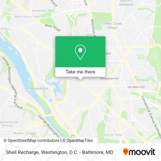
See Shell Recharge, Washington, on the map
Public Transit to Shell Recharge in Washington
Wondering how to get to Shell Recharge in Washington? Moovit helps you find the best way to get to Shell Recharge with step-by-step directions from the nearest public transit station.
Moovit provides free maps and live directions to help you navigate through your city. View schedules, routes, timetables, and find out how long does it take to get to Shell Recharge in real time.
Looking for the nearest stop or station to Shell Recharge? Check out this list of stops closest to your destination: Massachusetts Av Nw+49 St NW; Terminal;Westmoreland & Massachusetts; Woodley Park-Zoo/Adams Morgan.
Bus: D96, 29.Metro: RED.
Want to see if there’s another route that gets you there at an earlier time? Moovit helps you find alternative routes or times. Get directions from and directions to Shell Recharge easily from the Moovit App or Website.
We make riding to Shell Recharge easy, which is why over 1.5 million users, including users in Washington, trust Moovit as the best app for public transit. You don’t need to download an individual bus app or train app, Moovit is your all-in-one transit app that helps you find the best bus time or train time available.
For information on prices of bus and metro, costs and ride fares to Shell Recharge, please check the Moovit app.
Use the app to navigate to popular places including to the airport, hospital, stadium, grocery store, mall, coffee shop, school, college, and university.
Shell Recharge Address: 4851 Massachusetts Ave NW Washington, DC 20016 street in Washington
- Spring Valley Shopping Center,
- United Parcel Service of America,
- Shell,
- Playa Bowls,
- Chef Trini's,
- Bluestone Lane Spring Valley Café,
- Massachusetts Ave and 49th,
- Hygiene Carpet Cleaning,
- Le Pain Quotidien - Spring Valley,
- Dalton Psychiatric Services,
- Washington Interventional Psychiatry,
- Harwood Floor Cleaning,
- Millie’S,
- Roller Skylight,
- Janelle Chrie,
- Lot 746,
- AU - Spring Valley Building,
- Washington DC,
- STARBUCKS,
- American University Washington College of Law
Places Near Shell Recharge (Washington)
- PG Mall, Prince George's County,
- Rock Creek Tennis Center, Washington,
- Capital One Arena, Washington,
- National Mall, Washington,
- Museum Of The Bible, Washington,
- M&T Bank Stadium, Baltimore,
- Washington DC VA Medical Center, Washington,
- Amazon Hq2, Arlington County,
- The Anthem, Washington,
- National Museum of African American History and Culture, Washington,
- Washington National Cathedral, Washington,
- Sibley Memorial Hospital, Washington,
- Warner Theatre, Washington,
- National Zoo, Washington,
- Pennsylvania Ave NW (3rd st and pennsylvania), Washington,
- Georgetown, Washington,
- Camden Yards, Baltimore,
- Westfield Montgomery Mall, Montgomery County,
- Marriott Marquis Washington, DC, Washington,
- Basilica of the National Shrine, Washington
How to get to popular places in Washington, D.C. - Baltimore, MD with public transit
Get around Washington by public transit!
Traveling around Washington has never been so easy. See step by step directions as you travel to any attraction, street or major public transit station. View bus and train schedules, arrival times, service alerts and detailed routes on a map, so you know exactly how to get to anywhere in Washington.
When traveling to any destination around Washington use Moovit's Live Directions with Get Off Notifications to know exactly where and how far to walk, how long to wait for your line, and how many stops are left. Moovit will alert you when it's time to get off — no need to constantly re-check whether yours is the next stop.
Wondering how to use public transit in Washington or how to pay for public transit in Washington? Moovit public transit app can help you navigate your way with public transit easily, and at minimum cost. It includes public transit fees, ticket prices, and costs. Looking for a map of Washington public transit lines? Moovit public transit app shows all public transit maps in Washington with all Bus, Train, Metro, Light Rail and Ferry routes and stops on an interactive map.
Washington, D.C. - Baltimore, MD has 5 transit type(s), including: Bus, Train, Metro, Light Rail and Ferry, operated by several transit agencies, including WMATA, Montgomery County Ride On, Fairfax Connector, TheBus, PRTC, DASH - Alexandria, Arlington Transit (ART), RTA of Central Maryland, MDOT MTA, MDOT MTA Light RailLink, MDOT MTA Commuter Bus, MDOT MTA Local Bus, FXBGO!, Virginia Railway Express (VRE) and MARC