How to get to Jay Coy Photography by bus?
Click on the bus route to see step by step directions with maps, line arrival times and updated time schedules.
How to get to Jay Coy Photography by train?
Click on the train route to see step by step directions with maps, line arrival times and updated time schedules.
Bus stops near Jay Coy Photography in Lowell
Bus lines to Jay Coy Photography in Lowell
What are the closest stations to Jay Coy Photography?
The closest stations to Jay Coy Photography are:
- Boys & Girls Club is 161 yards away, 3 min walk.
- Westford St & Gates St is 420 yards away, 6 min walk.
- Broadway St & Suffolk St is 431 yards away, 6 min walk.
- Middlesex St & Lord Overpass Circle is 502 yards away, 7 min walk.
- Apple Street & Goward Place is 574 yards away, 7 min walk.
- Dutton St at Lowell Sun is 662 yards away, 8 min walk.
- Market Basket Senior Center is 1206 yards away, 15 min walk.
Which bus lines stop near Jay Coy Photography?
These bus lines stop near Jay Coy Photography: 24, 6.
Which train line stops near Jay Coy Photography?
LOWELL (#331 | Lowell)
What’s the nearest bus station to Jay Coy Photography in Lowell?
The nearest bus station to Jay Coy Photography in Lowell is Boys & Girls Club. It’s a 3 min walk away.
What time is the first bus to Jay Coy Photography in Lowell?
The 24 is the first bus that goes to Jay Coy Photography in Lowell. It stops nearby at 6:01 AM.
What time is the last bus to Jay Coy Photography in Lowell?
The 24 is the last bus that goes to Jay Coy Photography in Lowell. It stops nearby at 9:01 PM.
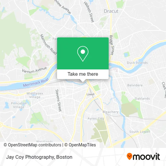
See Jay Coy Photography, Lowell, on the map
Public Transit to Jay Coy Photography in Lowell
Wondering how to get to Jay Coy Photography in Lowell? Moovit helps you find the best way to get to Jay Coy Photography with step-by-step directions from the nearest public transit station.
Moovit provides free maps and live directions to help you navigate through your city. View schedules, routes, timetables, and find out how long does it take to get to Jay Coy Photography in real time.
Looking for the nearest stop or station to Jay Coy Photography? Check out this list of stops closest to your destination: Boys & Girls Club; Westford St & Gates St; Broadway St & Suffolk St; Middlesex St & Lord Overpass Circle; Apple Street & Goward Place; Dutton St at Lowell Sun; Market Basket Senior Center.
Bus: 24, 6, 4, 17, 5, 18, 1, 7, 8, 10.Train: LOWELL.
Want to see if there’s another route that gets you there at an earlier time? Moovit helps you find alternative routes or times. Get directions from and directions to Jay Coy Photography easily from the Moovit App or Website.
We make riding to Jay Coy Photography easy, which is why over 1.7 million users, including users in Lowell, trust Moovit as the best app for public transit. You don’t need to download an individual bus app or train app, Moovit is your all-in-one transit app that helps you find the best bus time or train time available.
For information on prices of bus and train, costs and ride fares to Jay Coy Photography, please check the Moovit app.
Use the app to navigate to popular places including to the airport, hospital, stadium, grocery store, mall, coffee shop, school, college, and university.
Jay Coy Photography Address: 122 Western Ave street in Lowell
- Campaign Captures,
- Panospin360,
- Benjamin Rose Photography,
- Thara Ros Photography,
- Pompei Stained Glass Studio,
- Prunella's Workshop,
- Akm Graphics,
- Queen Adeline,
- The Anime Cafe,
- Nibbana Cafe,
- Boston Google Trusted Photographer,
- Taffeta,
- Dave Drinon Studio,
- Mamacasts,
- Arlene Hammel Art,
- Tracy Lévesque Fine Arts,
- Muddy Girls Studio,
- Western Avenue Studios & Lofts,
- Destramp Studio,
- Nancy Green Lesofsky Art Studio
Places Near Jay Coy Photography (Lowell)
- House Of Blues, Boston,
- Isabella Stewart Gardner Museum, Boston,
- North End, Boston,
- Prudential Center, Boston,
- Td Garden, Boston,
- Mgm Music Hall, Boston,
- Wilbur Theatre, Boston,
- Boston Common, Boston,
- Boston Medical Center, Boston,
- Boston Children's Hospital, Boston,
- Wang Theater, Boston,
- Massachusetts General Hospital, Boston,
- Castle Island, Boston,
- Faneuil Hall, Boston,
- Boston Convention & Exhibition Center, Boston,
- Seaport District, Boston,
- Cheers, Boston,
- Museum Of Science, Boston,
- Quincy Market, Boston,
- Leader Bank Pavilion (Leader Bank Pavillion), Boston
How to get to popular places in Boston with public transit
Get around Lowell by public transit!
Traveling around Lowell has never been so easy. See step by step directions as you travel to any attraction, street or major public transit station. View bus and train schedules, arrival times, service alerts and detailed routes on a map, so you know exactly how to get to anywhere in Lowell.
When traveling to any destination around Lowell use Moovit's Live Directions with Get Off Notifications to know exactly where and how far to walk, how long to wait for your line, and how many stops are left. Moovit will alert you when it's time to get off — no need to constantly re-check whether yours is the next stop.
Wondering how to use public transit in Lowell or how to pay for public transit in Lowell? Moovit public transit app can help you navigate your way with public transit easily, and at minimum cost. It includes public transit fees, ticket prices, and costs. Looking for a map of Lowell public transit lines? Moovit public transit app shows all public transit maps in Lowell with all Bus, Train, Subway and Ferry routes and stops on an interactive map.
Boston has 4 transit type(s), including: Bus, Train, Subway and Ferry, operated by several transit agencies, including MBTA, Southeastern Regional Transit Authority, MetroWest Regional Transit Authority, Rhode Island Public Transit Authority, WRTA, Lowell Regional Transit Authority, Merrimack Valley Transit, Montachusett Regional Transit Authority, Cape Cod Regional Transit Authority, Brockton Area Transit Authority, Martha's Vineyard Transit Authority, the WAVE - Nantucket Regional Transit Authority, GATRA, Cape Ann Transportation Authority and Massport