Directions to Jay's Photography Studio (Haverhill) with public transportation
The following transit lines have routes that pass near Jay's Photography Studio
 Bus: 18, 22.
- Train: HAVERHILL, DOWNEASTER.
How to get to Jay's Photography Studio by bus?
Click on the bus route to see step by step directions with maps, line arrival times and updated time schedules.
From Lawrence, MA, Lawrence
62 minFrom Parque de las ardillas, Lawrence
59 minFrom Lawrence, Massachusetts, Lawrence
61 minFrom Rockingham Mall Salem New Hampshire, Lawrence
62 minFrom Andover, MA, Andover
105 minFrom Amesbury, MA, Amesbury
62 minFrom QRD, Methuen Town
94 minFrom Methuen, Methuen Town
84 min
How to get to Jay's Photography Studio by train?
Click on the train route to see step by step directions with maps, line arrival times and updated time schedules.
Bus stops near Jay's Photography Studio in Haverhill
Train stations near Jay's Photography Studio in Haverhill
What are the closest stations to Jay's Photography Studio?
The closest stations to Jay's Photography Studio are:
- Groveland Street & Mechanic Street is 115 yards away, 2 min walk.
- Ahepa Apartments is 1056 yards away, 13 min walk.
- Bradford is 4499 yards away, 53 min walk.
- Haverhill is 4661 yards away, 55 min walk.
Which bus line stops near Jay's Photography Studio?
18 (Rivers Edge Plaza)
Which train line stops near Jay's Photography Studio?
HAVERHILL (#223 | Haverhill)
What’s the nearest bus station to Jay's Photography Studio in Haverhill?
The nearest bus station to Jay's Photography Studio in Haverhill is Groveland Street & Mechanic Street. It’s a 2 min walk away.
What time is the first train to Jay's Photography Studio in Haverhill?
The HAVERHILL is the first train that goes to Jay's Photography Studio in Haverhill. It stops nearby at 5:27 AM.
What time is the last train to Jay's Photography Studio in Haverhill?
The HAVERHILL is the last train that goes to Jay's Photography Studio in Haverhill. It stops nearby at 12:53 AM.
What time is the first bus to Jay's Photography Studio in Haverhill?
The 18 is the first bus that goes to Jay's Photography Studio in Haverhill. It stops nearby at 6:05 AM.
What time is the last bus to Jay's Photography Studio in Haverhill?
The 18 is the last bus that goes to Jay's Photography Studio in Haverhill. It stops nearby at 7:36 PM.
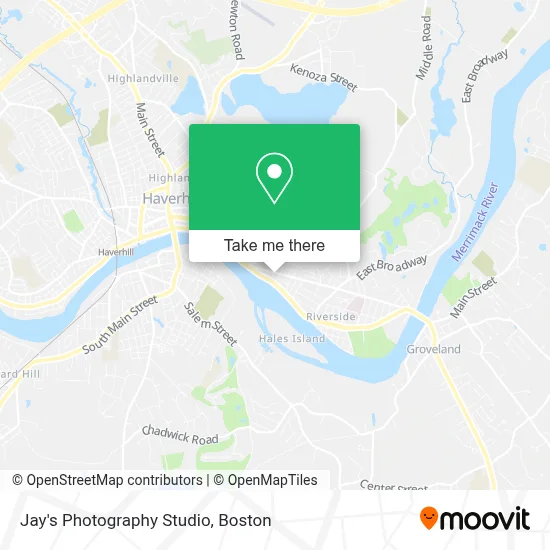
See Jay's Photography Studio, Haverhill, on the map
Public Transit to Jay's Photography Studio in Haverhill
Wondering how to get to Jay's Photography Studio in Haverhill? Moovit helps you find the best way to get to Jay's Photography Studio with step-by-step directions from the nearest public transit station.
Moovit provides free maps and live directions to help you navigate through your city. View schedules, routes, timetables, and find out how long does it take to get to Jay's Photography Studio in real time.
Looking for the nearest stop or station to Jay's Photography Studio? Check out this list of stops closest to your destination: Groveland Street & Mechanic Street; Ahepa Apartments; Bradford; Haverhill.
Bus: 18, 22.Train: HAVERHILL, DOWNEASTER.
Want to see if there’s another route that gets you there at an earlier time? Moovit helps you find alternative routes or times. Get directions from and directions to Jay's Photography Studio easily from the Moovit App or Website.
We make riding to Jay's Photography Studio easy, which is why over 1.7 million users, including users in Haverhill, trust Moovit as the best app for public transit. You don’t need to download an individual bus app or train app, Moovit is your all-in-one transit app that helps you find the best bus time or train time available.
For information on prices of bus and train, costs and ride fares to Jay's Photography Studio, please check the Moovit app.
Use the app to navigate to popular places including to the airport, hospital, stadium, grocery store, mall, coffee shop, school, college, and university.
Jay's Photography Studio Address: 83 Groveland St street in Haverhill
- T & T Roofing and Construction,
- Lindsay Hoffman,
- Mark Jr Plumbing & Heating,
- Cafe Graffs,
- Graffs Haverhill,
- PP*Integro Massage,
- Scott M Leduc,
- G Profit Construction,
- Bevilacqua Maria,
- M & M Construction Company,
- Glynn Memorial Nursing Home,
- Perfect Pekes,
- Riverside, Massachusetts,
- Towns Variety and Liquor,
- Plum Island Design,
- Sixty Railroad Street,
- Pro Tech Dynamic Auto Repair,
- Arrest A Pest,
- Bradford Welding,
- Frank Imbrescia, Pa
Places Near Jay's Photography Studio (Haverhill)
- Boston Children's Hospital, Boston,
- Massachusetts General Hospital, Boston,
- Boston Convention & Exhibition Center, Boston,
- Wilbur Theatre, Boston,
- Quincy Market, Boston,
- Prudential Center, Boston,
- Faneuil Hall, Boston,
- Wang Theater, Boston,
- Museum Of Science, Boston,
- Td Garden, Boston,
- Boston Common, Boston,
- Seaport District, Boston,
- Cheers, Boston,
- North End, Boston,
- Castle Island, Boston,
- Leader Bank Pavilion (Leader Bank Pavillion), Boston,
- Isabella Stewart Gardner Museum, Boston,
- Boston Medical Center, Boston,
- House Of Blues, Boston,
- Mgm Music Hall, Boston
How to get to popular places in Boston with public transit
Get around Haverhill by public transit!
Traveling around Haverhill has never been so easy. See step by step directions as you travel to any attraction, street or major public transit station. View bus and train schedules, arrival times, service alerts and detailed routes on a map, so you know exactly how to get to anywhere in Haverhill.
When traveling to any destination around Haverhill use Moovit's Live Directions with Get Off Notifications to know exactly where and how far to walk, how long to wait for your line, and how many stops are left. Moovit will alert you when it's time to get off — no need to constantly re-check whether yours is the next stop.
Wondering how to use public transit in Haverhill or how to pay for public transit in Haverhill? Moovit public transit app can help you navigate your way with public transit easily, and at minimum cost. It includes public transit fees, ticket prices, and costs. Looking for a map of Haverhill public transit lines? Moovit public transit app shows all public transit maps in Haverhill with all Bus, Train, Subway and Ferry routes and stops on an interactive map.
Boston has 4 transit type(s), including: Bus, Train, Subway and Ferry, operated by several transit agencies, including MBTA, Southeastern Regional Transit Authority, MetroWest Regional Transit Authority, Rhode Island Public Transit Authority, WRTA, Lowell Regional Transit Authority, Merrimack Valley Transit, Montachusett Regional Transit Authority, Cape Cod Regional Transit Authority, Brockton Area Transit Authority, Martha's Vineyard Transit Authority, the WAVE - Nantucket Regional Transit Authority, GATRA, Cape Ann Transportation Authority and Massport