Directions to Jbx Developers (Boston) with public transportation
The following transit lines have routes that pass near Jbx Developers
 Bus: 120, 450.
- Train: NEWBURYPORT/ROCKPORT.
- Subway: BLUE LINE.
How to get to Jbx Developers by bus?
Click on the bus route to see step by step directions with maps, line arrival times and updated time schedules.
From Harvard Stadium, Boston
92 minFrom Brigham and Women's, Boston
75 minFrom Copley Place, Boston
38 minFrom Nahant Beach, Nahant
92 minFrom Boston University Track and Tennis Center, Boston
100 minFrom Brigham & Women's Hospital, Boston
72 minFrom Brigham and Women's Hospital, Boston
87 minFrom The Fairmont Copley Plaza Hotel, Boston
39 minFrom Old State House, Boston
17 minFrom Rosenberg Building Bidmc, Boston
101 min
How to get to Jbx Developers by train?
Click on the train route to see step by step directions with maps, line arrival times and updated time schedules.
How to get to Jbx Developers by subway?
Click on the subway route to see step by step directions with maps, line arrival times and updated time schedules.
From Harvard Stadium, Boston
68 minFrom Brigham and Women's, Boston
60 minFrom Copley Place, Boston
38 minFrom Boston University Track and Tennis Center, Boston
68 minFrom Brigham & Women's Hospital, Boston
58 minFrom Brigham and Women's Hospital, Boston
62 minFrom The Fairmont Copley Plaza Hotel, Boston
40 minFrom Old State House, Boston
29 minFrom Rosenberg Building Bidmc, Boston
62 min
Bus stops near Jbx Developers in Boston
Subway station near Jbx Developers in Boston
- Wood Island, 13 min walk,VIEW
Bus lines to Jbx Developers in Boston
What are the closest stations to Jbx Developers?
The closest stations to Jbx Developers are:
- 202 Orient Ave is 60 yards away, 2 min walk.
- Mcclellan Highway @ Boardman St is 182 yards away, 3 min walk.
- Wood Island is 1041 yards away, 13 min walk.
Which bus lines stop near Jbx Developers?
These bus lines stop near Jbx Developers: 120, 450.
Which train line stops near Jbx Developers?
NEWBURYPORT/ROCKPORT (#125 | Newburyport)
Which subway line stops near Jbx Developers?
BLUE LINE (Wonderland)
What’s the nearest subway station to Jbx Developers in Boston?
The nearest subway station to Jbx Developers in Boston is Wood Island. It’s a 13 min walk away.
What’s the nearest bus station to Jbx Developers in Boston?
The nearest bus station to Jbx Developers in Boston is 202 Orient Ave. It’s a 2 min walk away.
What time is the first subway to Jbx Developers in Boston?
The BLUE LINE is the first subway that goes to Jbx Developers in Boston. It stops nearby at 5:08 AM.
What time is the last subway to Jbx Developers in Boston?
The BLUE LINE is the last subway that goes to Jbx Developers in Boston. It stops nearby at 2:08 AM.
What time is the first bus to Jbx Developers in Boston?
The 120 is the first bus that goes to Jbx Developers in Boston. It stops nearby at 6:10 AM.
What time is the last bus to Jbx Developers in Boston?
The 120 is the last bus that goes to Jbx Developers in Boston. It stops nearby at 1:35 AM.
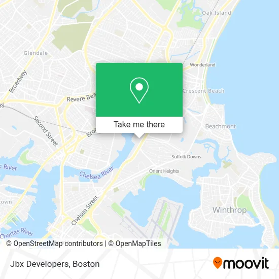
See Jbx Developers, Boston, on the map
Public Transit to Jbx Developers in Boston
Wondering how to get to Jbx Developers in Boston? Moovit helps you find the best way to get to Jbx Developers with step-by-step directions from the nearest public transit station.
Moovit provides free maps and live directions to help you navigate through your city. View schedules, routes, timetables, and find out how long does it take to get to Jbx Developers in real time.
Looking for the nearest stop or station to Jbx Developers? Check out this list of stops closest to your destination: 202 Orient Ave; Mcclellan Highway @ Boardman St; Wood Island.
Bus: 120, 450.Train: NEWBURYPORT/ROCKPORT.Subway: BLUE LINE.
Want to see if there’s another route that gets you there at an earlier time? Moovit helps you find alternative routes or times. Get directions from and directions to Jbx Developers easily from the Moovit App or Website.
We make riding to Jbx Developers easy, which is why over 1.7 million users, including users in Boston, trust Moovit as the best app for public transit. You don’t need to download an individual bus app or train app, Moovit is your all-in-one transit app that helps you find the best bus time or train time available.
For information on prices of bus, subway and train, costs and ride fares to Jbx Developers, please check the Moovit app.
Use the app to navigate to popular places including to the airport, hospital, stadium, grocery store, mall, coffee shop, school, college, and university.
Jbx Developers Address: 440 William F McClellan Hwy Ste 105C street in Boston
- Grossman Co.,
- Suffolk Downs,
- Cirque du Soleil,
- Legends Bar & Grill,
- Wonderland,
- Hilton Garden Inn Boston Logan Airport,
- AVIS,
- Budget,
- Noyes Park,
- Bellair Expediting Boston,
- Reference Real Estate,
- Constitution Beach,
- Don Orione Nursing Home,
- Enterprise,
- Dartmouth College,
- Happy Valley - Boston,
- Madonna Queen Of the Universe Shrine,
- Courtyard by Marriott Boston Logan Airport,
- Madonna Shrine (Madonna Queen National Shrine),
- Madonna Queen Gift Shop
Places Near Jbx Developers (Boston)
- Wang Theater, Boston,
- Museum Of Science, Boston,
- Massachusetts General Hospital, Boston,
- Isabella Stewart Gardner Museum, Boston,
- Seaport District, Boston,
- Boston Common, Boston,
- Wilbur Theatre, Boston,
- Boston Medical Center, Boston,
- Td Garden, Boston,
- House Of Blues, Boston,
- Boston Convention & Exhibition Center, Boston,
- Leader Bank Pavilion (Leader Bank Pavillion), Boston,
- North End, Boston,
- Castle Island, Boston,
- Cheers, Boston,
- Prudential Center, Boston,
- Mgm Music Hall, Boston,
- Faneuil Hall, Boston,
- Quincy Market, Boston,
- Boston Children's Hospital, Boston
How to get to popular places in Boston with public transit
Get around Boston by public transit!
Traveling around Boston has never been so easy. See step by step directions as you travel to any attraction, street or major public transit station. View bus and train schedules, arrival times, service alerts and detailed routes on a map, so you know exactly how to get to anywhere in Boston.
When traveling to any destination around Boston use Moovit's Live Directions with Get Off Notifications to know exactly where and how far to walk, how long to wait for your line, and how many stops are left. Moovit will alert you when it's time to get off — no need to constantly re-check whether yours is the next stop.
Wondering how to use public transit in Boston or how to pay for public transit in Boston? Moovit public transit app can help you navigate your way with public transit easily, and at minimum cost. It includes public transit fees, ticket prices, and costs. Looking for a map of Boston public transit lines? Moovit public transit app shows all public transit maps in Boston with all Bus, Train, Subway and Ferry routes and stops on an interactive map.
Boston has 4 transit type(s), including: Bus, Train, Subway and Ferry, operated by several transit agencies, including MBTA, Southeastern Regional Transit Authority, MetroWest Regional Transit Authority, Rhode Island Public Transit Authority, WRTA, Lowell Regional Transit Authority, Merrimack Valley Transit, Montachusett Regional Transit Authority, Cape Cod Regional Transit Authority, Brockton Area Transit Authority, Martha's Vineyard Transit Authority, the WAVE - Nantucket Regional Transit Authority, GATRA, Cape Ann Transportation Authority and Massport