Directions to Jc Studio (Quincy) with public transportation
The following transit lines have routes that pass near Jc Studio
 Bus: 210, 217, 211, 245, RED LINE SHUTTLE.
- Train: FALL RIVER/NEW BEDFORD, GREENBUSH.
- Subway: RED LINE, MATTAPAN LINE.
- Ferry: QUINCY FERRY, WINTHROP/QUINCY FERRY.
How to get to Jc Studio by bus?
Click on the bus route to see step by step directions with maps, line arrival times and updated time schedules.
From Home2 Suites-Boston South Bay (Home2 Stes by Hilton Boston S Bay), Boston
49 minFrom Tufts University, Boston
72 minFrom Tufts New England Medical Center, Boston
73 minFrom Vertex Pharmaceuticals (Fan Pier), Boston
96 minFrom Royale Boston, Boston
74 minFrom Hampton Inn Boston, Boston
70 minFrom new hampshire!, Boston
58 minFrom Boston University Goldman School of Dental Medicine, Boston
63 minFrom Intercontinental Boston, Boston
88 minFrom Huntington Theatre Company, Boston
70 min
How to get to Jc Studio by train?
Click on the train route to see step by step directions with maps, line arrival times and updated time schedules.
From Home2 Suites-Boston South Bay (Home2 Stes by Hilton Boston S Bay), Boston
92 minFrom Tufts University, Boston
58 minFrom Tufts New England Medical Center, Boston
61 minFrom Vertex Pharmaceuticals (Fan Pier), Boston
60 minFrom Royale Boston, Boston
61 minFrom Hampton Inn Boston, Boston
96 minFrom new hampshire!, Boston
80 minFrom Boston University Goldman School of Dental Medicine, Boston
80 minFrom Intercontinental Boston, Boston
54 minFrom Huntington Theatre Company, Boston
72 min
How to get to Jc Studio by subway?
Click on the subway route to see step by step directions with maps, line arrival times and updated time schedules.
From Home2 Suites-Boston South Bay (Home2 Stes by Hilton Boston S Bay), Boston
28 minFrom Tufts University, Boston
31 minFrom Tufts New England Medical Center, Boston
31 minFrom Vertex Pharmaceuticals (Fan Pier), Boston
35 minFrom Royale Boston, Boston
32 minFrom Hampton Inn Boston, Boston
35 minFrom new hampshire!, Boston
41 minFrom Boston University Goldman School of Dental Medicine, Boston
41 minFrom Intercontinental Boston, Boston
28 minFrom Huntington Theatre Company, Boston
43 min
Bus stops near Jc Studio in Quincy
Ferry station near Jc Studio in Quincy
- Quincy, 52 min walk,VIEW
Bus lines to Jc Studio in Quincy
- 210, Fields Corner,VIEW
- 217, Quincy Center Via North Quincy,VIEW
- 211, Squantum - Quincy Center,VIEW
- 245, Mattapan - Quincy Center,VIEW
- RED LINE SHUTTLE, Ashmont - Braintree,VIEW
- RED LINE SHUTTLE, Braintree - Broadway,VIEW
- RED LINE SHUTTLE, Braintree - JFK/UMass (Shuttle),VIEW
- RED LINE SHUTTLE, Braintree - North Quincy (Shuttle),VIEW
- RED LINE SHUTTLE, Quincy Center - Broadway (Shuttle),VIEW
What are the closest stations to Jc Studio?
The closest stations to Jc Studio are:
- Hancock St @ Beach St is 127 yards away, 2 min walk.
- Elm Ave @ Hancock St is 351 yards away, 5 min walk.
- Newport Ave @ Beale St is 357 yards away, 5 min walk.
- Wollaston is 2906 yards away, 35 min walk.
- Quincy is 4433 yards away, 52 min walk.
- Cedar Grove is 4607 yards away, 54 min walk.
Which bus line stops near Jc Studio?
210 (Quincy Center)
Which train lines stop near Jc Studio?
These train lines stop near Jc Studio: FALL RIVER/NEW BEDFORD, GREENBUSH.
Which subway line stops near Jc Studio?
RED LINE (Ashmont/Braintree)
What’s the nearest bus station to Jc Studio in Quincy?
The nearest bus station to Jc Studio in Quincy is Hancock St @ Beach St. It’s a 2 min walk away.
What time is the first subway to Jc Studio in Quincy?
The MATTAPAN LINE is the first subway that goes to Jc Studio in Quincy. It stops nearby at 5:10 AM.
What time is the last subway to Jc Studio in Quincy?
The MATTAPAN LINE is the last subway that goes to Jc Studio in Quincy. It stops nearby at 2:31 AM.
What time is the first bus to Jc Studio in Quincy?
The 210 is the first bus that goes to Jc Studio in Quincy. It stops nearby at 5:03 AM.
What time is the last bus to Jc Studio in Quincy?
The 210 is the last bus that goes to Jc Studio in Quincy. It stops nearby at 1:13 AM.
What time is the first ferry to Jc Studio in Quincy?
The QUINCY FERRY is the first ferry that goes to Jc Studio in Quincy. It stops nearby at 6:15 AM.
What time is the last ferry to Jc Studio in Quincy?
The QUINCY FERRY is the last ferry that goes to Jc Studio in Quincy. It stops nearby at 8:55 PM.
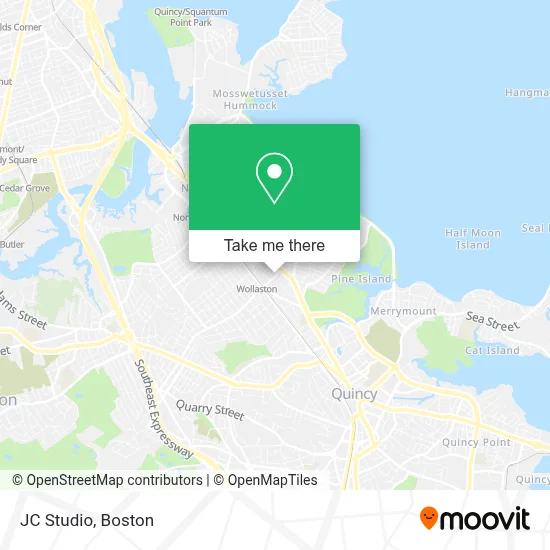
See Jc Studio, Quincy, on the map
Public Transit to Jc Studio in Quincy
Wondering how to get to Jc Studio in Quincy? Moovit helps you find the best way to get to Jc Studio with step-by-step directions from the nearest public transit station.
Moovit provides free maps and live directions to help you navigate through your city. View schedules, routes, timetables, and find out how long does it take to get to Jc Studio in real time.
Looking for the nearest stop or station to Jc Studio? Check out this list of stops closest to your destination: Hancock St @ Beach St; Elm Ave @ Hancock St; Newport Ave @ Beale St; Wollaston; Quincy; Cedar Grove.
Bus: 210, 217, 211, 245, RED LINE SHUTTLE, RED LINE SHUTTLE, RED LINE SHUTTLE.Train: FALL RIVER/NEW BEDFORD, GREENBUSH.Subway: RED LINE, MATTAPAN LINE.Ferry: QUINCY FERRY, WINTHROP/QUINCY FERRY.
Want to see if there’s another route that gets you there at an earlier time? Moovit helps you find alternative routes or times. Get directions from and directions to Jc Studio easily from the Moovit App or Website.
We make riding to Jc Studio easy, which is why over 1.7 million users, including users in Quincy, trust Moovit as the best app for public transit. You don’t need to download an individual bus app or train app, Moovit is your all-in-one transit app that helps you find the best bus time or train time available.
For information on prices of subway, bus and train, costs and ride fares to Jc Studio, please check the Moovit app.
Use the app to navigate to popular places including to the airport, hospital, stadium, grocery store, mall, coffee shop, school, college, and university.
Jc Studio Address: 29A Beale St street in Quincy
- Salvation Army,
- Quincy Phone Repair on Mobile,
- The Graduate Realtor(R) Institute,
- Koi Hot Pot,
- Tetrault Landscaping,
- Tiranga Indian Street Food,
- Neighborhood - Garage - Door,
- Tiranga by P&D,
- Libertyx Bitcoin Atm,
- ADT A Alarm & Security,
- Mango Mango Dessert,
- Mango Mango Dessert-Quincy,
- Matthews Jewelers Inc,
- Garage Door Springs Repair Garage Door,
- Waku Waku,
- Yaowarat Thai Street Food,
- Pos Center Boston,
- Doody Calls,
- The Mortgage Connection Llc,
- Donburi Sushi Shop
Places Near Jc Studio (Quincy)
- Isabella Stewart Gardner Museum, Boston,
- Seaport District, Boston,
- North End, Boston,
- Museum Of Science, Boston,
- Leader Bank Pavilion (Leader Bank Pavillion), Boston,
- House Of Blues, Boston,
- Td Garden, Boston,
- Prudential Center, Boston,
- Mgm Music Hall, Boston,
- Quincy Market, Boston,
- Faneuil Hall, Boston,
- Wilbur Theatre, Boston,
- Boston Common, Boston,
- Boston Children's Hospital, Boston,
- Boston Convention & Exhibition Center, Boston,
- Castle Island, Boston,
- Cheers, Boston,
- Wang Theater, Boston,
- Boston Medical Center, Boston,
- Massachusetts General Hospital, Boston
How to get to popular places in Boston with public transit
Get around Quincy by public transit!
Traveling around Quincy has never been so easy. See step by step directions as you travel to any attraction, street or major public transit station. View bus and train schedules, arrival times, service alerts and detailed routes on a map, so you know exactly how to get to anywhere in Quincy.
When traveling to any destination around Quincy use Moovit's Live Directions with Get Off Notifications to know exactly where and how far to walk, how long to wait for your line, and how many stops are left. Moovit will alert you when it's time to get off — no need to constantly re-check whether yours is the next stop.
Wondering how to use public transit in Quincy or how to pay for public transit in Quincy? Moovit public transit app can help you navigate your way with public transit easily, and at minimum cost. It includes public transit fees, ticket prices, and costs. Looking for a map of Quincy public transit lines? Moovit public transit app shows all public transit maps in Quincy with all Bus, Train, Subway and Ferry routes and stops on an interactive map.
Boston has 4 transit type(s), including: Bus, Train, Subway and Ferry, operated by several transit agencies, including MBTA, Southeastern Regional Transit Authority, MetroWest Regional Transit Authority, Rhode Island Public Transit Authority, WRTA, Lowell Regional Transit Authority, Merrimack Valley Transit, Montachusett Regional Transit Authority, Cape Cod Regional Transit Authority, Brockton Area Transit Authority, Martha's Vineyard Transit Authority, the WAVE - Nantucket Regional Transit Authority, GATRA, Cape Ann Transportation Authority and Massport