Directions to Jejes Coffeehouse & Roastery (Wellesley) with public transportation
The following transit lines have routes that pass near Jejes Coffeehouse & Roastery
 Bus: 01, 59, MBRS, MBCS.
- Train: FRAMINGHAM/WORCESTER.
- Subway: GREEN LINE D.
How to get to Jejes Coffeehouse & Roastery by bus?
Click on the bus route to see step by step directions with maps, line arrival times and updated time schedules.
From Brighton, Boston
103 minFrom Route 9 East / West Framingham, Framingham
58 minFrom The TJX Companies Inc., Framingham
65 minFrom Brighton, Boston
117 minFrom West Roxbury, Boston
130 minFrom the mall at rockingham park mall, Boston
108 minFrom VFW Parkway, Boston
114 minFrom Watertown, MA, Watertown Town
112 minFrom AC Hotel by Marriott Boston Cleveland Circle, Boston
109 min
How to get to Jejes Coffeehouse & Roastery by train?
Click on the train route to see step by step directions with maps, line arrival times and updated time schedules.
How to get to Jejes Coffeehouse & Roastery by subway?
Click on the subway route to see step by step directions with maps, line arrival times and updated time schedules.
Train station near Jejes Coffeehouse & Roastery in Wellesley
- Wellesley Square, 3 min walk,VIEW
Bus stop near Jejes Coffeehouse & Roastery in Wellesley
- Massbay Wellesley, 10 min walk,VIEW
Subway station near Jejes Coffeehouse & Roastery in Wellesley
- Woodland, 53 min walk,VIEW
Bus lines to Jejes Coffeehouse & Roastery in Wellesley
What are the closest stations to Jejes Coffeehouse & Roastery?
The closest stations to Jejes Coffeehouse & Roastery are:
- Wellesley Square is 139 yards away, 3 min walk.
- Massbay Wellesley is 775 yards away, 10 min walk.
- Woodland is 4490 yards away, 53 min walk.
Which bus lines stop near Jejes Coffeehouse & Roastery?
These bus lines stop near Jejes Coffeehouse & Roastery: 01, 59, MBRS.
Which train line stops near Jejes Coffeehouse & Roastery?
FRAMINGHAM/WORCESTER (#521 | Worcester)
Which subway line stops near Jejes Coffeehouse & Roastery?
GREEN LINE D (Riverside)
What’s the nearest train station to Jejes Coffeehouse & Roastery in Wellesley?
The nearest train station to Jejes Coffeehouse & Roastery in Wellesley is Wellesley Square. It’s a 3 min walk away.
What’s the nearest bus station to Jejes Coffeehouse & Roastery in Wellesley?
The nearest bus station to Jejes Coffeehouse & Roastery in Wellesley is Massbay Wellesley. It’s a 10 min walk away.
What time is the first subway to Jejes Coffeehouse & Roastery in Wellesley?
The GREEN LINE D is the first subway that goes to Jejes Coffeehouse & Roastery in Wellesley. It stops nearby at 4:45 AM.
What time is the last subway to Jejes Coffeehouse & Roastery in Wellesley?
The GREEN LINE D is the last subway that goes to Jejes Coffeehouse & Roastery in Wellesley. It stops nearby at 2:48 AM.
What time is the first train to Jejes Coffeehouse & Roastery in Wellesley?
The FRAMINGHAM/WORCESTER is the first train that goes to Jejes Coffeehouse & Roastery in Wellesley. It stops nearby at 5:09 AM.
What time is the last train to Jejes Coffeehouse & Roastery in Wellesley?
The FRAMINGHAM/WORCESTER is the last train that goes to Jejes Coffeehouse & Roastery in Wellesley. It stops nearby at 12:32 AM.
What time is the first bus to Jejes Coffeehouse & Roastery in Wellesley?
The 01 is the first bus that goes to Jejes Coffeehouse & Roastery in Wellesley. It stops nearby at 6:07 AM.
What time is the last bus to Jejes Coffeehouse & Roastery in Wellesley?
The 01 is the last bus that goes to Jejes Coffeehouse & Roastery in Wellesley. It stops nearby at 8:44 PM.
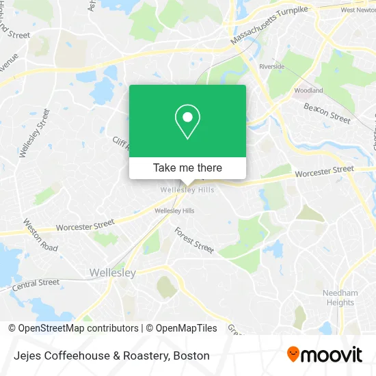
See Jejes Coffeehouse & Roastery, Wellesley, on the map
Public Transit to Jejes Coffeehouse & Roastery in Wellesley
Wondering how to get to Jejes Coffeehouse & Roastery in Wellesley? Moovit helps you find the best way to get to Jejes Coffeehouse & Roastery with step-by-step directions from the nearest public transit station.
Moovit provides free maps and live directions to help you navigate through your city. View schedules, routes, timetables, and find out how long does it take to get to Jejes Coffeehouse & Roastery in real time.
Looking for the nearest stop or station to Jejes Coffeehouse & Roastery? Check out this list of stops closest to your destination: Wellesley Square; Massbay Wellesley; Woodland.
Bus: 01, 59, MBRS, MBCS.Train: FRAMINGHAM/WORCESTER.Subway: GREEN LINE D.
Want to see if there’s another route that gets you there at an earlier time? Moovit helps you find alternative routes or times. Get directions from and directions to Jejes Coffeehouse & Roastery easily from the Moovit App or Website.
We make riding to Jejes Coffeehouse & Roastery easy, which is why over 1.7 million users, including users in Wellesley, trust Moovit as the best app for public transit. You don’t need to download an individual bus app or train app, Moovit is your all-in-one transit app that helps you find the best bus time or train time available.
For information on prices of bus, train and subway, costs and ride fares to Jejes Coffeehouse & Roastery, please check the Moovit app.
Use the app to navigate to popular places including to the airport, hospital, stadium, grocery store, mall, coffee shop, school, college, and university.
Jejes Coffeehouse & Roastery Address: 259 Washington St street in Wellesley
- Skinhealth Centers Wellesley Med Spa,
- Jejes Coffee,
- BHHS Global David,
- Elegant Homes With Erica,
- Home Care Assistance Of Massachusetts,
- Walgreens #13081,
- Western Union,
- Clock Tower Park Wellesley, Ma,
- Grantville, Massachusetts,
- Fresh Finish Details,
- House of Amonet,
- Sensory Play Labs,
- FLO,
- Lois S Goodman MD,
- Pappas Karen DMD,
- New England Breast And Wellness,
- Route 9 & Route 16 Interchange,
- Casey Photography,
- Cataldo Ambulance,
- Wellesley Emergency Management
Places Near Jejes Coffeehouse & Roastery (Wellesley)
- Leader Bank Pavilion (Leader Bank Pavillion), Boston,
- Isabella Stewart Gardner Museum, Boston,
- Prudential Center, Boston,
- Boston Common, Boston,
- Faneuil Hall, Boston,
- Boston Medical Center, Boston,
- Wang Theater, Boston,
- Mgm Music Hall, Boston,
- House Of Blues, Boston,
- Boston Children's Hospital, Boston,
- North End, Boston,
- Quincy Market, Boston,
- Td Garden, Boston,
- Wilbur Theatre, Boston,
- Cheers, Boston,
- Seaport District, Boston,
- Museum Of Science, Boston,
- Boston Convention & Exhibition Center, Boston,
- Massachusetts General Hospital, Boston,
- Castle Island, Boston
How to get to popular places in Boston with public transit
Get around Wellesley by public transit!
Traveling around Wellesley has never been so easy. See step by step directions as you travel to any attraction, street or major public transit station. View bus and train schedules, arrival times, service alerts and detailed routes on a map, so you know exactly how to get to anywhere in Wellesley.
When traveling to any destination around Wellesley use Moovit's Live Directions with Get Off Notifications to know exactly where and how far to walk, how long to wait for your line, and how many stops are left. Moovit will alert you when it's time to get off — no need to constantly re-check whether yours is the next stop.
Wondering how to use public transit in Wellesley or how to pay for public transit in Wellesley? Moovit public transit app can help you navigate your way with public transit easily, and at minimum cost. It includes public transit fees, ticket prices, and costs. Looking for a map of Wellesley public transit lines? Moovit public transit app shows all public transit maps in Wellesley with all Bus, Train, Subway and Ferry routes and stops on an interactive map.
Boston has 4 transit type(s), including: Bus, Train, Subway and Ferry, operated by several transit agencies, including MBTA, Southeastern Regional Transit Authority, MetroWest Regional Transit Authority, Rhode Island Public Transit Authority, WRTA, Lowell Regional Transit Authority, Merrimack Valley Transit, Montachusett Regional Transit Authority, Cape Cod Regional Transit Authority, Brockton Area Transit Authority, Martha's Vineyard Transit Authority, the WAVE - Nantucket Regional Transit Authority, GATRA, Cape Ann Transportation Authority and Massport