Directions to Jenna Kay Photography (Boston) with public transportation
The following transit lines have routes that pass near Jenna Kay Photography
 Bus: 10, 11, 18, 9.
- Train: FRAMINGHAM/WORCESTER, KINGSTON, COMMUTER RAIL SHUTTLE, FAIRMOUNT LINE SHUTTLE, FRANKLIN LINE SHUTTLE.
- Subway: RED LINE.
How to get to Jenna Kay Photography by bus?
Click on the bus route to see step by step directions with maps, line arrival times and updated time schedules.
From MBTA / Alewife #6, Cambridge
93 minFrom Harvard University, Cambridge
60 minFrom Goodwill Store, Boston
72 minFrom Hyatt Place Medford, Medford
57 minFrom Malden, MA, Malden
83 minFrom Sonia, Boston
70 minFrom Quincy Center Station, Quincy
101 minFrom Suffolk Downs, Boston
85 minFrom MBTA Alewife Station, Cambridge
93 minFrom Brattle St / Harvard Sq, Cambridge
60 min
How to get to Jenna Kay Photography by train?
Click on the train route to see step by step directions with maps, line arrival times and updated time schedules.
How to get to Jenna Kay Photography by subway?
Click on the subway route to see step by step directions with maps, line arrival times and updated time schedules.
From MBTA / Alewife #6, Cambridge
39 minFrom Harvard University, Cambridge
33 minFrom Goodwill Store, Boston
54 minFrom Hyatt Place Medford, Medford
77 minFrom Malden, MA, Malden
46 minFrom Sonia, Boston
74 minFrom Quincy Center Station, Quincy
31 minFrom Suffolk Downs, Boston
53 minFrom MBTA Alewife Station, Cambridge
38 minFrom Brattle St / Harvard Sq, Cambridge
33 min
Bus stops near Jenna Kay Photography in Boston
Train station near Jenna Kay Photography in Boston
- South Station, 5 min walk,VIEW
Bus lines to Jenna Kay Photography in Boston
What are the closest stations to Jenna Kay Photography?
The closest stations to Jenna Kay Photography are:
- W Broadway @ F St is 103 yards away, 2 min walk.
- W 7th St @ F St is 116 yards away, 2 min walk.
- Dorchester St @ W 5th St is 305 yards away, 4 min walk.
- South Station is 379 yards away, 5 min walk.
Which bus lines stop near Jenna Kay Photography?
These bus lines stop near Jenna Kay Photography: 10, 11, 18, 9.
Which train lines stop near Jenna Kay Photography?
These train lines stop near Jenna Kay Photography: FRAMINGHAM/WORCESTER, KINGSTON.
Which subway line stops near Jenna Kay Photography?
RED LINE (Ashmont/Braintree)
What’s the nearest train station to Jenna Kay Photography in Boston?
The nearest train station to Jenna Kay Photography in Boston is South Station. It’s a 5 min walk away.
What’s the nearest bus station to Jenna Kay Photography in Boston?
The nearest bus stations to Jenna Kay Photography in Boston are W Broadway @ F St and W 7th St @ F St. The closest one is a 2 min walk away.
What time is the first subway to Jenna Kay Photography in Boston?
The RED LINE is the first subway that goes to Jenna Kay Photography in Boston. It stops nearby at 5:23 AM.
What time is the last subway to Jenna Kay Photography in Boston?
The RED LINE is the last subway that goes to Jenna Kay Photography in Boston. It stops nearby at 1:55 AM.
What time is the first train to Jenna Kay Photography in Boston?
The PROVIDENCE/STOUGHTON is the first train that goes to Jenna Kay Photography in Boston. It stops nearby at 4:20 AM.
What time is the last train to Jenna Kay Photography in Boston?
The LAKE SHORE LIMITED is the last train that goes to Jenna Kay Photography in Boston. It stops nearby at 8:32 PM.
What time is the first bus to Jenna Kay Photography in Boston?
The SLW is the first bus that goes to Jenna Kay Photography in Boston. It stops nearby at 4:19 AM.
What time is the last bus to Jenna Kay Photography in Boston?
The 10 is the last bus that goes to Jenna Kay Photography in Boston. It stops nearby at 1:35 AM.
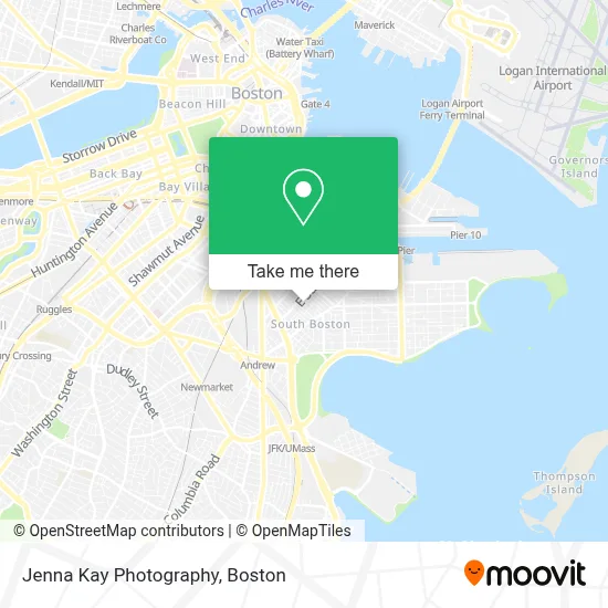
See Jenna Kay Photography, Boston, on the map
Public Transit to Jenna Kay Photography in Boston
Wondering how to get to Jenna Kay Photography in Boston? Moovit helps you find the best way to get to Jenna Kay Photography with step-by-step directions from the nearest public transit station.
Moovit provides free maps and live directions to help you navigate through your city. View schedules, routes, timetables, and find out how long does it take to get to Jenna Kay Photography in real time.
Looking for the nearest stop or station to Jenna Kay Photography? Check out this list of stops closest to your destination: W Broadway @ F St; W 7th St @ F St; Dorchester St @ W 5th St; South Station.
Bus: 10, 11, 18, 9.Train: FRAMINGHAM/WORCESTER, KINGSTON, COMMUTER RAIL SHUTTLE, FAIRMOUNT LINE SHUTTLE, FRANKLIN LINE SHUTTLE, KINGSTON LINE SHUTTLE, SL1.Subway: RED LINE.
Want to see if there’s another route that gets you there at an earlier time? Moovit helps you find alternative routes or times. Get directions from and directions to Jenna Kay Photography easily from the Moovit App or Website.
We make riding to Jenna Kay Photography easy, which is why over 1.7 million users, including users in Boston, trust Moovit as the best app for public transit. You don’t need to download an individual bus app or train app, Moovit is your all-in-one transit app that helps you find the best bus time or train time available.
For information on prices of bus, subway and train, costs and ride fares to Jenna Kay Photography, please check the Moovit app.
Use the app to navigate to popular places including to the airport, hospital, stadium, grocery store, mall, coffee shop, school, college, and university.
Location: Boston
- 18x9 W 5th St,
- Casper Funeral Home (Casper Funeral & Cremation Services),
- Pastel Nail Studio,
- Lincoln,
- Lincoln Tavern & Restaurant,
- Sherwin-Williams,
- South Boston,
- Condon James Elementary School,
- Catholic Charities,
- Capo Restaurant & Supper Club,
- Supper Club at Capo,
- Capo,
- Broadway Laundromat (Kays Laundromat),
- Martha Clarke Astrology,
- Marion Manor,
- Orthodox Church (Holy Trinity Albanian Orthodox Ch),
- The Goodwill Store,
- D Street Projects,
- Fat Baby,
- Navy Federal Credit Union
Places Near Jenna Kay Photography (Boston)
- Mgm Music Hall, Boston,
- Quincy Market, Boston,
- Td Garden, Boston,
- Boston Common, Boston,
- House Of Blues, Boston,
- Wilbur Theatre, Boston,
- Isabella Stewart Gardner Museum, Boston,
- Leader Bank Pavilion (Leader Bank Pavillion), Boston,
- Boston Children's Hospital, Boston,
- Boston Medical Center, Boston,
- Wang Theater, Boston,
- Museum Of Science, Boston,
- Massachusetts General Hospital, Boston,
- Castle Island, Boston,
- Prudential Center, Boston,
- Cheers, Boston,
- Faneuil Hall, Boston,
- Seaport District, Boston,
- North End, Boston,
- Boston Convention & Exhibition Center, Boston
How to get to popular places in Boston with public transit
Get around Boston by public transit!
Traveling around Boston has never been so easy. See step by step directions as you travel to any attraction, street or major public transit station. View bus and train schedules, arrival times, service alerts and detailed routes on a map, so you know exactly how to get to anywhere in Boston.
When traveling to any destination around Boston use Moovit's Live Directions with Get Off Notifications to know exactly where and how far to walk, how long to wait for your line, and how many stops are left. Moovit will alert you when it's time to get off — no need to constantly re-check whether yours is the next stop.
Wondering how to use public transit in Boston or how to pay for public transit in Boston? Moovit public transit app can help you navigate your way with public transit easily, and at minimum cost. It includes public transit fees, ticket prices, and costs. Looking for a map of Boston public transit lines? Moovit public transit app shows all public transit maps in Boston with all Bus, Train, Subway and Ferry routes and stops on an interactive map.
Boston has 4 transit type(s), including: Bus, Train, Subway and Ferry, operated by several transit agencies, including MBTA, Southeastern Regional Transit Authority, MetroWest Regional Transit Authority, Rhode Island Public Transit Authority, WRTA, Lowell Regional Transit Authority, Merrimack Valley Transit, Montachusett Regional Transit Authority, Cape Cod Regional Transit Authority, Brockton Area Transit Authority, Martha's Vineyard Transit Authority, the WAVE - Nantucket Regional Transit Authority, GATRA, Cape Ann Transportation Authority and Massport