How to get to Jennifer Kern by bus?
Click on the bus route to see step by step directions with maps, line arrival times and updated time schedules.
From Milton Academy, Milton
58 minFrom Dorchester, Boston
72 minFrom UMass Boston Campus Center, Boston
126 minFrom Best Western Adams Inn Quincy - Boston, Quincy
63 minFrom Marina Bay, Quincy
93 minFrom John F. Kennedy Presidential Library And Museum, Boston
103 minFrom Randolph, MA, Randolph
47 minFrom JFK Library, Boston
126 minFrom Hingham, MA, Hingham
57 minFrom Dorchester, Boston
75 min
How to get to Jennifer Kern by train?
Click on the train route to see step by step directions with maps, line arrival times and updated time schedules.
How to get to Jennifer Kern by subway?
Click on the subway route to see step by step directions with maps, line arrival times and updated time schedules.
Bus stops near Jennifer Kern in Braintree Town
Subway station near Jennifer Kern in Braintree Town
- Braintree, 7 min walk,VIEW
Train stations near Jennifer Kern in Braintree Town
Bus lines to Jennifer Kern in Braintree Town
What are the closest stations to Jennifer Kern?
The closest stations to Jennifer Kern are:
- Washington St Opp School St is 20 yards away, 1 min walk.
- Braintree is 509 yards away, 7 min walk.
- Middle St @ Elm St is 1059 yards away, 13 min walk.
- Independence Ave Opp Centre St is 3141 yards away, 38 min walk.
- Weymouth Landing/East Braintree is 4078 yards away, 49 min walk.
Which bus lines stop near Jennifer Kern?
These bus lines stop near Jennifer Kern: 215, 230, 238.
Which train lines stop near Jennifer Kern?
These train lines stop near Jennifer Kern: FALL RIVER/NEW BEDFORD, KINGSTON.
Which subway line stops near Jennifer Kern?
RED LINE (Ashmont/Braintree)
What’s the nearest subway station to Jennifer Kern in Braintree Town?
The nearest subway station to Jennifer Kern in Braintree Town is Braintree. It’s a 7 min walk away.
What’s the nearest train station to Jennifer Kern in Braintree Town?
The nearest train station to Jennifer Kern in Braintree Town is Braintree. It’s a 9 min walk away.
What’s the nearest bus station to Jennifer Kern in Braintree Town?
The nearest bus station to Jennifer Kern in Braintree Town is Washington St Opp School St. It’s a 1 min walk away.
What time is the first subway to Jennifer Kern in Braintree Town?
The RED LINE is the first subway that goes to Jennifer Kern in Braintree Town. It stops nearby at 5:09 AM.
What time is the last subway to Jennifer Kern in Braintree Town?
The RED LINE is the last subway that goes to Jennifer Kern in Braintree Town. It stops nearby at 2:00 AM.
What time is the first train to Jennifer Kern in Braintree Town?
The FALL RIVER/NEW BEDFORD is the first train that goes to Jennifer Kern in Braintree Town. It stops nearby at 5:27 AM.
What time is the last train to Jennifer Kern in Braintree Town?
The KINGSTON is the last train that goes to Jennifer Kern in Braintree Town. It stops nearby at 12:25 AM.
What time is the first bus to Jennifer Kern in Braintree Town?
The 230 is the first bus that goes to Jennifer Kern in Braintree Town. It stops nearby at 4:58 AM.
What time is the last bus to Jennifer Kern in Braintree Town?
The 230 is the last bus that goes to Jennifer Kern in Braintree Town. It stops nearby at 12:13 AM.
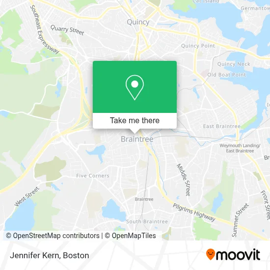
See Jennifer Kern, Braintree Town, on the map
Public Transit to Jennifer Kern in Braintree Town
Wondering how to get to Jennifer Kern in Braintree Town? Moovit helps you find the best way to get to Jennifer Kern with step-by-step directions from the nearest public transit station.
Moovit provides free maps and live directions to help you navigate through your city. View schedules, routes, timetables, and find out how long does it take to get to Jennifer Kern in real time.
Looking for the nearest stop or station to Jennifer Kern? Check out this list of stops closest to your destination: Washington St Opp School St; Braintree; Middle St @ Elm St; Independence Ave Opp Centre St; Weymouth Landing/East Braintree.
Bus: 215, 230, 238, 236.Train: FALL RIVER/NEW BEDFORD, KINGSTON, CAPEFLYER, GREENBUSH.Subway: RED LINE.
Want to see if there’s another route that gets you there at an earlier time? Moovit helps you find alternative routes or times. Get directions from and directions to Jennifer Kern easily from the Moovit App or Website.
We make riding to Jennifer Kern easy, which is why over 1.7 million users, including users in Braintree Town, trust Moovit as the best app for public transit. You don’t need to download an individual bus app or train app, Moovit is your all-in-one transit app that helps you find the best bus time or train time available.
For information on prices of bus, subway and train, costs and ride fares to Jennifer Kern, please check the Moovit app.
Use the app to navigate to popular places including to the airport, hospital, stadium, grocery store, mall, coffee shop, school, college, and university.
Jennifer Kern Address: 285 Washington St street in Braintree Town
- Thomas Green Real Estate,
- Yessica Fernandez,
- Maria Marchand Your Personal Realtor,
- Fairway Independent Mortgage Corporation,
- Joe Spinella Homes,
- Jose Rojas, Realtor,
- Maria Marchand - Success Real Estate,
- Jenelle O'Neil Realtor,
- Yeraldin Martinez Real Estate,
- Rachel Wilson Real Estate,
- Braintree Dental Group,
- Braintree Sda Church,
- King Optical Company,
- Liberty Automotive Services,
- Kristen's Breakfast,
- Pizza Maria,
- The Activation Church,
- Boston Real Estate,
- Cottage Tailor & Drycleaner,
- Canaa Boston Church
Places Near Jennifer Kern (Braintree Town)
- Seaport District, Boston,
- North End, Boston,
- Prudential Center, Boston,
- Museum Of Science, Boston,
- Boston Common, Boston,
- Leader Bank Pavilion (Leader Bank Pavillion), Boston,
- House Of Blues, Boston,
- Faneuil Hall, Boston,
- Castle Island, Boston,
- Boston Convention & Exhibition Center, Boston,
- Td Garden, Boston,
- Wang Theater, Boston,
- Quincy Market, Boston,
- Boston Children's Hospital, Boston,
- Massachusetts General Hospital, Boston,
- Mgm Music Hall, Boston,
- Isabella Stewart Gardner Museum, Boston,
- Wilbur Theatre, Boston,
- Cheers, Boston,
- Boston Medical Center, Boston
How to get to popular places in Boston with public transit
Get around Braintree Town by public transit!
Traveling around Braintree Town has never been so easy. See step by step directions as you travel to any attraction, street or major public transit station. View bus and train schedules, arrival times, service alerts and detailed routes on a map, so you know exactly how to get to anywhere in Braintree Town.
When traveling to any destination around Braintree Town use Moovit's Live Directions with Get Off Notifications to know exactly where and how far to walk, how long to wait for your line, and how many stops are left. Moovit will alert you when it's time to get off — no need to constantly re-check whether yours is the next stop.
Wondering how to use public transit in Braintree Town or how to pay for public transit in Braintree Town? Moovit public transit app can help you navigate your way with public transit easily, and at minimum cost. It includes public transit fees, ticket prices, and costs. Looking for a map of Braintree Town public transit lines? Moovit public transit app shows all public transit maps in Braintree Town with all Bus, Train, Subway and Ferry routes and stops on an interactive map.
Boston has 4 transit type(s), including: Bus, Train, Subway and Ferry, operated by several transit agencies, including MBTA, Southeastern Regional Transit Authority, MetroWest Regional Transit Authority, Rhode Island Public Transit Authority, WRTA, Lowell Regional Transit Authority, Merrimack Valley Transit, Montachusett Regional Transit Authority, Cape Cod Regional Transit Authority, Brockton Area Transit Authority, Martha's Vineyard Transit Authority, the WAVE - Nantucket Regional Transit Authority, GATRA, Cape Ann Transportation Authority and Massport