Directions to Jenny Ballantyne Studio (Needham) with public transportation
The following transit lines have routes that pass near Jenny Ballantyne Studio
 Bus: 52, 59.
- Train: NEEDHAM.
- Subway: GREEN LINE D.
How to get to Jenny Ballantyne Studio by bus?
Click on the bus route to see step by step directions with maps, line arrival times and updated time schedules.
From Moderna, Norwood
128 minFrom Wellesley, MA, Wellesley
143 minFrom Boston City Hall, Boston
112 minFrom Boston Latin School, Boston
103 minFrom Academy Of the Pacific Rim Charter Public School, Boston
126 minFrom MCPHS University-Boston, Boston
83 minFrom Franklin Park, Boston
98 minFrom Sonia, Boston
71 minFrom Six Flags New England, Newton
36 minFrom Emmanuel College, Boston
101 min
How to get to Jenny Ballantyne Studio by train?
Click on the train route to see step by step directions with maps, line arrival times and updated time schedules.
From Moderna, Norwood
126 minFrom Wellesley, MA, Wellesley
136 minFrom Boston City Hall, Boston
85 minFrom Boston Latin School, Boston
87 minFrom Academy Of the Pacific Rim Charter Public School, Boston
145 minFrom MCPHS University-Boston, Boston
87 minFrom Franklin Park, Boston
90 minFrom Sonia, Boston
119 minFrom Six Flags New England, Newton
121 minFrom Emmanuel College, Boston
90 min
How to get to Jenny Ballantyne Studio by subway?
Click on the subway route to see step by step directions with maps, line arrival times and updated time schedules.
Bus stop near Jenny Ballantyne Studio in Needham
- 173 Oak St, 6 min walk,VIEW
Train station near Jenny Ballantyne Studio in Needham
- Needham Center, 11 min walk,VIEW
Subway station near Jenny Ballantyne Studio in Needham
- Eliot, 33 min walk,VIEW
Bus lines to Jenny Ballantyne Studio in Needham
- 59, Needham Junction Via Needham St,VIEW
What are the closest stations to Jenny Ballantyne Studio?
The closest stations to Jenny Ballantyne Studio are:
- 173 Oak St is 467 yards away, 6 min walk.
- Needham Center is 865 yards away, 11 min walk.
- Eliot is 2829 yards away, 33 min walk.
Which bus lines stop near Jenny Ballantyne Studio?
These bus lines stop near Jenny Ballantyne Studio: 52, 59.
Which train line stops near Jenny Ballantyne Studio?
NEEDHAM (#617 | Needham Heights)
Which subway line stops near Jenny Ballantyne Studio?
GREEN LINE D (Riverside)
What’s the nearest train station to Jenny Ballantyne Studio in Needham?
The nearest train station to Jenny Ballantyne Studio in Needham is Needham Center. It’s a 11 min walk away.
What’s the nearest bus station to Jenny Ballantyne Studio in Needham?
The nearest bus station to Jenny Ballantyne Studio in Needham is 173 Oak St. It’s a 6 min walk away.
What time is the first subway to Jenny Ballantyne Studio in Needham?
The GREEN LINE D is the first subway that goes to Jenny Ballantyne Studio in Needham. It stops nearby at 4:50 AM.
What time is the last subway to Jenny Ballantyne Studio in Needham?
The GREEN LINE D is the last subway that goes to Jenny Ballantyne Studio in Needham. It stops nearby at 2:41 AM.
What time is the first train to Jenny Ballantyne Studio in Needham?
The NEEDHAM is the first train that goes to Jenny Ballantyne Studio in Needham. It stops nearby at 7:05 AM.
What time is the last train to Jenny Ballantyne Studio in Needham?
The NEEDHAM is the last train that goes to Jenny Ballantyne Studio in Needham. It stops nearby at 6:38 PM.
What time is the first bus to Jenny Ballantyne Studio in Needham?
The 59 is the first bus that goes to Jenny Ballantyne Studio in Needham. It stops nearby at 6:22 AM.
What time is the last bus to Jenny Ballantyne Studio in Needham?
The 59 is the last bus that goes to Jenny Ballantyne Studio in Needham. It stops nearby at 8:03 PM.
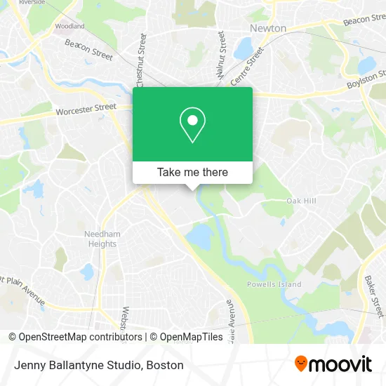
See Jenny Ballantyne Studio, Needham, on the map
Public Transit to Jenny Ballantyne Studio in Needham
Wondering how to get to Jenny Ballantyne Studio in Needham? Moovit helps you find the best way to get to Jenny Ballantyne Studio with step-by-step directions from the nearest public transit station.
Moovit provides free maps and live directions to help you navigate through your city. View schedules, routes, timetables, and find out how long does it take to get to Jenny Ballantyne Studio in real time.
Looking for the nearest stop or station to Jenny Ballantyne Studio? Check out this list of stops closest to your destination: 173 Oak St; Needham Center; Eliot.
Bus: 52, 59.Train: NEEDHAM.Subway: GREEN LINE D.
Want to see if there’s another route that gets you there at an earlier time? Moovit helps you find alternative routes or times. Get directions from and directions to Jenny Ballantyne Studio easily from the Moovit App or Website.
We make riding to Jenny Ballantyne Studio easy, which is why over 1.7 million users, including users in Needham, trust Moovit as the best app for public transit. You don’t need to download an individual bus app or train app, Moovit is your all-in-one transit app that helps you find the best bus time or train time available.
For information on prices of bus, train and subway, costs and ride fares to Jenny Ballantyne Studio, please check the Moovit app.
Use the app to navigate to popular places including to the airport, hospital, stadium, grocery store, mall, coffee shop, school, college, and university.
Jenny Ballantyne Studio Address: 33 4th Ave street in Needham
- Goldfish Swim School,
- The Kendrick,
- Nbcuniversal Boston Mediacenter,
- Wellesley Townsman,
- World Out World (Work Out World),
- SharkNinja Operating LLC,
- Allego,
- Horizon Financial Group,
- N2 Innovation District,
- Waterstone Properties Group,
- Next Level,
- Government Offices City,
- Boylston Tax Group,
- WB Games Boston,
- Nahanton Park,
- Residence Inn Boston Needham,
- Sheraton-Needham Hotel ,
- Sheraton Boston Needham Hotel,
- Coca-Cola Enterprises,
- Cutler Park Reservation
Places Near Jenny Ballantyne Studio (Needham)
- Boston Children's Hospital, Boston,
- Td Garden, Boston,
- Wilbur Theatre, Boston,
- Massachusetts General Hospital, Boston,
- Castle Island, Boston,
- Leader Bank Pavilion (Leader Bank Pavillion), Boston,
- House Of Blues, Boston,
- Seaport District, Boston,
- Museum Of Science, Boston,
- Mgm Music Hall, Boston,
- Wang Theater, Boston,
- Faneuil Hall, Boston,
- Boston Convention & Exhibition Center, Boston,
- North End, Boston,
- Quincy Market, Boston,
- Boston Medical Center, Boston,
- Cheers, Boston,
- Boston Common, Boston,
- Isabella Stewart Gardner Museum, Boston,
- Prudential Center, Boston
How to get to popular places in Boston with public transit
Get around Needham by public transit!
Traveling around Needham has never been so easy. See step by step directions as you travel to any attraction, street or major public transit station. View bus and train schedules, arrival times, service alerts and detailed routes on a map, so you know exactly how to get to anywhere in Needham.
When traveling to any destination around Needham use Moovit's Live Directions with Get Off Notifications to know exactly where and how far to walk, how long to wait for your line, and how many stops are left. Moovit will alert you when it's time to get off — no need to constantly re-check whether yours is the next stop.
Wondering how to use public transit in Needham or how to pay for public transit in Needham? Moovit public transit app can help you navigate your way with public transit easily, and at minimum cost. It includes public transit fees, ticket prices, and costs. Looking for a map of Needham public transit lines? Moovit public transit app shows all public transit maps in Needham with all Bus, Train, Subway and Ferry routes and stops on an interactive map.
Boston has 4 transit type(s), including: Bus, Train, Subway and Ferry, operated by several transit agencies, including MBTA, Southeastern Regional Transit Authority, MetroWest Regional Transit Authority, Rhode Island Public Transit Authority, WRTA, Lowell Regional Transit Authority, Merrimack Valley Transit, Montachusett Regional Transit Authority, Cape Cod Regional Transit Authority, Brockton Area Transit Authority, Martha's Vineyard Transit Authority, the WAVE - Nantucket Regional Transit Authority, GATRA, Cape Ann Transportation Authority and Massport