Directions to Jeremy Presents (Boston) with public transportation
The following transit lines have routes that pass near Jeremy Presents
 Bus: 38, 39, 35.
- Train: FRANKLIN/FOXBORO, NEEDHAM, PROVIDENCE/STOUGHTON.
- Subway: ORANGE LINE, GREEN LINE D, GREEN LINE E.
How to get to Jeremy Presents by bus?
Click on the bus route to see step by step directions with maps, line arrival times and updated time schedules.
From Bos21 - Amazon, Boston
75 minFrom The Institute Of Contemporary Art, Boston
76 minFrom Tufts Dental School, Boston
52 minFrom LEGOLAND Discovery Center Boston, Somerville
96 minFrom Granite Links Golf Club at Quarry Hills, Quincy
98 minFrom Legacy Place, Dedham
64 minFrom Hampton Inn & Suites Boston Crosstown Ctr, Boston
59 minFrom Bos17 - Amazon, Boston
69 minFrom Fort Independence, Boston
97 minFrom moakley federal court house, Boston
81 min
How to get to Jeremy Presents by train?
Click on the train route to see step by step directions with maps, line arrival times and updated time schedules.
How to get to Jeremy Presents by subway?
Click on the subway route to see step by step directions with maps, line arrival times and updated time schedules.
From Bos21 - Amazon, Boston
64 minFrom The Institute Of Contemporary Art, Boston
67 minFrom Tufts Dental School, Boston
46 minFrom LEGOLAND Discovery Center Boston, Somerville
59 minFrom Hampton Inn & Suites Boston Crosstown Ctr, Boston
57 minFrom moakley federal court house, Boston
61 minFrom Bos17 - Amazon, Boston
55 min
Bus stop near Jeremy Presents in Boston
- Centre St @ Ballard St, 4 min walk,VIEW
Subway stations near Jeremy Presents in Boston
Train station near Jeremy Presents in Boston
- Forest Hills, 21 min walk,VIEW
Bus lines to Jeremy Presents in Boston
What are the closest stations to Jeremy Presents?
The closest stations to Jeremy Presents are:
- Centre St @ Ballard St is 308 yards away, 4 min walk.
- Stony Brook is 861 yards away, 11 min walk.
- Brookline Hills is 876 yards away, 11 min walk.
- Forest Hills is 1725 yards away, 21 min walk.
- Heath Street is 2295 yards away, 27 min walk.
Which bus lines stop near Jeremy Presents?
These bus lines stop near Jeremy Presents: 38, 39.
Which train lines stop near Jeremy Presents?
These train lines stop near Jeremy Presents: FRANKLIN/FOXBORO, NEEDHAM.
Which subway line stops near Jeremy Presents?
ORANGE LINE (Forest Hills)
What’s the nearest subway station to Jeremy Presents in Boston?
The nearest subway stations to Jeremy Presents in Boston are Stony Brook and Brookline Hills. The closest one is a 11 min walk away.
What’s the nearest train station to Jeremy Presents in Boston?
The nearest train station to Jeremy Presents in Boston is Forest Hills. It’s a 21 min walk away.
What’s the nearest bus station to Jeremy Presents in Boston?
The nearest bus station to Jeremy Presents in Boston is Centre St @ Ballard St. It’s a 4 min walk away.
What time is the first subway to Jeremy Presents in Boston?
The GREEN LINE D is the first subway that goes to Jeremy Presents in Boston. It stops nearby at 4:51 AM.
What time is the last subway to Jeremy Presents in Boston?
The GREEN LINE D is the last subway that goes to Jeremy Presents in Boston. It stops nearby at 2:26 AM.
What time is the first train to Jeremy Presents in Boston?
The NEEDHAM is the first train that goes to Jeremy Presents in Boston. It stops nearby at 7:34 AM.
What time is the last train to Jeremy Presents in Boston?
The PROVIDENCE/STOUGHTON is the last train that goes to Jeremy Presents in Boston. It stops nearby at 12:08 AM.
What time is the first bus to Jeremy Presents in Boston?
The 38 is the first bus that goes to Jeremy Presents in Boston. It stops nearby at 5:33 AM.
What time is the last bus to Jeremy Presents in Boston?
The 38 is the last bus that goes to Jeremy Presents in Boston. It stops nearby at 11:29 PM.
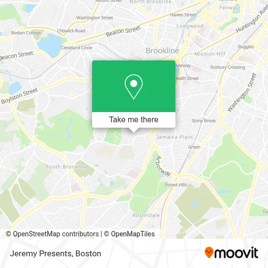
See Jeremy Presents, Boston, on the map
Public Transit to Jeremy Presents in Boston
Wondering how to get to Jeremy Presents in Boston? Moovit helps you find the best way to get to Jeremy Presents with step-by-step directions from the nearest public transit station.
Moovit provides free maps and live directions to help you navigate through your city. View schedules, routes, timetables, and find out how long does it take to get to Jeremy Presents in real time.
Looking for the nearest stop or station to Jeremy Presents? Check out this list of stops closest to your destination: Centre St @ Ballard St; Stony Brook; Brookline Hills; Forest Hills; Heath Street.
Bus: 38, 39, 35.Train: FRANKLIN/FOXBORO, NEEDHAM, PROVIDENCE/STOUGHTON.Subway: ORANGE LINE, GREEN LINE D, GREEN LINE E.
Want to see if there’s another route that gets you there at an earlier time? Moovit helps you find alternative routes or times. Get directions from and directions to Jeremy Presents easily from the Moovit App or Website.
We make riding to Jeremy Presents easy, which is why over 1.7 million users, including users in Boston, trust Moovit as the best app for public transit. You don’t need to download an individual bus app or train app, Moovit is your all-in-one transit app that helps you find the best bus time or train time available.
For information on prices of bus, subway and train, costs and ride fares to Jeremy Presents, please check the Moovit app.
Use the app to navigate to popular places including to the airport, hospital, stadium, grocery store, mall, coffee shop, school, college, and university.
Jeremy Presents Address: 18 Conry Cres street in Boston
- Park School CR,
- Hellenic College,
- Larz Anderson Auto Museum - Museum of Transportation,
- Larz Anderson Auto Museum,
- Showa Boston Institute,
- Southfield School MA USA,
- British International School of Boston,
- Larz Anderson Park,
- Jamaica Plain,
- Joseph P. Manning Elementary School (JP Manning School Parent Council),
- USPS Collection Box - Blue Box,
- Boston College Law School,
- The Arnold Arboretum of Harvard University,
- Appliance Repair Maytag Repair Service,
- Longyear Museum,
- Sausage Connection,
- Arnold Arboretum-Arborway Gate,
- Southfield School,
- Clay Center Observatory at Dexter and Southfield School,
- Directangle Press
Places Near Jeremy Presents (Boston)
- Quincy Market, Boston,
- Castle Island, Boston,
- House Of Blues, Boston,
- Boston Convention & Exhibition Center, Boston,
- Massachusetts General Hospital, Boston,
- Cheers, Boston,
- Boston Children's Hospital, Boston,
- Leader Bank Pavilion (Leader Bank Pavillion), Boston,
- North End, Boston,
- Td Garden, Boston,
- Museum Of Science, Boston,
- Prudential Center, Boston,
- Boston Medical Center, Boston,
- Isabella Stewart Gardner Museum, Boston,
- Wang Theater, Boston,
- Mgm Music Hall, Boston,
- Seaport District, Boston,
- Boston Common, Boston,
- Faneuil Hall, Boston,
- Wilbur Theatre, Boston
How to get to popular places in Boston with public transit
Get around Boston by public transit!
Traveling around Boston has never been so easy. See step by step directions as you travel to any attraction, street or major public transit station. View bus and train schedules, arrival times, service alerts and detailed routes on a map, so you know exactly how to get to anywhere in Boston.
When traveling to any destination around Boston use Moovit's Live Directions with Get Off Notifications to know exactly where and how far to walk, how long to wait for your line, and how many stops are left. Moovit will alert you when it's time to get off — no need to constantly re-check whether yours is the next stop.
Wondering how to use public transit in Boston or how to pay for public transit in Boston? Moovit public transit app can help you navigate your way with public transit easily, and at minimum cost. It includes public transit fees, ticket prices, and costs. Looking for a map of Boston public transit lines? Moovit public transit app shows all public transit maps in Boston with all Bus, Train, Subway and Ferry routes and stops on an interactive map.
Boston has 4 transit type(s), including: Bus, Train, Subway and Ferry, operated by several transit agencies, including MBTA, Southeastern Regional Transit Authority, MetroWest Regional Transit Authority, Rhode Island Public Transit Authority, WRTA, Lowell Regional Transit Authority, Merrimack Valley Transit, Montachusett Regional Transit Authority, Cape Cod Regional Transit Authority, Brockton Area Transit Authority, Martha's Vineyard Transit Authority, the WAVE - Nantucket Regional Transit Authority, GATRA, Cape Ann Transportation Authority and Massport