Directions to Jericho Circle Project (Cambridge) with public transportation
The following transit lines have routes that pass near Jericho Circle Project
 Bus: 350, 71, 74, 78, 83.
- Train: FITCHBURG, RED LINE.
- Subway: RED LINE, GREEN LINE B, GREEN LINE C, GREEN LINE E.
How to get to Jericho Circle Project by bus?
Click on the bus route to see step by step directions with maps, line arrival times and updated time schedules.
From Atlantic Fish Co, Boston
51 minFrom Cruiseport Boston's Black Falcon Cruise Terminal, Boston
109 minFrom Lasell College, Newton
86 minFrom O'Bryant High School, Boston
64 minFrom Landmark Center, Boston
56 minFrom Pizzeria Regina, Boston
67 minFrom Cyclorama, Boston
64 minFrom Courtyard by Marriott Boston Logan Airport, Boston
96 minFrom Massport Security Badge Office, Boston
61 minFrom Terminal E- Logan International Airport, Boston
61 min
How to get to Jericho Circle Project by train?
Click on the train route to see step by step directions with maps, line arrival times and updated time schedules.
How to get to Jericho Circle Project by subway?
Click on the subway route to see step by step directions with maps, line arrival times and updated time schedules.
From Massport Security Badge Office, Boston
60 minFrom Terminal E- Logan International Airport, Boston
60 minFrom Atlantic Fish Co, Boston
48 minFrom Lasell College, Newton
100 minFrom O'Bryant High School, Boston
59 minFrom Landmark Center, Boston
57 minFrom Pizzeria Regina, Boston
47 minFrom Cyclorama, Boston
52 minFrom Courtyard by Marriott Boston Logan Airport, Boston
68 min
Bus stops near Jericho Circle Project in Cambridge
Train station near Jericho Circle Project in Cambridge
- Porter, 16 min walk,VIEW
Subway station near Jericho Circle Project in Cambridge
- Ball Square Station, 41 min walk,VIEW
Bus lines to Jericho Circle Project in Cambridge
What are the closest stations to Jericho Circle Project?
The closest stations to Jericho Circle Project are:
- Rindge Ave @ Clay St is 371 yards away, 5 min walk.
- Concord Ave @ Wheeler St is 394 yards away, 5 min walk.
- Cambridge (Ma) is 630 yards away, 8 min walk.
- Alewife Station (Arrive) is 721 yards away, 9 min walk.
- Porter is 1296 yards away, 16 min walk.
- Ball Square Station is 3425 yards away, 41 min walk.
Which bus lines stop near Jericho Circle Project?
These bus lines stop near Jericho Circle Project: 350, 71, 74, 78.
Which train line stops near Jericho Circle Project?
FITCHBURG (#409 | Wachusett)
Which subway line stops near Jericho Circle Project?
RED LINE (Alewife)
What’s the nearest train station to Jericho Circle Project in Cambridge?
The nearest train station to Jericho Circle Project in Cambridge is Porter. It’s a 16 min walk away.
What’s the nearest bus station to Jericho Circle Project in Cambridge?
The nearest bus stations to Jericho Circle Project in Cambridge are Rindge Ave @ Clay St and Concord Ave @ Wheeler St. The closest one is a 5 min walk away.
What time is the first subway to Jericho Circle Project in Cambridge?
The GREEN LINE E is the first subway that goes to Jericho Circle Project in Cambridge. It stops nearby at 4:55 AM.
What time is the last subway to Jericho Circle Project in Cambridge?
The GREEN LINE E is the last subway that goes to Jericho Circle Project in Cambridge. It stops nearby at 2:39 AM.
What time is the first train to Jericho Circle Project in Cambridge?
The FITCHBURG is the first train that goes to Jericho Circle Project in Cambridge. It stops nearby at 5:47 AM.
What time is the last train to Jericho Circle Project in Cambridge?
The FITCHBURG is the last train that goes to Jericho Circle Project in Cambridge. It stops nearby at 12:17 AM.
What time is the first bus to Jericho Circle Project in Cambridge?
The 83 is the first bus that goes to Jericho Circle Project in Cambridge. It stops nearby at 5:10 AM.
What time is the last bus to Jericho Circle Project in Cambridge?
The 83 is the last bus that goes to Jericho Circle Project in Cambridge. It stops nearby at 1:28 AM.
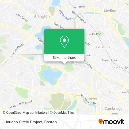
See Jericho Circle Project, Cambridge, on the map
Public Transit to Jericho Circle Project in Cambridge
Wondering how to get to Jericho Circle Project in Cambridge? Moovit helps you find the best way to get to Jericho Circle Project with step-by-step directions from the nearest public transit station.
Moovit provides free maps and live directions to help you navigate through your city. View schedules, routes, timetables, and find out how long does it take to get to Jericho Circle Project in real time.
Looking for the nearest stop or station to Jericho Circle Project? Check out this list of stops closest to your destination: Rindge Ave @ Clay St; Concord Ave @ Wheeler St; Cambridge (Ma); Alewife Station (Arrive); Porter; Ball Square Station.
Bus: 350, 71, 74, 78, 83, FLIXBUS 2610, FLIXBUS 2619, R1, R2.Train: FITCHBURG, RED LINE.Subway: RED LINE, GREEN LINE B, GREEN LINE C, GREEN LINE E.
Want to see if there’s another route that gets you there at an earlier time? Moovit helps you find alternative routes or times. Get directions from and directions to Jericho Circle Project easily from the Moovit App or Website.
We make riding to Jericho Circle Project easy, which is why over 1.7 million users, including users in Cambridge, trust Moovit as the best app for public transit. You don’t need to download an individual bus app or train app, Moovit is your all-in-one transit app that helps you find the best bus time or train time available.
For information on prices of subway, bus and train, costs and ride fares to Jericho Circle Project, please check the Moovit app.
Use the app to navigate to popular places including to the airport, hospital, stadium, grocery store, mall, coffee shop, school, college, and university.
Jericho Circle Project Address: 160 Alewife Brook Pkwy street in Cambridge
- Bridge Informatics,
- Carpet Cleaning Cambridge Ma,
- Pixpro Photo,
- Fresh Pond Mall,
- Santana Team,
- Pearson Vue Test Center,
- Amazon Locker-Wedding,
- Apple Cinemas (Cinemas Fresh Pond Mall),
- Apple Cinemas,
- Jury Associates,
- Petsafe Brand,
- Verizon Wireless,
- Pearson Vue (Pearson Professional Centers),
- Pearson Vue,
- Xfinity,
- Wholefoods Fresh Pond,
- Amazon Hub Counter+ (Fresh Pond-Whole Foods),
- American Locksmith,
- Eos Imaging,
- Marie Landel & Associates
Places Near Jericho Circle Project (Cambridge)
- Wilbur Theatre, Boston,
- Boston Convention & Exhibition Center, Boston,
- Castle Island, Boston,
- Cheers, Boston,
- Boston Common, Boston,
- Isabella Stewart Gardner Museum, Boston,
- Museum Of Science, Boston,
- Td Garden, Boston,
- House Of Blues, Boston,
- Boston Medical Center, Boston,
- North End, Boston,
- Quincy Market, Boston,
- Faneuil Hall, Boston,
- Prudential Center, Boston,
- Mgm Music Hall, Boston,
- Seaport District, Boston,
- Boston Children's Hospital, Boston,
- Wang Theater, Boston,
- Massachusetts General Hospital, Boston,
- Leader Bank Pavilion (Leader Bank Pavillion), Boston
How to get to popular places in Boston with public transit
Get around Cambridge by public transit!
Traveling around Cambridge has never been so easy. See step by step directions as you travel to any attraction, street or major public transit station. View bus and train schedules, arrival times, service alerts and detailed routes on a map, so you know exactly how to get to anywhere in Cambridge.
When traveling to any destination around Cambridge use Moovit's Live Directions with Get Off Notifications to know exactly where and how far to walk, how long to wait for your line, and how many stops are left. Moovit will alert you when it's time to get off — no need to constantly re-check whether yours is the next stop.
Wondering how to use public transit in Cambridge or how to pay for public transit in Cambridge? Moovit public transit app can help you navigate your way with public transit easily, and at minimum cost. It includes public transit fees, ticket prices, and costs. Looking for a map of Cambridge public transit lines? Moovit public transit app shows all public transit maps in Cambridge with all Bus, Train, Subway and Ferry routes and stops on an interactive map.
Boston has 4 transit type(s), including: Bus, Train, Subway and Ferry, operated by several transit agencies, including MBTA, Southeastern Regional Transit Authority, MetroWest Regional Transit Authority, Rhode Island Public Transit Authority, WRTA, Lowell Regional Transit Authority, Merrimack Valley Transit, Montachusett Regional Transit Authority, Cape Cod Regional Transit Authority, Brockton Area Transit Authority, Martha's Vineyard Transit Authority, the WAVE - Nantucket Regional Transit Authority, GATRA, Cape Ann Transportation Authority and Massport