Directions to Jersey Mike's (Dedham) with public transportation
The following transit lines have routes that pass near Jersey Mike's
 Bus: 34, 34E, 35, 52.
- Train: NEEDHAM, FRANKLIN/FOXBORO, FOXBORO EVENT SERVICE, PROVIDENCE/STOUGHTON.
How to get to Jersey Mike's by bus?
Click on the bus route to see step by step directions with maps, line arrival times and updated time schedules.
From VA Medical Center, Boston (Jamaica Plain), Boston
45 minFrom Mspca, Boston
45 minFrom Brighton, Boston
70 minFrom Washington St, Boston
51 minFrom MBTA Jackson Square Station, Boston
52 minFrom The Mall At Chestnut Hill, Newton
82 minFrom The Monument, Boston
37 minFrom Astrazeneca Hope Lodge, Boston
45 minFrom Granite Links Golf Club at Quarry Hills, Quincy
94 minFrom Angell Animal Medical Center (Mspca Angell), Boston
45 min
How to get to Jersey Mike's by train?
Click on the train route to see step by step directions with maps, line arrival times and updated time schedules.
Bus stops near Jersey Mike's in Dedham
Train stations near Jersey Mike's in Dedham
Bus lines to Jersey Mike's in Dedham
What are the closest stations to Jersey Mike's?
The closest stations to Jersey Mike's are:
- 245 Washington St is 197 yards away, 3 min walk.
- Dedham Mall @ South Side is 389 yards away, 5 min walk.
- Endicott is 464 yards away, 6 min walk.
- Dedham Corporate Center is 1889 yards away, 22 min walk.
- Readville is 2825 yards away, 34 min walk.
Which bus lines stop near Jersey Mike's?
These bus lines stop near Jersey Mike's: 34, 34E, 35.
Which train line stops near Jersey Mike's?
NEEDHAM (#625 | Needham Heights)
What’s the nearest train station to Jersey Mike's in Dedham?
The nearest train station to Jersey Mike's in Dedham is Endicott. It’s a 6 min walk away.
What’s the nearest bus station to Jersey Mike's in Dedham?
The nearest bus station to Jersey Mike's in Dedham is 245 Washington St. It’s a 3 min walk away.
What time is the first train to Jersey Mike's in Dedham?
The PROVIDENCE/STOUGHTON is the first train that goes to Jersey Mike's in Dedham. It stops nearby at 9:44 AM.
What time is the last train to Jersey Mike's in Dedham?
The PROVIDENCE/STOUGHTON is the last train that goes to Jersey Mike's in Dedham. It stops nearby at 12:15 AM.
What time is the first bus to Jersey Mike's in Dedham?
The 34 is the first bus that goes to Jersey Mike's in Dedham. It stops nearby at 4:44 AM.
What time is the last bus to Jersey Mike's in Dedham?
The 34 is the last bus that goes to Jersey Mike's in Dedham. It stops nearby at 1:32 AM.
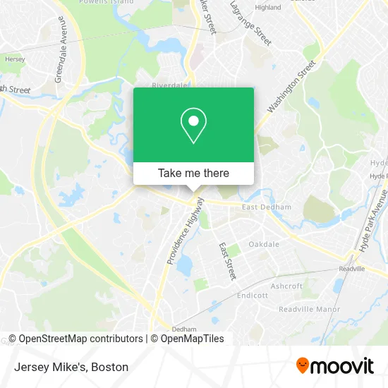
See Jersey Mike's, Dedham, on the map
Public Transit to Jersey Mike's in Dedham
Wondering how to get to Jersey Mike's in Dedham? Moovit helps you find the best way to get to Jersey Mike's with step-by-step directions from the nearest public transit station.
Moovit provides free maps and live directions to help you navigate through your city. View schedules, routes, timetables, and find out how long does it take to get to Jersey Mike's in real time.
Looking for the nearest stop or station to Jersey Mike's? Check out this list of stops closest to your destination: 245 Washington St; Dedham Mall @ South Side; Endicott; Dedham Corporate Center; Readville.
Bus: 34, 34E, 35, 52.Train: NEEDHAM, FRANKLIN/FOXBORO, FOXBORO EVENT SERVICE, PROVIDENCE/STOUGHTON.
Want to see if there’s another route that gets you there at an earlier time? Moovit helps you find alternative routes or times. Get directions from and directions to Jersey Mike's easily from the Moovit App or Website.
We make riding to Jersey Mike's easy, which is why over 1.7 million users, including users in Dedham, trust Moovit as the best app for public transit. You don’t need to download an individual bus app or train app, Moovit is your all-in-one transit app that helps you find the best bus time or train time available.
For information on prices of bus, subway and train, costs and ride fares to Jersey Mike's, please check the Moovit app.
Use the app to navigate to popular places including to the airport, hospital, stadium, grocery store, mall, coffee shop, school, college, and university.
Jersey Mike's Address: 395 Providence Hwy street in Dedham
- Law Office of Kevin Gillis,
- Ubreakifix (U Break I Fix),
- Needham Bank,
- Roach Industries,
- Charlotte Maguire,
- New England School of Whole Health Education,
- Ecco,
- Melty,
- Bundts and Tea,
- Dedham Dental Lab,
- Bob's Discount Furniture (Bob's Discount Furniture and Mattress Store),
- Pevomat,
- Love and Grace Girls,
- Locksmith 24 Hour Inc,
- C2 Body,
- C2 Pilates and Barre Dedham,
- Massachusetts Association of Guardians Ad Litem,
- Uchi,
- Pinto Cleaning Services,
- Liberty Tax Service
Places Near Jersey Mike's (Dedham)
- Boston Children's Hospital, Boston,
- North End, Boston,
- Cheers, Boston,
- Wang Theater, Boston,
- Boston Convention & Exhibition Center, Boston,
- Museum Of Science, Boston,
- Mgm Music Hall, Boston,
- House Of Blues, Boston,
- Boston Medical Center, Boston,
- Wilbur Theatre, Boston,
- Boston Common, Boston,
- Leader Bank Pavilion (Leader Bank Pavillion), Boston,
- Massachusetts General Hospital, Boston,
- Prudential Center, Boston,
- Castle Island, Boston,
- Td Garden, Boston,
- Faneuil Hall, Boston,
- Isabella Stewart Gardner Museum, Boston,
- Seaport District, Boston,
- Quincy Market, Boston
How to get to popular places in Boston with public transit
Get around Dedham by public transit!
Traveling around Dedham has never been so easy. See step by step directions as you travel to any attraction, street or major public transit station. View bus and train schedules, arrival times, service alerts and detailed routes on a map, so you know exactly how to get to anywhere in Dedham.
When traveling to any destination around Dedham use Moovit's Live Directions with Get Off Notifications to know exactly where and how far to walk, how long to wait for your line, and how many stops are left. Moovit will alert you when it's time to get off — no need to constantly re-check whether yours is the next stop.
Wondering how to use public transit in Dedham or how to pay for public transit in Dedham? Moovit public transit app can help you navigate your way with public transit easily, and at minimum cost. It includes public transit fees, ticket prices, and costs. Looking for a map of Dedham public transit lines? Moovit public transit app shows all public transit maps in Dedham with all Bus, Train, Subway and Ferry routes and stops on an interactive map.
Boston has 4 transit type(s), including: Bus, Train, Subway and Ferry, operated by several transit agencies, including MBTA, Southeastern Regional Transit Authority, MetroWest Regional Transit Authority, Rhode Island Public Transit Authority, WRTA, Lowell Regional Transit Authority, Merrimack Valley Transit, Montachusett Regional Transit Authority, Cape Cod Regional Transit Authority, Brockton Area Transit Authority, Martha's Vineyard Transit Authority, the WAVE - Nantucket Regional Transit Authority, GATRA, Cape Ann Transportation Authority and Massport