Directions to Jill A Smith (Newton) with public transportation
The following transit lines have routes that pass near Jill A Smith
 Bus: 01, 505, 553, 558, GREEN LINE D SHUTTLE.
- Train: FRAMINGHAM/WORCESTER.
- Subway: GREEN LINE D.
How to get to Jill A Smith by bus?
Click on the bus route to see step by step directions with maps, line arrival times and updated time schedules.
From McLean Hospital, Belmont
69 minFrom Arsenal Yards, Watertown Town
76 minFrom Courtyard by Marriott Brookline, Brookline
81 minFrom Brookline, MA, Brookline
83 minFrom Conte Forum, Boston
89 minFrom Chestnut Hill, Boston
89 minFrom Hebrew Rehab Center, Boston
122 minFrom Coolidge Corner Theatre, Brookline
80 minFrom Spaulding Rehab, Boston
153 min
How to get to Jill A Smith by train?
Click on the train route to see step by step directions with maps, line arrival times and updated time schedules.
How to get to Jill A Smith by subway?
Click on the subway route to see step by step directions with maps, line arrival times and updated time schedules.
Train station near Jill A Smith in Newton
- Auburndale, 2 min walk,VIEW
Bus stops near Jill A Smith in Newton
Subway station near Jill A Smith in Newton
- Riverside, 18 min walk,VIEW
Bus lines to Jill A Smith in Newton
- GREEN LINE D SHUTTLE, Riverside - Copley (Shuttle),VIEW
- GREEN LINE D SHUTTLE, Riverside - Kenmore (Shuttle),VIEW
- GREEN LINE D SHUTTLE, Riverside - Reservoir,VIEW
- GREEN LINE D SHUTTLE, Riverside - Copley via Woodland (Express),VIEW
- GREEN LINE D SHUTTLE, Riverside - Fenway,VIEW
- GREEN LINE D SHUTTLE, Riverside - Newton Highlands,VIEW
- GREEN LINE D SHUTTLE, Woodland - Copley via Riverside (Express),VIEW
- GREEN LINE D SHUTTLE, Riverside - Kenmore via Saint Mary's Street,VIEW
- GREEN LINE D SHUTTLE, Riverside - Brookline Hills,VIEW
- GREEN LINE D SHUTTLE, Riverside - Brookline Village,VIEW
- GREEN LINE D SHUTTLE, Riverside - Kenmore,VIEW
- 01, Natick Mall - Wegmans,VIEW
- MANSFIELD TO LOGAN AIRPORT, Terminal E - Arrivals,VIEW
- MBRS, Riverside Station,VIEW
- 558, Riverside,VIEW
- GREEN LINE D SHUTTLE, Riverside (Express Shuttle),VIEW
What are the closest stations to Jill A Smith?
The closest stations to Jill A Smith are:
- Auburndale is 104 yards away, 2 min walk.
- Woodland is 1188 yards away, 15 min walk.
- Woodland Mbta Train Station is 1194 yards away, 15 min walk.
- Riverside is 1509 yards away, 18 min walk.
- Riverside Mbta Station is 1973 yards away, 24 min walk.
- Riverside Station is 2662 yards away, 32 min walk.
Which bus lines stop near Jill A Smith?
These bus lines stop near Jill A Smith: 01, 505, 553, 558.
Which train line stops near Jill A Smith?
FRAMINGHAM/WORCESTER (#525 | Worcester)
Which subway line stops near Jill A Smith?
GREEN LINE D (Government Center)
What’s the nearest subway station to Jill A Smith in Newton?
The nearest subway station to Jill A Smith in Newton is Riverside. It’s a 18 min walk away.
What’s the nearest train station to Jill A Smith in Newton?
The nearest train station to Jill A Smith in Newton is Auburndale. It’s a 2 min walk away.
What’s the nearest bus station to Jill A Smith in Newton?
The nearest bus stations to Jill A Smith in Newton are Woodland and Woodland Mbta Train Station. The closest one is a 15 min walk away.
What time is the first subway to Jill A Smith in Newton?
The GREEN LINE D is the first subway that goes to Jill A Smith in Newton. It stops nearby at 4:45 AM.
What time is the last subway to Jill A Smith in Newton?
The GREEN LINE D is the last subway that goes to Jill A Smith in Newton. It stops nearby at 2:48 AM.
What time is the first train to Jill A Smith in Newton?
The FRAMINGHAM/WORCESTER is the first train that goes to Jill A Smith in Newton. It stops nearby at 5:19 AM.
What time is the last train to Jill A Smith in Newton?
The FRAMINGHAM/WORCESTER is the last train that goes to Jill A Smith in Newton. It stops nearby at 12:22 AM.
What time is the first bus to Jill A Smith in Newton?
The MANSFIELD TO LOGAN AIRPORT is the first bus that goes to Jill A Smith in Newton. It stops nearby at 3:35 AM.
What time is the last bus to Jill A Smith in Newton?
The MANSFIELD TO LOGAN AIRPORT is the last bus that goes to Jill A Smith in Newton. It stops nearby at 1:50 AM.
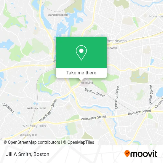
See Jill A Smith, Newton, on the map
Public Transit to Jill A Smith in Newton
Wondering how to get to Jill A Smith in Newton? Moovit helps you find the best way to get to Jill A Smith with step-by-step directions from the nearest public transit station.
Moovit provides free maps and live directions to help you navigate through your city. View schedules, routes, timetables, and find out how long does it take to get to Jill A Smith in real time.
Looking for the nearest stop or station to Jill A Smith? Check out this list of stops closest to your destination: Auburndale; Woodland; Woodland Mbta Train Station; Riverside; Riverside Mbta Station; Riverside Station.
Bus: 01, 505, 553, 558, GREEN LINE D SHUTTLE, GREEN LINE D SHUTTLE, GREEN LINE D SHUTTLE, GREEN LINE D SHUTTLE, GREEN LINE D SHUTTLE, MANSFIELD TO LOGAN AIRPORT, MBRS.Train: FRAMINGHAM/WORCESTER.Subway: GREEN LINE D.
Want to see if there’s another route that gets you there at an earlier time? Moovit helps you find alternative routes or times. Get directions from and directions to Jill A Smith easily from the Moovit App or Website.
We make riding to Jill A Smith easy, which is why over 1.7 million users, including users in Newton, trust Moovit as the best app for public transit. You don’t need to download an individual bus app or train app, Moovit is your all-in-one transit app that helps you find the best bus time or train time available.
For information on prices of bus, subway and train, costs and ride fares to Jill A Smith, please check the Moovit app.
Use the app to navigate to popular places including to the airport, hospital, stadium, grocery store, mall, coffee shop, school, college, and university.
Jill A Smith Address: 2000 Washington St Ste 462 street in Newton
- Newton-Wellesley Hospital,
- Coffee Shop (Newton-Wellesley Hospital),
- Wikstrom Surgical Center,
- Newton Wellesley Hospital Green Building,
- Harry Schrager, MD,
- Catharina Armstrong, MD MPH,
- Wychmere Aesthetics,
- Bruce Tofias Dr,
- Arun Mukherjee, MD - Newton Welllesley Hospital,
- Cher (Xue) Zhao, M.D.,
- Effective Heating & Cooling Repair,
- Todd Francone, MD,
- Pediatric Pediatrcian,
- Nicholas M Mascoli III, MD,
- Sheila Partridge, MD,
- Robert Friday, MD PHD,
- Allen Riddle Building,
- Juliana Chen, MD,
- Spector, Carl C,
- Newton-Wellesley Hospital, Emergency - Garage
Places Near Jill A Smith (Newton)
- Isabella Stewart Gardner Museum, Boston,
- Cheers, Boston,
- Seaport District, Boston,
- House Of Blues, Boston,
- Boston Common, Boston,
- Wilbur Theatre, Boston,
- Leader Bank Pavilion (Leader Bank Pavillion), Boston,
- Faneuil Hall, Boston,
- Boston Medical Center, Boston,
- Quincy Market, Boston,
- Boston Children's Hospital, Boston,
- Massachusetts General Hospital, Boston,
- North End, Boston,
- Boston Convention & Exhibition Center, Boston,
- Museum Of Science, Boston,
- Mgm Music Hall, Boston,
- Wang Theater, Boston,
- Castle Island, Boston,
- Prudential Center, Boston,
- Td Garden, Boston
How to get to popular places in Boston with public transit
Get around Newton by public transit!
Traveling around Newton has never been so easy. See step by step directions as you travel to any attraction, street or major public transit station. View bus and train schedules, arrival times, service alerts and detailed routes on a map, so you know exactly how to get to anywhere in Newton.
When traveling to any destination around Newton use Moovit's Live Directions with Get Off Notifications to know exactly where and how far to walk, how long to wait for your line, and how many stops are left. Moovit will alert you when it's time to get off — no need to constantly re-check whether yours is the next stop.
Wondering how to use public transit in Newton or how to pay for public transit in Newton? Moovit public transit app can help you navigate your way with public transit easily, and at minimum cost. It includes public transit fees, ticket prices, and costs. Looking for a map of Newton public transit lines? Moovit public transit app shows all public transit maps in Newton with all Bus, Train, Subway and Ferry routes and stops on an interactive map.
Boston has 4 transit type(s), including: Bus, Train, Subway and Ferry, operated by several transit agencies, including MBTA, Southeastern Regional Transit Authority, MetroWest Regional Transit Authority, Rhode Island Public Transit Authority, WRTA, Lowell Regional Transit Authority, Merrimack Valley Transit, Montachusett Regional Transit Authority, Cape Cod Regional Transit Authority, Brockton Area Transit Authority, Martha's Vineyard Transit Authority, the WAVE - Nantucket Regional Transit Authority, GATRA, Cape Ann Transportation Authority and Massport