Directions to Jillian Hanley: Allstate Insurance (Quincy) with public transportation
The following transit lines have routes that pass near Jillian Hanley: Allstate Insurance
 Bus: 215, 245, 217.
- Train: FALL RIVER/NEW BEDFORD, GREENBUSH.
- Subway: RED LINE, MATTAPAN LINE.
How to get to Jillian Hanley: Allstate Insurance by bus?
Click on the bus route to see step by step directions with maps, line arrival times and updated time schedules.
From SoWa Winter Market, Boston
61 minFrom J.J. Foley's Cafe, Boston
68 minFrom Laugh Boston, Boston
92 minFrom WESTIN Boston Waterfront (The WESTIN Boston Seaport District), Boston
92 minFrom Seaport District, Boston
95 minFrom John F. Kennedy Presidential Library And Museum, Boston
62 minFrom 415 Summer Street, Boston
91 minFrom Academy Of the Pacific Rim Charter Public School, Boston
64 minFrom Sam Adams Boston Brewery Tour, Boston
42 minFrom Boston Medical Center, Boston
59 min
How to get to Jillian Hanley: Allstate Insurance by train?
Click on the train route to see step by step directions with maps, line arrival times and updated time schedules.
From SoWa Winter Market, Boston
81 minFrom J.J. Foley's Cafe, Boston
82 minFrom Laugh Boston, Boston
71 minFrom WESTIN Boston Waterfront (The WESTIN Boston Seaport District), Boston
71 minFrom Seaport District, Boston
73 minFrom John F. Kennedy Presidential Library And Museum, Boston
102 minFrom 415 Summer Street, Boston
70 minFrom Academy Of the Pacific Rim Charter Public School, Boston
105 minFrom Sam Adams Boston Brewery Tour, Boston
104 minFrom Boston Medical Center, Boston
107 min
How to get to Jillian Hanley: Allstate Insurance by subway?
Click on the subway route to see step by step directions with maps, line arrival times and updated time schedules.
From SoWa Winter Market, Boston
61 minFrom J.J. Foley's Cafe, Boston
48 minFrom Laugh Boston, Boston
55 minFrom WESTIN Boston Waterfront (The WESTIN Boston Seaport District), Boston
55 minFrom Seaport District, Boston
58 minFrom John F. Kennedy Presidential Library And Museum, Boston
56 minFrom 415 Summer Street, Boston
54 minFrom Sam Adams Boston Brewery Tour, Boston
63 minFrom Boston Medical Center, Boston
55 min
Bus stops near Jillian Hanley: Allstate Insurance in Quincy
Subway stations near Jillian Hanley: Allstate Insurance in Quincy
Bus lines to Jillian Hanley: Allstate Insurance in Quincy
What are the closest stations to Jillian Hanley: Allstate Insurance?
The closest stations to Jillian Hanley: Allstate Insurance are:
- Adams St @ Campbell St is 30 yards away, 1 min walk.
- Beale St @ Forbes Hill Rd is 268 yards away, 4 min walk.
- Robertson St Opp Kimball St is 284 yards away, 4 min walk.
- Wollaston is 1561 yards away, 19 min walk.
- Milton is 4181 yards away, 49 min walk.
Which bus lines stop near Jillian Hanley: Allstate Insurance?
These bus lines stop near Jillian Hanley: Allstate Insurance: 215, 245.
Which train lines stop near Jillian Hanley: Allstate Insurance?
These train lines stop near Jillian Hanley: Allstate Insurance: FALL RIVER/NEW BEDFORD, GREENBUSH.
Which subway line stops near Jillian Hanley: Allstate Insurance?
RED LINE (Ashmont/Braintree)
What’s the nearest subway station to Jillian Hanley: Allstate Insurance in Quincy?
The nearest subway station to Jillian Hanley: Allstate Insurance in Quincy is Wollaston. It’s a 19 min walk away.
What’s the nearest bus station to Jillian Hanley: Allstate Insurance in Quincy?
The nearest bus station to Jillian Hanley: Allstate Insurance in Quincy is Adams St @ Campbell St. It’s a 1 min walk away.
What time is the first subway to Jillian Hanley: Allstate Insurance in Quincy?
The MATTAPAN LINE is the first subway that goes to Jillian Hanley: Allstate Insurance in Quincy. It stops nearby at 5:06 AM.
What time is the last subway to Jillian Hanley: Allstate Insurance in Quincy?
The MATTAPAN LINE is the last subway that goes to Jillian Hanley: Allstate Insurance in Quincy. It stops nearby at 2:35 AM.
What time is the first bus to Jillian Hanley: Allstate Insurance in Quincy?
The 215 is the first bus that goes to Jillian Hanley: Allstate Insurance in Quincy. It stops nearby at 5:15 AM.
What time is the last bus to Jillian Hanley: Allstate Insurance in Quincy?
The 215 is the last bus that goes to Jillian Hanley: Allstate Insurance in Quincy. It stops nearby at 1:08 AM.
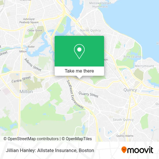
See Jillian Hanley: Allstate Insurance, Quincy, on the map
Public Transit to Jillian Hanley: Allstate Insurance in Quincy
Wondering how to get to Jillian Hanley: Allstate Insurance in Quincy? Moovit helps you find the best way to get to Jillian Hanley: Allstate Insurance with step-by-step directions from the nearest public transit station.
Moovit provides free maps and live directions to help you navigate through your city. View schedules, routes, timetables, and find out how long does it take to get to Jillian Hanley: Allstate Insurance in real time.
Looking for the nearest stop or station to Jillian Hanley: Allstate Insurance? Check out this list of stops closest to your destination: Adams St @ Campbell St; Beale St @ Forbes Hill Rd; Robertson St Opp Kimball St; Wollaston; Milton.
Bus: 215, 245, 217.Train: FALL RIVER/NEW BEDFORD, GREENBUSH.Subway: RED LINE, MATTAPAN LINE.
Want to see if there’s another route that gets you there at an earlier time? Moovit helps you find alternative routes or times. Get directions from and directions to Jillian Hanley: Allstate Insurance easily from the Moovit App or Website.
We make riding to Jillian Hanley: Allstate Insurance easy, which is why over 1.7 million users, including users in Quincy, trust Moovit as the best app for public transit. You don’t need to download an individual bus app or train app, Moovit is your all-in-one transit app that helps you find the best bus time or train time available.
For information on prices of bus, subway and train, costs and ride fares to Jillian Hanley: Allstate Insurance, please check the Moovit app.
Use the app to navigate to popular places including to the airport, hospital, stadium, grocery store, mall, coffee shop, school, college, and university.
Jillian Hanley: Allstate Insurance Address: 695 Adams St street in Quincy
- Brick & Beam Fruity Toot Tootskis,
- United Scientific,
- Paintzen,
- AAA,
- Amazon Locker-Rulo,
- Keyme Locksmiths,
- Quincy AAA RMV,
- Bright Horizons,
- The Color Bar,
- Quincy Youth Baseball & Softball,
- Tello Jorge MD,
- Montilios Quincy,
- Locksmith Day And Night,
- Russian School of Mathematics RSM Milton,
- Care Dental Implants & Invisalign Center,
- Care Dental,
- Crime Scene Cleanup Massachusetts,
- Plate Kitchen Milt,
- Peak Physical Therapy and Sports Performance,
- Dragan and Associates
Places Near Jillian Hanley: Allstate Insurance (Quincy)
- Cheers, Boston,
- Prudential Center, Boston,
- Boston Medical Center, Boston,
- Td Garden, Boston,
- Massachusetts General Hospital, Boston,
- Leader Bank Pavilion (Leader Bank Pavillion), Boston,
- Castle Island, Boston,
- North End, Boston,
- Wang Theater, Boston,
- Quincy Market, Boston,
- Museum Of Science, Boston,
- House Of Blues, Boston,
- Boston Convention & Exhibition Center, Boston,
- Boston Common, Boston,
- Mgm Music Hall, Boston,
- Boston Children's Hospital, Boston,
- Faneuil Hall, Boston,
- Seaport District, Boston,
- Wilbur Theatre, Boston,
- Isabella Stewart Gardner Museum, Boston
How to get to popular places in Boston with public transit
Get around Quincy by public transit!
Traveling around Quincy has never been so easy. See step by step directions as you travel to any attraction, street or major public transit station. View bus and train schedules, arrival times, service alerts and detailed routes on a map, so you know exactly how to get to anywhere in Quincy.
When traveling to any destination around Quincy use Moovit's Live Directions with Get Off Notifications to know exactly where and how far to walk, how long to wait for your line, and how many stops are left. Moovit will alert you when it's time to get off — no need to constantly re-check whether yours is the next stop.
Wondering how to use public transit in Quincy or how to pay for public transit in Quincy? Moovit public transit app can help you navigate your way with public transit easily, and at minimum cost. It includes public transit fees, ticket prices, and costs. Looking for a map of Quincy public transit lines? Moovit public transit app shows all public transit maps in Quincy with all Bus, Train, Subway and Ferry routes and stops on an interactive map.
Boston has 4 transit type(s), including: Bus, Train, Subway and Ferry, operated by several transit agencies, including MBTA, Southeastern Regional Transit Authority, MetroWest Regional Transit Authority, Rhode Island Public Transit Authority, WRTA, Lowell Regional Transit Authority, Merrimack Valley Transit, Montachusett Regional Transit Authority, Cape Cod Regional Transit Authority, Brockton Area Transit Authority, Martha's Vineyard Transit Authority, the WAVE - Nantucket Regional Transit Authority, GATRA, Cape Ann Transportation Authority and Massport