How to get to Jim Casey by bus?
Click on the bus route to see step by step directions with maps, line arrival times and updated time schedules.
From Sommerville Theatre, Somerville
71 minFrom AC Hotel Boston Cambridge, Cambridge
111 minFrom Harvard Business School, Boston
49 minFrom Vertex Pharmaceuticals, Inc., Boston
61 minFrom Conte Forum, Boston
62 minFrom Boston University Track and Tennis Center, Boston
55 minFrom Belmont, MA, Belmont
61 minFrom Regina Pizzeria, Boston
58 minFrom Davis Sq, Somerville
71 minFrom Watertown Mall, Watertown Town
35 min
How to get to Jim Casey by train?
Click on the train route to see step by step directions with maps, line arrival times and updated time schedules.
Bus stops near Jim Casey in Waltham
Bus lines to Jim Casey in Waltham
What are the closest stations to Jim Casey?
The closest stations to Jim Casey are:
- 59 South St is 75 yards away, 1 min walk.
- Hammond St @ Lawrence St is 182 yards away, 3 min walk.
- Main St @ Weston St is 242 yards away, 3 min walk.
- Main St @ Exchange St is 257 yards away, 4 min walk.
- West Newton is 1772 yards away, 21 min walk.
- Waltham is 2934 yards away, 35 min walk.
Which bus lines stop near Jim Casey?
These bus lines stop near Jim Casey: 553, 70.
Which train line stops near Jim Casey?
FITCHBURG (#409 | Wachusett)
What’s the nearest train station to Jim Casey in Waltham?
The nearest train station to Jim Casey in Waltham is West Newton. It’s a 21 min walk away.
What’s the nearest bus station to Jim Casey in Waltham?
The nearest bus station to Jim Casey in Waltham is 59 South St. It’s a 1 min walk away.
What time is the first train to Jim Casey in Waltham?
The FRAMINGHAM/WORCESTER is the first train that goes to Jim Casey in Waltham. It stops nearby at 5:19 AM.
What time is the last train to Jim Casey in Waltham?
The FRAMINGHAM/WORCESTER is the last train that goes to Jim Casey in Waltham. It stops nearby at 12:22 AM.
What time is the first bus to Jim Casey in Waltham?
The 70 is the first bus that goes to Jim Casey in Waltham. It stops nearby at 4:54 AM.
What time is the last bus to Jim Casey in Waltham?
The 70 is the last bus that goes to Jim Casey in Waltham. It stops nearby at 12:25 AM.
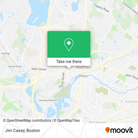
See Jim Casey, Waltham, on the map
Public Transit to Jim Casey in Waltham
Wondering how to get to Jim Casey in Waltham? Moovit helps you find the best way to get to Jim Casey with step-by-step directions from the nearest public transit station.
Moovit provides free maps and live directions to help you navigate through your city. View schedules, routes, timetables, and find out how long does it take to get to Jim Casey in real time.
Looking for the nearest stop or station to Jim Casey? Check out this list of stops closest to your destination: 59 South St; Hammond St @ Lawrence St; Main St @ Weston St; Main St @ Exchange St; West Newton; Waltham.
Bus: 553, 70, 556, 61.Train: FITCHBURG, FRAMINGHAM/WORCESTER.
Want to see if there’s another route that gets you there at an earlier time? Moovit helps you find alternative routes or times. Get directions from and directions to Jim Casey easily from the Moovit App or Website.
We make riding to Jim Casey easy, which is why over 1.7 million users, including users in Waltham, trust Moovit as the best app for public transit. You don’t need to download an individual bus app or train app, Moovit is your all-in-one transit app that helps you find the best bus time or train time available.
For information on prices of bus, train and subway, costs and ride fares to Jim Casey, please check the Moovit app.
Use the app to navigate to popular places including to the airport, hospital, stadium, grocery store, mall, coffee shop, school, college, and university.
Jim Casey Address: 867 Main St street in Waltham
- Lindsay Shea Baccari - Realtor at Coldwell Banker Residential Brokerage,
- Claire Leblanc,
- ADT Alarm & A D T Security,
- Stockman Farrar Group,
- Amanda Beaton, Realtor,
- Mls Property Information Network,
- Bitcoin ATM Coinhub,
- Commercial Plumbing,
- Hannaford Supermarket,
- Goldstar Carpet Cleaning Carpet Cleaning,
- Coinstar - Bitcoin ATM,
- Star Locks,
- Mulan,
- Justice Resource Institute,
- Dominican Grill Chicken Pizza,
- Waltham Track Club,
- Metro PCS,
- Auto Glass Now,
- Christina E Camacho,
- Ace's Emergency Locksmith
Places Near Jim Casey (Waltham)
- House Of Blues, Boston,
- Massachusetts General Hospital, Boston,
- Castle Island, Boston,
- Cheers, Boston,
- Boston Medical Center, Boston,
- Isabella Stewart Gardner Museum, Boston,
- Td Garden, Boston,
- Quincy Market, Boston,
- North End, Boston,
- Prudential Center, Boston,
- Boston Common, Boston,
- Leader Bank Pavilion (Leader Bank Pavillion), Boston,
- Seaport District, Boston,
- Boston Convention & Exhibition Center, Boston,
- Wang Theater, Boston,
- Faneuil Hall, Boston,
- Boston Children's Hospital, Boston,
- Mgm Music Hall, Boston,
- Wilbur Theatre, Boston,
- Museum Of Science, Boston
How to get to popular places in Boston with public transit
Get around Waltham by public transit!
Traveling around Waltham has never been so easy. See step by step directions as you travel to any attraction, street or major public transit station. View bus and train schedules, arrival times, service alerts and detailed routes on a map, so you know exactly how to get to anywhere in Waltham.
When traveling to any destination around Waltham use Moovit's Live Directions with Get Off Notifications to know exactly where and how far to walk, how long to wait for your line, and how many stops are left. Moovit will alert you when it's time to get off — no need to constantly re-check whether yours is the next stop.
Wondering how to use public transit in Waltham or how to pay for public transit in Waltham? Moovit public transit app can help you navigate your way with public transit easily, and at minimum cost. It includes public transit fees, ticket prices, and costs. Looking for a map of Waltham public transit lines? Moovit public transit app shows all public transit maps in Waltham with all Bus, Train, Subway and Ferry routes and stops on an interactive map.
Boston has 4 transit type(s), including: Bus, Train, Subway and Ferry, operated by several transit agencies, including MBTA, Southeastern Regional Transit Authority, MetroWest Regional Transit Authority, Rhode Island Public Transit Authority, WRTA, Lowell Regional Transit Authority, Merrimack Valley Transit, Montachusett Regional Transit Authority, Cape Cod Regional Transit Authority, Brockton Area Transit Authority, Martha's Vineyard Transit Authority, the WAVE - Nantucket Regional Transit Authority, GATRA, Cape Ann Transportation Authority and Massport