Jinočany station - Wednesday schedule
| Line | Direction | Time |
|---|---|---|
| R26 | Č.Budějovice Os.N. | 7:46 |
| R26 | Praha Hl.N. | 8:10 |
| T7 | Rakovník | 9:18 |
| R26 | Praha Hl.N. | 12:10 |
| R26 | Č.Budějovice Os.N. | 13:44 |
| R26 | Č.Budějovice Os.N. | 15:47 |
| R26 | Praha Hl.N. | 16:10 |
| R26 | Písek | 17:47 |
| R26 | Praha Hl.N. | 18:10 |
| R26 | Praha Hl.N. | 20:10 |
See Jinočany, Praha - Západ, on the map
Directions to Jinočany (Praha - Západ) with public transportation
The following transit lines have routes that pass near Jinočany
 Bus:
Bus: - Train:
How to get to Jinočany by bus?
Click on the bus route to see step by step directions with maps, line arrival times and updated time schedules.
Bus stations near Jinočany in Praha - Západ
- Jinočany, Nádraží,1 min walk,
- Jinočany, Náměstí,8 min walk,
Train stations near Jinočany in Praha - Západ
- Zbuzany,25 min walk,
Bus lines to Jinočany in Praha - Západ
- 309,Praha,Nádraží Radotín,
- 310,Rudná,Zdrav.Stř.,
- 352,Jinočany,Náměstí,
What are the closest stations to Jinočany?
The closest stations to Jinočany are:
- Jinočany, Nádraží is 21 meters away, 1 min walk.
- Jinočany, Náměstí is 558 meters away, 8 min walk.
- Zbuzany is 1906 meters away, 25 min walk.
Which bus lines stop near Jinočany?
These bus lines stop near Jinočany: 309, 310, 352.
What’s the nearest train station to Jinočany in Praha - Západ?
The nearest train station to Jinočany in Praha - Západ is Zbuzany. It’s a 25 min walk away.
What’s the nearest bus stop to Jinočany in Praha - Západ?
The nearest bus stop to Jinočany in Praha - Západ is Jinočany, Nádraží. It’s a 1 min walk away.
What time is the first train to Jinočany in Praha - Západ?
The R26 is the first train that goes to Jinočany in Praha - Západ. It stops nearby at 8:02 AM.
What time is the last train to Jinočany in Praha - Západ?
The R26 is the last train that goes to Jinočany in Praha - Západ. It stops nearby at 8:11 PM.
What time is the first bus to Jinočany in Praha - Západ?
The 352 is the first bus that goes to Jinočany in Praha - Západ. It stops nearby at 4:29 AM.
What time is the last bus to Jinočany in Praha - Západ?
The 352 is the last bus that goes to Jinočany in Praha - Západ. It stops nearby at 12:47 AM.
See Jinočany, Praha - Západ, on the map
Public transit to Jinočany station in Praha - Západ
Looking for directions to Jinočany in Praha - Západ, Czech Republic?
Download the Moovit App to find the current schedule and step-by-step directions for Bus, Subway or Light Rail routes that pass through Jinočany.
Looking for the nearest stops closest to Jinočany ? Check out this list of closest stops to your destination: Jinočany; Jinočany; Zbuzany.
Bus:Train:
We make riding on public transit to Jinočany easy, which is why over 1.5 million users, including users in Praha - Západ trust Moovit as the best app for public transit.
Use the app to navigate to popular places including to the airport, hospital, stadium, grocery store, mall, coffee shop, school, college, and university.
The station has the following entrances: Karlštejnská
The first line to this station is R26, at 7:46, and the last line is R26 at 20:10.
This station serves ARRIVA vlaky s.r.o. and KŽC Doprava,s.r.o.’s lines
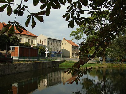
Jinočany is a municipality and village in Prague-West District in the Central Bohemian Region of the Czech Republic. It has about 2,200 inhabitants.Wiki
Popular routes from Jinočany, Praha - Západ
Train station near Jinočany
ZbuzanyPopular public transit stations in Praha - Západ
Bořislavka,Týnec Nad Sázavou,Dobrovíz,Trmice, Metal,Praha-Smíchov,Křižíkova,Spomyšl, U Lávky,Poliklinika Petřiny,Jenštejn, Dehtáry,Neratovice, Korycany,Avia Letňany,Kamenice, Štiřín, U Rybníka,Jirny,Těšnov,Vysočanská,Ústí N.L., Bukov, Městský Stadion,Tuchoměřice, Komerční Zóna,Smíchovské Nádraží,Národní Divadlo,Dolní Chvatliny, MančiceGet around Praha - Západ by public transit!
Traveling around Praha - Západ has never been so easy. See step by step directions as you travel to any attraction, street or major public transit station. View bus and train schedules, arrival times, service alerts and detailed routes on a map, so you know exactly how to get to anywhere in Praha - Západ.
When traveling to any destination around Praha - Západ use Moovit's Live Directions with Get Off Notifications to know exactly where and how far to walk, how long to wait for your line, and how many stops are left. Moovit will alert you when it's time to get off — no need to constantly re-check whether yours is the next stop.
Wondering how to use public transit in Praha - Západ or how to pay for public transit in Praha - Západ? Moovit public transit app can help you navigate your way with public transit easily, and at minimum cost. It includes public transit fees, ticket prices, and costs. Looking for a map of Praha - Západ public transit lines? Moovit public transit app shows all public transit maps in Praha - Západ with all bus, subway or light rail routes and stops on an interactive map.
Praha - Západ has 3 transit type(s), including: bus, subway or light rail, operated by several transit agencies, including Dopravní podnik měst Liberce a Jablonce nad Nisou, a.s., Dopravní podnik měst Liberce a Jablonce nad Nisou, a.s., BusLine jižní Čechy s.r.o., Railway Capital a.s., Dopravní společnost Ústeckého kraje, příspěvková organizace, DPP, DPP, DPP, DPP, Dopravní podnik hl. m. Prahy, akciová společnost, České dráhy, a.s., KŽC Doprava,s.r.o., ARRIVA vlaky s.r.o., KAD BUS spol. s r.o. and ARRIVA PRAHA s.r.o