Directions to Jobe's Locksmith Services (Boston) with public transportation
The following transit lines have routes that pass near Jobe's Locksmith Services
 Bus: 35, 36, 37, NEEDHAM LINE SHUTTLE, NEEDHAM LINE SHUTTLE.
- Train: NEEDHAM, FRANKLIN/FOXBORO, PROVIDENCE/STOUGHTON.
How to get to Jobe's Locksmith Services by bus?
Click on the bus route to see step by step directions with maps, line arrival times and updated time schedules.
From Fogo De Chão, Boston
53 minFrom 240 Mount Vernon Street, Boston
65 minFrom Old South Church, Boston
54 minFrom Doubletree-Boston Bayside, Boston
66 minFrom Copley MBTA Station, Boston
54 minFrom Prudential Center South Garden, Boston
52 minFrom Andrew Square, Boston
59 minFrom Saltie Girl, Boston
68 minFrom Homewood Suites by Hilton Boston Brookline-Longwood Medical, Brookline
43 minFrom 110 Francis Street Garage, Boston
43 min
How to get to Jobe's Locksmith Services by train?
Click on the train route to see step by step directions with maps, line arrival times and updated time schedules.
From Fogo De Chão, Boston
28 minFrom 240 Mount Vernon Street, Boston
58 minFrom Old South Church, Boston
31 minFrom Doubletree-Boston Bayside, Boston
59 minFrom Copley MBTA Station, Boston
31 minFrom Prudential Center South Garden, Boston
33 minFrom Andrew Square, Boston
69 minFrom Saltie Girl, Boston
63 minFrom 110 Francis Street Garage, Boston
48 min
Bus stops near Jobe's Locksmith Services in Boston
Train stations near Jobe's Locksmith Services in Boston
Bus lines to Jobe's Locksmith Services in Boston
What are the closest stations to Jobe's Locksmith Services?
The closest stations to Jobe's Locksmith Services are:
- Lagrange St @ Virgil Rd is 132 yards away, 2 min walk.
- Centre St @ Lagrange St is 472 yards away, 6 min walk.
- West Roxbury is 636 yards away, 8 min walk.
- Roslindale Village is 2809 yards away, 33 min walk.
- Hyde Park is 4853 yards away, 57 min walk.
Which bus lines stop near Jobe's Locksmith Services?
These bus lines stop near Jobe's Locksmith Services: 35, 36, 37.
Which train line stops near Jobe's Locksmith Services?
NEEDHAM (#625 | Needham Heights)
What’s the nearest bus station to Jobe's Locksmith Services in Boston?
The nearest bus station to Jobe's Locksmith Services in Boston is Lagrange St @ Virgil Rd. It’s a 2 min walk away.
What time is the first train to Jobe's Locksmith Services in Boston?
The PROVIDENCE/STOUGHTON is the first train that goes to Jobe's Locksmith Services in Boston. It stops nearby at 5:08 AM.
What time is the last train to Jobe's Locksmith Services in Boston?
The PROVIDENCE/STOUGHTON is the last train that goes to Jobe's Locksmith Services in Boston. It stops nearby at 12:22 AM.
What time is the first bus to Jobe's Locksmith Services in Boston?
The 36 is the first bus that goes to Jobe's Locksmith Services in Boston. It stops nearby at 4:41 AM.
What time is the last bus to Jobe's Locksmith Services in Boston?
The 36 is the last bus that goes to Jobe's Locksmith Services in Boston. It stops nearby at 1:33 AM.
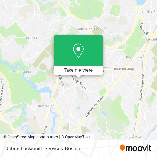
See Jobe's Locksmith Services, Boston, on the map
Public Transit to Jobe's Locksmith Services in Boston
Wondering how to get to Jobe's Locksmith Services in Boston? Moovit helps you find the best way to get to Jobe's Locksmith Services with step-by-step directions from the nearest public transit station.
Moovit provides free maps and live directions to help you navigate through your city. View schedules, routes, timetables, and find out how long does it take to get to Jobe's Locksmith Services in real time.
Looking for the nearest stop or station to Jobe's Locksmith Services? Check out this list of stops closest to your destination: Lagrange St @ Virgil Rd; Centre St @ Lagrange St; West Roxbury; Roslindale Village; Hyde Park.
Bus: 35, 36, 37, NEEDHAM LINE SHUTTLE, NEEDHAM LINE SHUTTLE.Train: NEEDHAM, FRANKLIN/FOXBORO, PROVIDENCE/STOUGHTON.
Want to see if there’s another route that gets you there at an earlier time? Moovit helps you find alternative routes or times. Get directions from and directions to Jobe's Locksmith Services easily from the Moovit App or Website.
We make riding to Jobe's Locksmith Services easy, which is why over 1.7 million users, including users in Boston, trust Moovit as the best app for public transit. You don’t need to download an individual bus app or train app, Moovit is your all-in-one transit app that helps you find the best bus time or train time available.
For information on prices of bus, subway and train, costs and ride fares to Jobe's Locksmith Services, please check the Moovit app.
Use the app to navigate to popular places including to the airport, hospital, stadium, grocery store, mall, coffee shop, school, college, and university.
Jobe's Locksmith Services Address: 1999 Centre St street in Boston
- English High School,
- City Lock Co.,
- Parkway Community Ymca,
- West Roxbury,
- Hercules Stump Grinding,
- MBTA West Roxbury Station,
- St. Theresa-Avila Catholic Church,
- Violet,
- Dr Green Thumb,
- Boston Ale House,
- Bellevue Hill, Massachusetts,
- Boston Private School Search,
- West Roxbury,
- Panera Test Kitchen,
- Roche Bros.,
- West Roxbury,
- Catholic Memorial,
- AB Tel Specialists,
- Catholic Memorial School,
- Claude's Jewelry
Places Near Jobe's Locksmith Services (Boston)
- Seaport District, Boston,
- Museum Of Science, Boston,
- House Of Blues, Boston,
- Mgm Music Hall, Boston,
- Castle Island, Boston,
- North End, Boston,
- Isabella Stewart Gardner Museum, Boston,
- Quincy Market, Boston,
- Leader Bank Pavilion (Leader Bank Pavillion), Boston,
- Wang Theater, Boston,
- Boston Children's Hospital, Boston,
- Cheers, Boston,
- Massachusetts General Hospital, Boston,
- Boston Convention & Exhibition Center, Boston,
- Wilbur Theatre, Boston,
- Faneuil Hall, Boston,
- Prudential Center, Boston,
- Boston Common, Boston,
- Boston Medical Center, Boston,
- Td Garden, Boston
How to get to popular places in Boston with public transit
Get around Boston by public transit!
Traveling around Boston has never been so easy. See step by step directions as you travel to any attraction, street or major public transit station. View bus and train schedules, arrival times, service alerts and detailed routes on a map, so you know exactly how to get to anywhere in Boston.
When traveling to any destination around Boston use Moovit's Live Directions with Get Off Notifications to know exactly where and how far to walk, how long to wait for your line, and how many stops are left. Moovit will alert you when it's time to get off — no need to constantly re-check whether yours is the next stop.
Wondering how to use public transit in Boston or how to pay for public transit in Boston? Moovit public transit app can help you navigate your way with public transit easily, and at minimum cost. It includes public transit fees, ticket prices, and costs. Looking for a map of Boston public transit lines? Moovit public transit app shows all public transit maps in Boston with all Bus, Train, Subway and Ferry routes and stops on an interactive map.
Boston has 4 transit type(s), including: Bus, Train, Subway and Ferry, operated by several transit agencies, including MBTA, Southeastern Regional Transit Authority, MetroWest Regional Transit Authority, Rhode Island Public Transit Authority, WRTA, Lowell Regional Transit Authority, Merrimack Valley Transit, Montachusett Regional Transit Authority, Cape Cod Regional Transit Authority, Brockton Area Transit Authority, Martha's Vineyard Transit Authority, the WAVE - Nantucket Regional Transit Authority, GATRA, Cape Ann Transportation Authority and Massport