Directions to Jobs For the Future (Boston) with public transportation
The following transit lines have routes that pass near Jobs For the Future
 Bus: 354, 501, 504, 7, 92.
- Train: FRAMINGHAM/WORCESTER, GREENBUSH, LOWELL, COMMUTER RAIL SHUTTLE, FAIRMOUNT LINE SHUTTLE.
- Subway: BLUE LINE, GREEN LINE D, ORANGE LINE, RED LINE, GREEN LINE B.
How to get to Jobs For the Future by bus?
Click on the bus route to see step by step directions with maps, line arrival times and updated time schedules.
From Studio Allston, Boston
64 minFrom Courtyard by Marriott Brookline, Brookline
66 minFrom Qea, Quincy
102 minFrom Arlington, MA, Arlington
77 minFrom Regent Theatre, Arlington
65 minFrom FOUR POINTS BY SHERATON Boston Newton, Newton
34 minFrom Showa Boston Institute, Boston
81 minFrom The Mall At Chestnut Hill, Newton
78 minFrom JFK Library, Boston
63 min
How to get to Jobs For the Future by train?
Click on the train route to see step by step directions with maps, line arrival times and updated time schedules.
How to get to Jobs For the Future by subway?
Click on the subway route to see step by step directions with maps, line arrival times and updated time schedules.
Bus stops near Jobs For the Future in Boston
- Devonshire St @ Milk St, 1 min walk,VIEW
- Milk St @ Devonshire St, 1 min walk,VIEW
- Devonshire St @ Water St, 2 min walk,VIEW
- State St @ Washington Mall - State St Sta, 4 min walk,VIEW
- Downtown Crossing - Franklin St @ Washington St, 4 min walk,VIEW
- Federal St @ Franklin St, 4 min walk,VIEW
- Federal St @ Matthews St, 5 min walk,VIEW
- State, 7 min walk,VIEW
Subway stations near Jobs For the Future in Boston
Train station near Jobs For the Future in Boston
- South Station, 16 min walk,VIEW
Bus lines to Jobs For the Future in Boston
- 92, Sullivan,VIEW
- 93, Sullivan Via Navy Yard,VIEW
- 15, Mattapan Via Nubian & Fields Corner,VIEW
- 39, Haymarket Via Forest Hills,VIEW
- 57, Haymarket Via Kenmore,VIEW
- 4, North Station,VIEW
- 116, Maverick - Wonderland,VIEW
- 354, Boston (Express) via Woburn - Burlington (Express) via Woburn,VIEW
- BLUE LINE SHUTTLE, Airport - Government Center (Express),VIEW
- BLUE LINE SHUTTLE, Airport - Government Center via Maverick,VIEW
- BLUE LINE SHUTTLE, Orient Heights - Government Center (Local),VIEW
- BLUE LINE SHUTTLE, Orient Heights - Government Center (Express),VIEW
- BLUE LINE SHUTTLE, Airport - Government Center (Local),VIEW
- BLUE LINE SHUTTLE, Wonderland - Government Center,VIEW
- RED LINE SHUTTLE, Harvard - JFK/UMass via State Street,VIEW
- RED LINE SHUTTLE, Ashmont - Park Street via Post Office,VIEW
- RED LINE SHUTTLE, JFK/UMass - Park Street via Post Office,VIEW
- RED LINE SHUTTLE, JFK/UMass - Park Street,VIEW
- 501, Downtown via Copley (Express) - Brighton via Copley (Express),VIEW
- 504, Downtown via Copley (Express) - Watertown via Copley and Newton Corner (Express),VIEW
What are the closest stations to Jobs For the Future?
The closest stations to Jobs For the Future are:
- Devonshire St @ Milk St is 30 yards away, 1 min walk.
- Milk St @ Devonshire St is 42 yards away, 1 min walk.
- State Street is 54 yards away, 1 min walk.
- Devonshire St @ Water St is 87 yards away, 2 min walk.
- State St @ Washington Mall - State St Sta is 241 yards away, 4 min walk.
- Downtown Crossing - Franklin St @ Washington St is 264 yards away, 4 min walk.
- Federal St @ Franklin St is 277 yards away, 4 min walk.
- Downtown Crossing is 311 yards away, 4 min walk.
- Federal St @ Matthews St is 338 yards away, 5 min walk.
- Government Center is 448 yards away, 6 min walk.
- State is 518 yards away, 7 min walk.
- South Station is 1317 yards away, 16 min walk.
Which bus lines stop near Jobs For the Future?
These bus lines stop near Jobs For the Future: 354, 501, 504, 7, 92, SL4, SL5.
Which train lines stop near Jobs For the Future?
These train lines stop near Jobs For the Future: FRAMINGHAM/WORCESTER, GREENBUSH, LOWELL.
Which subway lines stop near Jobs For the Future?
These subway lines stop near Jobs For the Future: BLUE LINE, GREEN LINE D, ORANGE LINE, RED LINE.
What’s the nearest subway station to Jobs For the Future in Boston?
The nearest subway station to Jobs For the Future in Boston is State Street. It’s a 1 min walk away.
What’s the nearest train station to Jobs For the Future in Boston?
The nearest train station to Jobs For the Future in Boston is South Station. It’s a 16 min walk away.
What’s the nearest bus station to Jobs For the Future in Boston?
The nearest bus stations to Jobs For the Future in Boston are Devonshire St @ Milk St and Milk St @ Devonshire St. The closest one is a 1 min walk away.
What time is the first subway to Jobs For the Future in Boston?
The GREEN LINE E is the first subway that goes to Jobs For the Future in Boston. It stops nearby at 5:05 AM.
What time is the last subway to Jobs For the Future in Boston?
The GREEN LINE E is the last subway that goes to Jobs For the Future in Boston. It stops nearby at 2:20 AM.
What time is the first train to Jobs For the Future in Boston?
The PROVIDENCE/STOUGHTON is the first train that goes to Jobs For the Future in Boston. It stops nearby at 4:20 AM.
What time is the last train to Jobs For the Future in Boston?
The LAKE SHORE LIMITED is the last train that goes to Jobs For the Future in Boston. It stops nearby at 8:32 PM.
What time is the first bus to Jobs For the Future in Boston?
The SLW is the first bus that goes to Jobs For the Future in Boston. It stops nearby at 4:19 AM.
What time is the last bus to Jobs For the Future in Boston?
The 116 is the last bus that goes to Jobs For the Future in Boston. It stops nearby at 1:58 AM.
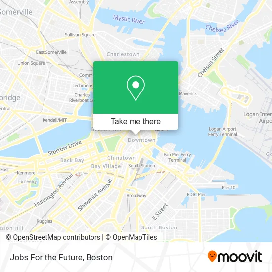
See Jobs For the Future, Boston, on the map
Public Transit to Jobs For the Future in Boston
Wondering how to get to Jobs For the Future in Boston? Moovit helps you find the best way to get to Jobs For the Future with step-by-step directions from the nearest public transit station.
Moovit provides free maps and live directions to help you navigate through your city. View schedules, routes, timetables, and find out how long does it take to get to Jobs For the Future in real time.
Looking for the nearest stop or station to Jobs For the Future? Check out this list of stops closest to your destination: Devonshire St @ Milk St; Milk St @ Devonshire St; State Street; Devonshire St @ Water St; State St @ Washington Mall - State St Sta; Downtown Crossing - Franklin St @ Washington St; Federal St @ Franklin St; Downtown Crossing; Federal St @ Matthews St; Government Center; State; South Station.
Bus: 354, 501, 504, 7, 92, SL4, SL5, 93, 15, 39, 57.Train: FRAMINGHAM/WORCESTER, GREENBUSH, LOWELL, COMMUTER RAIL SHUTTLE, FAIRMOUNT LINE SHUTTLE, FRANKLIN LINE SHUTTLE, KINGSTON LINE SHUTTLE, SL1.Subway: BLUE LINE, GREEN LINE D, ORANGE LINE, RED LINE, GREEN LINE B, GREEN LINE C, GREEN LINE E.
Want to see if there’s another route that gets you there at an earlier time? Moovit helps you find alternative routes or times. Get directions from and directions to Jobs For the Future easily from the Moovit App or Website.
We make riding to Jobs For the Future easy, which is why over 1.7 million users, including users in Boston, trust Moovit as the best app for public transit. You don’t need to download an individual bus app or train app, Moovit is your all-in-one transit app that helps you find the best bus time or train time available.
For information on prices of bus, subway, train and ferry, costs and ride fares to Jobs For the Future, please check the Moovit app.
Use the app to navigate to popular places including to the airport, hospital, stadium, grocery store, mall, coffee shop, school, college, and university.
Jobs For the Future Address: 50 Milk St street in Boston
- French Tech Hub,
- Imagine Optic,
- Milk Street Cafe (Milk St Cafe),
- McCormack Federal Building,
- Thyssen Krupp Elevator,
- It's Easy Passport & Visa Services (Itseasy Passport and Visa Services),
- McCormack Courthouse Building,
- Ogawa Coffee,
- Old South Building,
- 31 Milk Street Lobby Post Office,
- Pivot Point Consulting,
- Credit Union 1,
- YMCA (Y M C A of Greater Boston),
- Travisa Visa Service,
- Dr Sabrina Popp,
- Galen Gilbert,
- Beth Israel Deaconess Medical Center (Beth Israel Lahey Health Primary Care),
- Patriot Care,
- Elephant & Castle Pub and Restaurant (Ec Restaurants Boston),
- Cannabist Boston
Places Near Jobs For the Future (Boston)
- Boston Common, Boston,
- Td Garden, Boston,
- Wang Theater, Boston,
- Mgm Music Hall, Boston,
- North End, Boston,
- Quincy Market, Boston,
- Prudential Center, Boston,
- Leader Bank Pavilion (Leader Bank Pavillion), Boston,
- Boston Children's Hospital, Boston,
- Isabella Stewart Gardner Museum, Boston,
- Museum Of Science, Boston,
- Massachusetts General Hospital, Boston,
- Boston Medical Center, Boston,
- Castle Island, Boston,
- House Of Blues, Boston,
- Seaport District, Boston,
- Faneuil Hall, Boston,
- Boston Convention & Exhibition Center, Boston,
- Wilbur Theatre, Boston,
- Cheers, Boston
How to get to popular places in Boston with public transit
Get around Boston by public transit!
Traveling around Boston has never been so easy. See step by step directions as you travel to any attraction, street or major public transit station. View bus and train schedules, arrival times, service alerts and detailed routes on a map, so you know exactly how to get to anywhere in Boston.
When traveling to any destination around Boston use Moovit's Live Directions with Get Off Notifications to know exactly where and how far to walk, how long to wait for your line, and how many stops are left. Moovit will alert you when it's time to get off — no need to constantly re-check whether yours is the next stop.
Wondering how to use public transit in Boston or how to pay for public transit in Boston? Moovit public transit app can help you navigate your way with public transit easily, and at minimum cost. It includes public transit fees, ticket prices, and costs. Looking for a map of Boston public transit lines? Moovit public transit app shows all public transit maps in Boston with all Bus, Train, Subway and Ferry routes and stops on an interactive map.
Boston has 4 transit type(s), including: Bus, Train, Subway and Ferry, operated by several transit agencies, including MBTA, Southeastern Regional Transit Authority, MetroWest Regional Transit Authority, Rhode Island Public Transit Authority, WRTA, Lowell Regional Transit Authority, Merrimack Valley Transit, Montachusett Regional Transit Authority, Cape Cod Regional Transit Authority, Brockton Area Transit Authority, Martha's Vineyard Transit Authority, the WAVE - Nantucket Regional Transit Authority, GATRA, Cape Ann Transportation Authority and Massport