Directions to John Fitzgerald Kennedy (Boston) with public transportation
The following transit lines have routes that pass near John Fitzgerald Kennedy
 Bus: 354, 43, 501, 504, 93.
- Train: FITCHBURG, FRAMINGHAM/WORCESTER, HAVERHILL, NEEDHAM, LOWELL.
- Subway: GREEN LINE B, GREEN LINE D, ORANGE LINE, RED LINE, BLUE LINE.
How to get to John Fitzgerald Kennedy by bus?
Click on the bus route to see step by step directions with maps, line arrival times and updated time schedules.
From The Mall At Chestnut Hill, Newton
91 minFrom Melrose, MA, Melrose
69 minFrom Showa Boston Institute, Boston
83 minFrom Harvard Stadium, Boston
49 minFrom Wollaston Beach, Quincy
135 minFrom FOUR POINTS BY SHERATON Boston Newton, Newton
44 minFrom Staybridge Suites Boston-Quincy, Quincy
117 minFrom Spaulding Rehab, Boston
74 minFrom The Burren, Somerville
49 minFrom the mall at rockingham park mall, Boston
69 min
How to get to John Fitzgerald Kennedy by train?
Click on the train route to see step by step directions with maps, line arrival times and updated time schedules.
How to get to John Fitzgerald Kennedy by subway?
Click on the subway route to see step by step directions with maps, line arrival times and updated time schedules.
Bus stops near John Fitzgerald Kennedy in Boston
- Portland St @ Causeway St, 1 min walk,VIEW
- North Station - Haverhill St @ Causeway St, 3 min walk,VIEW
- Cambridge St @ Government Ctr Sta, 3 min walk,VIEW
- Government Center - Cambridge St @ Sudbury St, 4 min walk,VIEW
- North Station - Nashua St @ Red Auerbach Way, 5 min walk,VIEW
- Haymarket - Congress St @ Hanover St, 6 min walk,VIEW
- Congress St @ Sudbury St, 6 min walk,VIEW
- Haymarket - Congress St @ New Sudbury St, 6 min walk,VIEW
- N Washington St @ Cooper St, 6 min walk,VIEW
- Congress St @ Haymarket Sta, 8 min walk,VIEW
- Surface Rd @ Hanover St, 8 min walk,VIEW
Subway stations near John Fitzgerald Kennedy in Boston
Train station near John Fitzgerald Kennedy in Boston
- North Station, 15 min walk,VIEW
Bus lines to John Fitzgerald Kennedy in Boston
- 4, Design Center,VIEW
- GREEN LINE SHUTTLE, North Station (Shuttle),VIEW
- ORANGE LINE SHUTTLE, North Station (Local Shuttle),VIEW
- ORANGE LINE SHUTTLE, Oak Grove (Express Shuttle),VIEW
- ORANGE LINE SHUTTLE, Oak Grove (Local Shuttle),VIEW
- ORANGE LINE SHUTTLE, Wellington (Express Shuttle),VIEW
- 116, Maverick - Wonderland,VIEW
- 354, Boston (Express) via Woburn - Burlington (Express) via Woburn,VIEW
- BLUE LINE SHUTTLE, Orient Heights - Government Center (Local),VIEW
- BLUE LINE SHUTTLE, Airport - Government Center (Express),VIEW
- BLUE LINE SHUTTLE, Orient Heights - Government Center (Express),VIEW
- BLUE LINE SHUTTLE, Wonderland - Government Center,VIEW
- GREEN LINE E SHUTTLE, Government Center - Medford/Tufts (Shuttle),VIEW
- GREEN LINE SHUTTLE, Medford/Tufts - Government Center via Union Square,VIEW
- GREEN LINE SHUTTLE, Union Square - Government Center,VIEW
- RED LINE SHUTTLE, Kendall/MIT - Broadway via Pearl Street,VIEW
- RED LINE SHUTTLE, Harvard - South Station,VIEW
- RED LINE SHUTTLE, Kendall/MIT - Broadway via Downtown Crossing,VIEW
- RED LINE SHUTTLE, Harvard - JFK/UMass via State Street,VIEW
- BLUE LINE SHUTTLE, Government Center Via Maverick (Shuttle),VIEW
What are the closest stations to John Fitzgerald Kennedy?
The closest stations to John Fitzgerald Kennedy are:
- Portland St @ Causeway St is 73 yards away, 1 min walk.
- Government Center is 82 yards away, 2 min walk.
- North Station - Haverhill St @ Causeway St is 164 yards away, 3 min walk.
- Causeway St (East) is 167 yards away, 3 min walk.
- Cambridge St @ Government Ctr Sta is 168 yards away, 3 min walk.
- Government Center - Cambridge St @ Sudbury St is 283 yards away, 4 min walk.
- North Station - Nashua St @ Red Auerbach Way is 339 yards away, 5 min walk.
- Haymarket - Congress St @ Hanover St is 442 yards away, 6 min walk.
- Congress St @ Sudbury St is 449 yards away, 6 min walk.
- Haymarket - Congress St @ New Sudbury St is 467 yards away, 6 min walk.
- N Washington St @ Cooper St is 467 yards away, 6 min walk.
- Congress St @ Haymarket Sta is 577 yards away, 8 min walk.
- Surface Rd @ Hanover St is 609 yards away, 8 min walk.
- North Station is 1199 yards away, 15 min walk.
Which bus lines stop near John Fitzgerald Kennedy?
These bus lines stop near John Fitzgerald Kennedy: 354, 43, 501, 504, 93, EZRIDE, SL5.
Which train lines stop near John Fitzgerald Kennedy?
These train lines stop near John Fitzgerald Kennedy: FITCHBURG, FRAMINGHAM/WORCESTER, HAVERHILL, NEEDHAM.
Which subway lines stop near John Fitzgerald Kennedy?
These subway lines stop near John Fitzgerald Kennedy: GREEN LINE B, GREEN LINE D, ORANGE LINE, RED LINE.
What’s the nearest subway station to John Fitzgerald Kennedy in Boston?
The nearest subway station to John Fitzgerald Kennedy in Boston is Government Center. It’s a 2 min walk away.
What’s the nearest train station to John Fitzgerald Kennedy in Boston?
The nearest train station to John Fitzgerald Kennedy in Boston is North Station. It’s a 15 min walk away.
What’s the nearest bus station to John Fitzgerald Kennedy in Boston?
The nearest bus station to John Fitzgerald Kennedy in Boston is Portland St @ Causeway St. It’s a 1 min walk away.
What time is the first subway to John Fitzgerald Kennedy in Boston?
The GREEN LINE E is the first subway that goes to John Fitzgerald Kennedy in Boston. It stops nearby at 5:01 AM.
What time is the last subway to John Fitzgerald Kennedy in Boston?
The GREEN LINE E is the last subway that goes to John Fitzgerald Kennedy in Boston. It stops nearby at 2:24 AM.
What time is the first train to John Fitzgerald Kennedy in Boston?
The LOWELL is the first train that goes to John Fitzgerald Kennedy in Boston. It stops nearby at 5:20 AM.
What time is the last train to John Fitzgerald Kennedy in Boston?
The LOWELL is the last train that goes to John Fitzgerald Kennedy in Boston. It stops nearby at 12:34 AM.
What time is the first bus to John Fitzgerald Kennedy in Boston?
The 116 is the first bus that goes to John Fitzgerald Kennedy in Boston. It stops nearby at 4:55 AM.
What time is the last bus to John Fitzgerald Kennedy in Boston?
The 111 is the last bus that goes to John Fitzgerald Kennedy in Boston. It stops nearby at 2:16 AM.
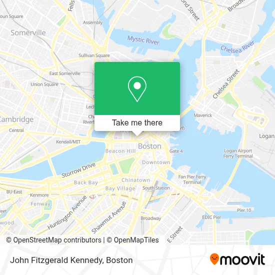
See John Fitzgerald Kennedy, Boston, on the map
Public Transit to John Fitzgerald Kennedy in Boston
Wondering how to get to John Fitzgerald Kennedy in Boston? Moovit helps you find the best way to get to John Fitzgerald Kennedy with step-by-step directions from the nearest public transit station.
Moovit provides free maps and live directions to help you navigate through your city. View schedules, routes, timetables, and find out how long does it take to get to John Fitzgerald Kennedy in real time.
Looking for the nearest stop or station to John Fitzgerald Kennedy? Check out this list of stops closest to your destination: Portland St @ Causeway St; Government Center; North Station - Haverhill St @ Causeway St; Causeway St (East); Cambridge St @ Government Ctr Sta; Government Center - Cambridge St @ Sudbury St; North Station - Nashua St @ Red Auerbach Way; Haymarket - Congress St @ Hanover St; Congress St @ Sudbury St; Haymarket - Congress St @ New Sudbury St; N Washington St @ Cooper St; Congress St @ Haymarket Sta; Surface Rd @ Hanover St; North Station.
Bus: 354, 43, 501, 504, 93, EZRIDE, SL5, 4, GREEN LINE SHUTTLE, ORANGE LINE SHUTTLE, ORANGE LINE SHUTTLE, ORANGE LINE SHUTTLE, ORANGE LINE SHUTTLE, 116, BLUE LINE SHUTTLE, BLUE LINE SHUTTLE, BLUE LINE SHUTTLE.Train: FITCHBURG, FRAMINGHAM/WORCESTER, HAVERHILL, NEEDHAM, LOWELL, NEWBURYPORT/ROCKPORT, DOWNEASTER.Subway: GREEN LINE B, GREEN LINE D, ORANGE LINE, RED LINE, BLUE LINE, GREEN LINE C, GREEN LINE E, HAVERHILL LINE SHUTTLE, HAVERHILL LINE SHUTTLE, LOWELL LINE SHUTTLE, LOWELL LINE SHUTTLE, NEWBURYPORT/ROCKPORT LINE SHUTTLE.
Want to see if there’s another route that gets you there at an earlier time? Moovit helps you find alternative routes or times. Get directions from and directions to John Fitzgerald Kennedy easily from the Moovit App or Website.
We make riding to John Fitzgerald Kennedy easy, which is why over 1.7 million users, including users in Boston, trust Moovit as the best app for public transit. You don’t need to download an individual bus app or train app, Moovit is your all-in-one transit app that helps you find the best bus time or train time available.
For information on prices of bus, subway and train, costs and ride fares to John Fitzgerald Kennedy, please check the Moovit app.
Use the app to navigate to popular places including to the airport, hospital, stadium, grocery store, mall, coffee shop, school, college, and university.
John Fitzgerald Kennedy Address: 25 NEW CHARDON ST LBBY street in Boston
- 1 Bowdoin Street,
- Bowdoin Station,
- MBTA-Bowdoin (Bowdoin MBTA Station - Blue Line),
- Federal Courthouse,
- Charles F. Hurley Building,
- Masud Co PC,
- Boston Sports Club,
- Saltonstall Building,
- Anthony D. Albondy Square,
- Teddy's on the Hill,
- The Red Hat,
- Department Of Unemployment Assistance,
- Parcel 7 Parking Garage,
- Sudbury,
- Somewhere on Stanford St,
- Sattler College,
- 100 Cambridge Street Garage,
- Massachusetts State Employees Credit Union (MSECU),
- Christine M Netski Lawyer,
- The Towers at Longfellow Apartments
Places Near John Fitzgerald Kennedy (Boston)
- Wilbur Theatre, Boston,
- Seaport District, Boston,
- Boston Children's Hospital, Boston,
- Mgm Music Hall, Boston,
- Quincy Market, Boston,
- North End, Boston,
- Boston Common, Boston,
- Faneuil Hall, Boston,
- Wang Theater, Boston,
- Castle Island, Boston,
- Museum Of Science, Boston,
- Prudential Center, Boston,
- House Of Blues, Boston,
- Isabella Stewart Gardner Museum, Boston,
- Massachusetts General Hospital, Boston,
- Td Garden, Boston,
- Boston Convention & Exhibition Center, Boston,
- Cheers, Boston,
- Boston Medical Center, Boston,
- Leader Bank Pavilion (Leader Bank Pavillion), Boston
How to get to popular places in Boston with public transit
Get around Boston by public transit!
Traveling around Boston has never been so easy. See step by step directions as you travel to any attraction, street or major public transit station. View bus and train schedules, arrival times, service alerts and detailed routes on a map, so you know exactly how to get to anywhere in Boston.
When traveling to any destination around Boston use Moovit's Live Directions with Get Off Notifications to know exactly where and how far to walk, how long to wait for your line, and how many stops are left. Moovit will alert you when it's time to get off — no need to constantly re-check whether yours is the next stop.
Wondering how to use public transit in Boston or how to pay for public transit in Boston? Moovit public transit app can help you navigate your way with public transit easily, and at minimum cost. It includes public transit fees, ticket prices, and costs. Looking for a map of Boston public transit lines? Moovit public transit app shows all public transit maps in Boston with all Bus, Train, Subway and Ferry routes and stops on an interactive map.
Boston has 4 transit type(s), including: Bus, Train, Subway and Ferry, operated by several transit agencies, including MBTA, Southeastern Regional Transit Authority, MetroWest Regional Transit Authority, Rhode Island Public Transit Authority, WRTA, Lowell Regional Transit Authority, Merrimack Valley Transit, Montachusett Regional Transit Authority, Cape Cod Regional Transit Authority, Brockton Area Transit Authority, Martha's Vineyard Transit Authority, the WAVE - Nantucket Regional Transit Authority, GATRA, Cape Ann Transportation Authority and Massport