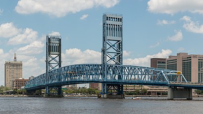
Directions to John T. Alsop Jr. Bridge (Jacksonville) with public transportation
The following transit lines have routes that pass near John T. Alsop Jr. Bridge
How to get to John T. Alsop Jr. Bridge by bus?
Click on the bus route to see step by step directions with maps, line arrival times and updated time schedules.
Bus stations near John T. Alsop Jr. Bridge in Jacksonville
- Museum Cir + Main St,5 min walk,
- Bay St + Laura St,5 min walk,
- San Marco Blvd + Prudential Dr,8 min walk,
Metro stations near John T. Alsop Jr. Bridge in Jacksonville
- Kings Ave. Station,21 min walk,
Bus lines to John T. Alsop Jr. Bridge in Jacksonville
- FCF,To Downtown,
- CLAY,Clay Express Select,
- NASSAU,Nassau Express Select,
- ST. JOHNS,St. Johns Express Select,
- 1,North Main,
- 3,Moncrief,
- 11,A Phillip Randolph,
- 18,Atlantic/Monument,
- 8,8 - B - To FSCJ South - Downtown,
- 25,To University Hub,
What are the closest stations to John T. Alsop Jr. Bridge?
The closest stations to John T. Alsop Jr. Bridge are:
- Museum Cir + Main St is 340 yards away, 5 min walk.
- Bay St + Laura St is 382 yards away, 5 min walk.
- San Marco Blvd + Prudential Dr is 593 yards away, 8 min walk.
- Kings Ave. Station is 1727 yards away, 21 min walk.
Which bus lines stop near John T. Alsop Jr. Bridge?
These bus lines stop near John T. Alsop Jr. Bridge: 27, 8, FCF.
Which metro line stops near John T. Alsop Jr. Bridge?
SKYWAY
What’s the nearest metro station to John T. Alsop Jr. Bridge in Jacksonville?
The nearest metro station to John T. Alsop Jr. Bridge in Jacksonville is Kings Ave. Station. It’s a 21 min walk away.
What’s the nearest bus stop to John T. Alsop Jr. Bridge in Jacksonville?
The nearest bus stops to John T. Alsop Jr. Bridge in Jacksonville are Museum Cir + Main St and Bay St + Laura St. The closest one is a 5 min walk away.
What time is the first metro to John T. Alsop Jr. Bridge in Jacksonville?
The SKYWAY is the first metro that goes to John T. Alsop Jr. Bridge in Jacksonville. It stops nearby at 6:00 AM.
What time is the last metro to John T. Alsop Jr. Bridge in Jacksonville?
The SKYWAY is the last metro that goes to John T. Alsop Jr. Bridge in Jacksonville. It stops nearby at 6:06 PM.
What time is the first bus to John T. Alsop Jr. Bridge in Jacksonville?
The 25 is the first bus that goes to John T. Alsop Jr. Bridge in Jacksonville. It stops nearby at 4:34 AM.
What time is the last bus to John T. Alsop Jr. Bridge in Jacksonville?
The 1 is the last bus that goes to John T. Alsop Jr. Bridge in Jacksonville. It stops nearby at 1:20 AM.
See John T. Alsop Jr. Bridge, Jacksonville, on the map
Public Transit to John T. Alsop Jr. Bridge in Jacksonville
How to get to John T. Alsop Jr. Bridge in Jacksonville, United States?
It’s easy with Moovit. Type in your street address and Moovit’s route finder will locate the fastest way to get you there! Not sure where to get off on the street? Download the Moovit App to find live directions (including where to get off on John T. Alsop Jr. Bridge), see timetables and get the estimated arrival times for your favorite bus or metro lines.
Looking for the nearest stop or station to John T. Alsop Jr. Bridge? Check out this list of closest stops available to your destination: Museum Cir + Main St; Bay St + Laura St; San Marco Blvd + Prudential Dr; Kings Ave. Station.
Bus:278FCFCLAYNASSAUST. JOHNS1325Metro:SKYWAY
Download the Moovit App to see the current schedule and routes available for Jacksonville. No need to install a special bus app to check the bus time or a train app to get train time. Moovit is the only all-in-one transit app that helps you get where you need to go.
We make riding on public transit to John T. Alsop Jr. Bridge easy, which is why over 1.5 million users, including users in Jacksonville trust Moovit as the best app for public transit.
Get to John T. Alsop Jr. Bridge with public transit and pay for the ride in the Moovit app. In addition to all info you may need for your trip to John T. Alsop Jr. Bridge, including live directions, real-time arrivals and fare prices, you can also buy public transit passes for your rides. No need for cash or paper tickets to get to John T. Alsop Jr. Bridge - everything you need is accessible in the app with a click of the button.
Use the app to navigate to popular places including to the airport, hospital, stadium, grocery store, mall, coffee shop, school, college, and university.
Location: Jacksonville, Jacksonville Johns County
Streets near John T. Alsop Jr. Bridge, Jacksonville
Accessibility Ramp, Jacksonville,Museum Circle, Jacksonville,Main Street Bridge, Jacksonville,Mary Street, Jacksonville,Riverplace Boulevard, Jacksonville,San Marco Boulevard, Jacksonville,John T. Aslop Bridge, Jacksonville,Southbank Riverwalk, Jacksonville,Acosta Bridge, Jacksonville,East Coastline Drive, Jacksonville,Main Street, Jacksonville,Newman Street, Jacksonville,Prudential Drive, Jacksonville,East Independent Drive, Jacksonville,South Laura Street, Jacksonville,Wharfside Way, Jacksonville,Courthouse Drive, Jacksonville,Acosta Expressway, Jacksonville,South Market Street, Jacksonville,South Hogan Street, JacksonvilleHow to get to popular attractions in Jacksonville with public transit
Exxon, Jacksonville,Bacardi Rum Distribution Center, Jacksonville,Circle K, Jacksonville,295 & JTB, Jacksonville,Charles Rutland - CMG Home Loans Mortgage Loan,University Boulevard and Beach Blvd, Jacksonville,Amazon Locker-Assertion, Jacksonville,Tripps Elite, Jacksonville,Amazon Locker-Tres, Jacksonville,pipeline gas station, Jacksonville,Cold Stone Creamery, Jacksonville,Sava Outdoor, Jacksonville,JEA Southside Service Center, Jacksonville,Latg, Jacksonville,Exxon, Jacksonville,Jason's Cuts, Bellair-Meadowbrook Terrace,Florida Lottery District Office, Jacksonville,Tax Collector's Office, Jacksonville,Amazon Counter-Ifix&Cell, Jacksonville,John Gorrie High School, JacksonvilleGet around Jacksonville by public transit!
Traveling around Jacksonville has never been so easy. See step by step directions as you travel to any attraction, street or major public transit station. View bus and train schedules, arrival times, service alerts and detailed routes on a map, so you know exactly how to get to anywhere in Jacksonville.
When traveling to any destination around Jacksonville use Moovit's Live Directions with Get Off Notifications to know exactly where and how far to walk, how long to wait for your line, and how many stops are left. Moovit will alert you when it's time to get off — no need to constantly re-check whether yours is the next stop.
Wondering how to use public transit in Jacksonville or how to pay for public transit in Jacksonville? Moovit public transit app can help you navigate your way with public transit easily, and at minimum cost. It includes public transit fees, ticket prices, and costs. Looking for a map of Jacksonville public transit lines? Moovit public transit app shows all public transit maps in Jacksonville with all bus or metro routes and stops on an interactive map.
Jacksonville has 2 transit type(s), including: bus or metro, operated by several transit agencies, including Jacksonville Transportation Authority, JTA Skyway, Jacksonville Transportation Authority, Sunshine Bus Company, Megabus, FlixBus-us and Greyhound-us