Directions to Johns Hopkins Children's Center (Baltimore) with public transportation
The following transit lines have routes that pass near Johns Hopkins Children's Center
How to get to Johns Hopkins Children's Center by bus?
Click on the bus route to see step by step directions with maps, line arrival times and updated time schedules.
How to get to Johns Hopkins Children's Center by metro?
Click on the metro route to see step by step directions with maps, line arrival times and updated time schedules.
Bus stops near Johns Hopkins Children's Center in Baltimore
- Washington St & Orleans St Nb, 2 min walk,
- Fayette St & Wolfe St Wb, 3 min walk,
- Wolfe St & Mcelderry St FS, 3 min walk,
Bus lines to Johns Hopkins Children's Center in Baltimore
- CITYLINK GOLD, Walbrook Junction,
- CITYLINK BLUE, Joseph Lee,
- CITYLINK ORANGE, Highlandtown,
- 120, White Marsh,
- 160, Whispering Woods,
What are the closest stations to Johns Hopkins Children's Center?
The closest stations to Johns Hopkins Children's Center are:
- Washington St & Orleans St Nb is 145 yards away, 2 min walk.
- Fayette St & Wolfe St Wb is 162 yards away, 3 min walk.
- Wolfe St & Mcelderry St FS is 199 yards away, 3 min walk.
Which bus lines stop near Johns Hopkins Children's Center?
These bus lines stop near Johns Hopkins Children's Center: 21, CITYLINK GOLD, CITYLINK ORANGE.
Which metro line stops near Johns Hopkins Children's Center?
METRO
What’s the nearest bus stop to Johns Hopkins Children's Center in Baltimore?
The nearest bus stop to Johns Hopkins Children's Center in Baltimore is Washington St & Orleans St Nb. It’s a 2 min walk away.
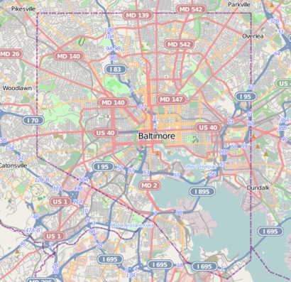
See Johns Hopkins Children's Center, Baltimore, on the map
Public Transit to Johns Hopkins Children's Center in Baltimore
Wondering how to get to Johns Hopkins Children's Center in Baltimore, United States? Moovit helps you find the best way to get to Johns Hopkins Children's Center with step-by-step directions from the nearest public transit station.
Moovit provides free maps and live directions to help you navigate through your city. View schedules, routes, timetables, and find out how long does it take to get to Johns Hopkins Children's Center in real time.
Looking for the nearest stop or station to Johns Hopkins Children's Center? Check out this list of stops closest to your destination: Washington St & Orleans St Nb; Fayette St & Wolfe St Wb; Wolfe St & Mcelderry St FS.
Bus: 21, CITYLINK GOLD, CITYLINK ORANGE, CITYLINK BLUE, 120, 160.Metro: METRO.
Want to see if there’s another route that gets you there at an earlier time? Moovit helps you find alternative routes or times. Get directions from and directions to Johns Hopkins Children's Center easily from the Moovit App or Website.
We make riding to Johns Hopkins Children's Center easy, which is why over 1.5 million users, including users in Baltimore, trust Moovit as the best app for public transit. You don’t need to download an individual bus app or train app, Moovit is your all-in-one transit app that helps you find the best bus time or train time available.
For information on prices of bus and metro, costs and ride fares to Johns Hopkins Children's Center, please check the Moovit app.
Use the app to navigate to popular places including to the airport, hospital, stadium, grocery store, mall, coffee shop, school, college, and university.
Johns Hopkins Children's Center Address: 428 North Wolfe Street, Baltimore, MD 21287, USA street in Baltimore
Attractions near Johns Hopkins Children's Center
422 N Wolfe St,Wolfe St & Orleans S/B,Johns Hopkins Moore Clinic,Orleans St / Wolfe St Intersection,N Wolfe St (wolfe and orleans),JHMI Rutland Garage,The David M. Rubenstein Child Health Building,Maryann F Fralic Drph,306 N Wolfe St ,Johns Hopkins Pediatric Specialty Clinic,Skm Associates,403,N Chapel St N Chapel St,1800 Orleans Street,Hugh G. Calkins, MD,Dana Kim Furstenau, MD,Balducci on the Go,Sunoco,500 N Chapel St ,Sunoco,Johns Hopkins HospitalHow to get to popular attractions in Baltimore with public transit
Clipper Mill, Baltimore,Rome Building - Johns Hopkins SAIS, Washington,Dunkin Donuts, Washington,Wyndham Old Town Alexandria, Alexandria,Seneca Valley High School, Montgomery County,Logistics Management Institute (LMI), Fairfax County,PRTC Transit Center, Prince William County,The Brig, Washington,Mackey Building at Howard University, Washington,Brent Elementary School, Washington,Dirty Habit, Washington,Watkins Elementary School, Washington,Carderock Recreation Area, Montgomery County,Parkdale High School, Prince George's County,Argyle Middle School, Montgomery County,Cooks Lane, Baltimore,Edmondson High School, Baltimore,Broken Land Parkway, Howard County,Lee Jackson Hwy & Centreville Rd, Fairfax County,I-95 Exit 55 (Key Hwy), BaltimoreGet around Washington, D.C. - Baltimore, MD by public transit!
Traveling around Washington, D.C. - Baltimore, MD has never been so easy. See step by step directions as you travel to any attraction, street or major public transit station. View bus and train schedules, arrival times, service alerts and detailed routes on a map, so you know exactly how to get to anywhere in Washington, D.C. - Baltimore, MD.
When traveling to any destination around Washington, D.C. - Baltimore, MD use Moovit's Live Directions with Get Off Notifications to know exactly where and how far to walk, how long to wait for your line, and how many stops are left. Moovit will alert you when it's time to get off — no need to constantly re-check whether yours is the next stop.
Wondering how to use public transit in Washington, D.C. - Baltimore, MD or how to pay for public transit in Washington, D.C. - Baltimore, MD? Moovit public transit app can help you navigate your way with public transit easily, and at minimum cost. It includes public transit fees, ticket prices, and costs. Looking for a map of Washington, D.C. - Baltimore, MD public transit lines? Moovit public transit app shows all public transit maps in Washington, D.C. - Baltimore, MD with all Bus, Train, Metro, Light Rail and Ferry routes and stops on an interactive map.
Washington, D.C. - Baltimore, MD has 5 transit type(s), including: Bus, Train, Metro, Light Rail and Ferry, operated by several transit agencies, including WMATA, Montgomery County Ride On, Montgomery County MD Ride On, Fairfax Connector, TheBus, PRTC, DC Circulator, DASH - Alexandria, Arlington Transit (ART), DC Streetcar, RTA of Central Maryland, FRED, MDOT MTA, Marc, Virginia Railway Express (VRE)