Directions to Joleen Weissert, Md (Boston) with public transportation
The following transit lines have routes that pass near Joleen Weissert, Md
 Bus: 14, 22, 39, 41, ORANGE LINE SHUTTLE.
- Train: FAIRMOUNT, PROVIDENCE/STOUGHTON.
- Subway: ORANGE LINE, GREEN LINE E.
How to get to Joleen Weissert, Md by bus?
Click on the bus route to see step by step directions with maps, line arrival times and updated time schedules.
From City Winery, Boston
56 minFrom Canobie Lake Park, Chelsea
83 minFrom Quincy Market, Boston
48 minFrom Everett, MA, Everett
95 minFrom La Quinta, Somerville
81 minFrom Dedham District Court, Dedham
53 minFrom Washington St, Boston
55 minFrom Constitution Beach, Boston
82 minFrom Castle Island, Boston
65 minFrom Hyatt Place Medford, Medford
73 min
How to get to Joleen Weissert, Md by train?
Click on the train route to see step by step directions with maps, line arrival times and updated time schedules.
How to get to Joleen Weissert, Md by subway?
Click on the subway route to see step by step directions with maps, line arrival times and updated time schedules.
Bus stops near Joleen Weissert, Md in Boston
Subway stations near Joleen Weissert, Md in Boston
Bus lines to Joleen Weissert, Md in Boston
- 14, Heath St,VIEW
- 41, Jfk/Umass,VIEW
- ORANGE LINE SHUTTLE, Forest Hills - Jackson Square (Shuttle),VIEW
- ORANGE LINE SHUTTLE, Forest Hills - Jackson Square,VIEW
- ORANGE LINE SHUTTLE, Forest Hills - Back Bay via Copley (Shuttle),VIEW
- ORANGE LINE SHUTTLE, Forest Hills - Copley,VIEW
- ORANGE LINE SHUTTLE, Forest Hills - Ruggles,VIEW
- ORANGE LINE SHUTTLE, Forest Hills - Back Bay (Shuttle),VIEW
- ORANGE LINE SHUTTLE, Forest Hills - Back Bay via Ruggles Busway (Shuttle),VIEW
- 22, Kenmore Via Ruggles,VIEW
- 29, Mattapan Via Franklin Field,VIEW
- 44, Ruggles,VIEW
- ORANGE LINE SHUTTLE, Copley (Shuttle),VIEW
- ORANGE LINE SHUTTLE, Back Bay (Shuttle),VIEW
What are the closest stations to Joleen Weissert, Md?
The closest stations to Joleen Weissert, Md are:
- Heath St @ Walden St is 212 yards away, 3 min walk.
- Centre St @ Mozart St is 313 yards away, 4 min walk.
- Jackson Square - Centre St Opp Jackson Square Busway is 411 yards away, 5 min walk.
- Jackson Square is 453 yards away, 6 min walk.
- Heath Street is 803 yards away, 10 min walk.
- Roxbury Crossing is 896 yards away, 11 min walk.
Which bus lines stop near Joleen Weissert, Md?
These bus lines stop near Joleen Weissert, Md: 14, 22, 39, 41.
Which train lines stop near Joleen Weissert, Md?
These train lines stop near Joleen Weissert, Md: FAIRMOUNT, PROVIDENCE/STOUGHTON.
Which subway line stops near Joleen Weissert, Md?
ORANGE LINE (Forest Hills)
What’s the nearest subway station to Joleen Weissert, Md in Boston?
The nearest subway station to Joleen Weissert, Md in Boston is Heath Street. It’s a 10 min walk away.
What’s the nearest bus station to Joleen Weissert, Md in Boston?
The nearest bus station to Joleen Weissert, Md in Boston is Heath St @ Walden St. It’s a 3 min walk away.
What time is the first subway to Joleen Weissert, Md in Boston?
The ORANGE LINE is the first subway that goes to Joleen Weissert, Md in Boston. It stops nearby at 5:18 AM.
What time is the last subway to Joleen Weissert, Md in Boston?
The GREEN LINE E is the last subway that goes to Joleen Weissert, Md in Boston. It stops nearby at 2:00 AM.
What time is the first bus to Joleen Weissert, Md in Boston?
The 44 is the first bus that goes to Joleen Weissert, Md in Boston. It stops nearby at 5:10 AM.
What time is the last bus to Joleen Weissert, Md in Boston?
The 22 is the last bus that goes to Joleen Weissert, Md in Boston. It stops nearby at 2:16 AM.
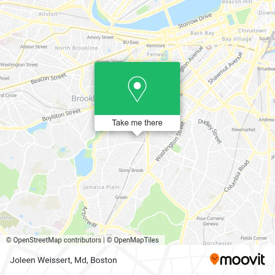
See Joleen Weissert, Md, Boston, on the map
Public Transit to Joleen Weissert, Md in Boston
Wondering how to get to Joleen Weissert, Md in Boston? Moovit helps you find the best way to get to Joleen Weissert, Md with step-by-step directions from the nearest public transit station.
Moovit provides free maps and live directions to help you navigate through your city. View schedules, routes, timetables, and find out how long does it take to get to Joleen Weissert, Md in real time.
Looking for the nearest stop or station to Joleen Weissert, Md? Check out this list of stops closest to your destination: Heath St @ Walden St; Centre St @ Mozart St; Jackson Square - Centre St Opp Jackson Square Busway; Jackson Square; Heath Street; Roxbury Crossing.
Bus: 14, 22, 39, 41, ORANGE LINE SHUTTLE, ORANGE LINE SHUTTLE, ORANGE LINE SHUTTLE, ORANGE LINE SHUTTLE, ORANGE LINE SHUTTLE, 29, 44, ORANGE LINE SHUTTLE, ORANGE LINE SHUTTLE.Train: FAIRMOUNT, PROVIDENCE/STOUGHTON.Subway: ORANGE LINE, GREEN LINE E.
Want to see if there’s another route that gets you there at an earlier time? Moovit helps you find alternative routes or times. Get directions from and directions to Joleen Weissert, Md easily from the Moovit App or Website.
We make riding to Joleen Weissert, Md easy, which is why over 1.7 million users, including users in Boston, trust Moovit as the best app for public transit. You don’t need to download an individual bus app or train app, Moovit is your all-in-one transit app that helps you find the best bus time or train time available.
For information on prices of bus, subway and train, costs and ride fares to Joleen Weissert, Md, please check the Moovit app.
Use the app to navigate to popular places including to the airport, hospital, stadium, grocery store, mall, coffee shop, school, college, and university.
Joleen Weissert, Md Address: 75 Bickford St street in Boston
- Maria T. Pearl, MD,
- Alexandra A Epee-Bounya M.D.,
- Mildred C. Hailey Apartments,
- Coinstar - Bitcoin ATM,
- Yely's Coffee Shop (Jelly Coffee Shop),
- Jerison Barber Shop,
- Amador Robert R,
- Young Kong,
- Educational Professional Multiservices,
- J&P Dry Cleaners - Jamaica Plain,
- Golden Rice Bowl,
- Jamaica Plain Locksmith Store,
- Horan Way Building 57,
- Tori Japan,
- Direct SAT TV,
- DUNKIN',
- Centre St,
- Bank of America,
- Keating Total Fitness,
- Walden Garden
Places Near Joleen Weissert, Md (Boston)
- Museum Of Science, Boston,
- North End, Boston,
- House Of Blues, Boston,
- Wang Theater, Boston,
- Faneuil Hall, Boston,
- Boston Convention & Exhibition Center, Boston,
- Cheers, Boston,
- Boston Common, Boston,
- Castle Island, Boston,
- Boston Children's Hospital, Boston,
- Wilbur Theatre, Boston,
- Mgm Music Hall, Boston,
- Quincy Market, Boston,
- Massachusetts General Hospital, Boston,
- Isabella Stewart Gardner Museum, Boston,
- Td Garden, Boston,
- Seaport District, Boston,
- Prudential Center, Boston,
- Leader Bank Pavilion (Leader Bank Pavillion), Boston,
- Boston Medical Center, Boston
How to get to popular places in Boston with public transit
Get around Boston by public transit!
Traveling around Boston has never been so easy. See step by step directions as you travel to any attraction, street or major public transit station. View bus and train schedules, arrival times, service alerts and detailed routes on a map, so you know exactly how to get to anywhere in Boston.
When traveling to any destination around Boston use Moovit's Live Directions with Get Off Notifications to know exactly where and how far to walk, how long to wait for your line, and how many stops are left. Moovit will alert you when it's time to get off — no need to constantly re-check whether yours is the next stop.
Wondering how to use public transit in Boston or how to pay for public transit in Boston? Moovit public transit app can help you navigate your way with public transit easily, and at minimum cost. It includes public transit fees, ticket prices, and costs. Looking for a map of Boston public transit lines? Moovit public transit app shows all public transit maps in Boston with all Bus, Train, Subway and Ferry routes and stops on an interactive map.
Boston has 4 transit type(s), including: Bus, Train, Subway and Ferry, operated by several transit agencies, including MBTA, Southeastern Regional Transit Authority, MetroWest Regional Transit Authority, Rhode Island Public Transit Authority, WRTA, Lowell Regional Transit Authority, Merrimack Valley Transit, Montachusett Regional Transit Authority, Cape Cod Regional Transit Authority, Brockton Area Transit Authority, Martha's Vineyard Transit Authority, the WAVE - Nantucket Regional Transit Authority, GATRA, Cape Ann Transportation Authority and Massport