How to get to Joseph A Browne School by bus?
Click on the bus route to see step by step directions with maps, line arrival times and updated time schedules.
From Trader Joe's, Boston
60 minFrom Belmont, MA, Belmont
71 minFrom Mass Lottery, Boston
57 minFrom Best Buy, Boston
67 minFrom The Colonnade Hotel Boston, Boston
58 minFrom Samuel Adams Brewery, Boston
83 minFrom Arlington, MA, Arlington
91 minFrom The Mapparium, Boston
67 minFrom Brookline High School (Brookline Town High School), Brookline
91 minFrom Warren St, Boston
77 min
How to get to Joseph A Browne School by subway?
Click on the subway route to see step by step directions with maps, line arrival times and updated time schedules.
From Trader Joe's, Boston
66 minFrom Mass Lottery, Boston
64 minFrom Best Buy, Boston
74 minFrom The Colonnade Hotel Boston, Boston
62 minFrom Samuel Adams Brewery, Boston
67 minFrom The Mapparium, Boston
65 minFrom Brookline High School (Brookline Town High School), Brookline
78 minFrom Warren St, Boston
90 min
Bus stops near Joseph A Browne School in Chelsea
Subway station near Joseph A Browne School in Chelsea
- Airport, 20 min walk,VIEW
Train station near Joseph A Browne School in Chelsea
- Chelsea, 56 min walk,VIEW
Bus lines to Joseph A Browne School in Chelsea
What are the closest stations to Joseph A Browne School?
The closest stations to Joseph A Browne School are:
- Hawthorne St @ Broadway is 120 yards away, 2 min walk.
- Bellingham Square is 647 yards away, 8 min walk.
- Airport is 1597 yards away, 20 min walk.
- Chelsea is 4703 yards away, 56 min walk.
Which bus lines stop near Joseph A Browne School?
These bus lines stop near Joseph A Browne School: 104, 111, SL3.
Which subway line stops near Joseph A Browne School?
BLUE LINE (Wonderland)
What’s the nearest subway station to Joseph A Browne School in Chelsea?
The nearest subway station to Joseph A Browne School in Chelsea is Airport. It’s a 20 min walk away.
What’s the nearest bus station to Joseph A Browne School in Chelsea?
The nearest bus station to Joseph A Browne School in Chelsea is Hawthorne St @ Broadway. It’s a 2 min walk away.
What time is the first subway to Joseph A Browne School in Chelsea?
The BLUE LINE is the first subway that goes to Joseph A Browne School in Chelsea. It stops nearby at 5:10 AM.
What time is the last subway to Joseph A Browne School in Chelsea?
The BLUE LINE is the last subway that goes to Joseph A Browne School in Chelsea. It stops nearby at 2:01 AM.
What time is the first train to Joseph A Browne School in Chelsea?
The NEWBURYPORT/ROCKPORT is the first train that goes to Joseph A Browne School in Chelsea. It stops nearby at 5:40 AM.
What time is the last train to Joseph A Browne School in Chelsea?
The NEWBURYPORT/ROCKPORT is the last train that goes to Joseph A Browne School in Chelsea. It stops nearby at 12:06 AM.
What time is the first bus to Joseph A Browne School in Chelsea?
The 104 is the first bus that goes to Joseph A Browne School in Chelsea. It stops nearby at 4:32 AM.
What time is the last bus to Joseph A Browne School in Chelsea?
The 111 is the last bus that goes to Joseph A Browne School in Chelsea. It stops nearby at 2:28 AM.
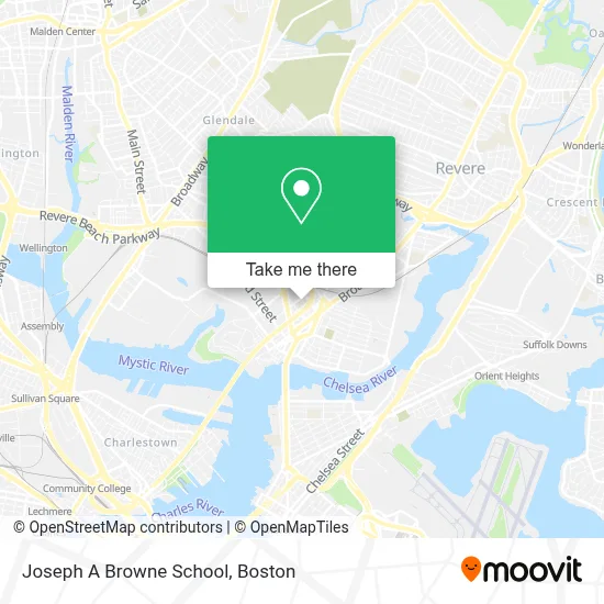
See Joseph A Browne School, Chelsea, on the map
Public Transit to Joseph A Browne School in Chelsea
Wondering how to get to Joseph A Browne School in Chelsea? Moovit helps you find the best way to get to Joseph A Browne School with step-by-step directions from the nearest public transit station.
Moovit provides free maps and live directions to help you navigate through your city. View schedules, routes, timetables, and find out how long does it take to get to Joseph A Browne School in real time.
Looking for the nearest stop or station to Joseph A Browne School? Check out this list of stops closest to your destination: Hawthorne St @ Broadway; Bellingham Square; Airport; Chelsea.
Bus: 104, 111, SL3, 112, 114, 116.Train: NEWBURYPORT/ROCKPORT.Subway: BLUE LINE.
Want to see if there’s another route that gets you there at an earlier time? Moovit helps you find alternative routes or times. Get directions from and directions to Joseph A Browne School easily from the Moovit App or Website.
We make riding to Joseph A Browne School easy, which is why over 1.7 million users, including users in Chelsea, trust Moovit as the best app for public transit. You don’t need to download an individual bus app or train app, Moovit is your all-in-one transit app that helps you find the best bus time or train time available.
For information on prices of bus and subway, costs and ride fares to Joseph A Browne School, please check the Moovit app.
Use the app to navigate to popular places including to the airport, hospital, stadium, grocery store, mall, coffee shop, school, college, and university.
Joseph A Browne School Address: 180 Walnut St street in Chelsea
- Voting at Williams School,
- Family & Chilofdren's Service Greater Lynn,
- Information Technology Div,
- Massachusetts Dept of St Treasurer,
- NT Lucky Varieties,
- Trueblue,
- Ministerio Vida en Cristo,
- Tile & Grout Cleaning,
- Yesenia Velasquez,
- Bachata Rosa Restaurant,
- Gordon, Michelle D,
- Quick Heating & Cooling Repair,
- Joseph B Gimbel Podiatrist,
- Boston Orthopaedic PC,
- Extensiones Massachusetts,
- Jonathan All Hours Lock & Key,
- Ponde Juancho,
- Global Cargo,
- Dollar Tienda,
- La Chula Restaurant
Places Near Joseph A Browne School (Chelsea)
- Prudential Center, Boston,
- Boston Medical Center, Boston,
- Boston Common, Boston,
- Museum Of Science, Boston,
- Mgm Music Hall, Boston,
- Seaport District, Boston,
- Isabella Stewart Gardner Museum, Boston,
- Wilbur Theatre, Boston,
- North End, Boston,
- Castle Island, Boston,
- Boston Children's Hospital, Boston,
- Leader Bank Pavilion (Leader Bank Pavillion), Boston,
- House Of Blues, Boston,
- Cheers, Boston,
- Td Garden, Boston,
- Boston Convention & Exhibition Center, Boston,
- Massachusetts General Hospital, Boston,
- Faneuil Hall, Boston,
- Quincy Market, Boston,
- Wang Theater, Boston
How to get to popular places in Boston with public transit
Get around Chelsea by public transit!
Traveling around Chelsea has never been so easy. See step by step directions as you travel to any attraction, street or major public transit station. View bus and train schedules, arrival times, service alerts and detailed routes on a map, so you know exactly how to get to anywhere in Chelsea.
When traveling to any destination around Chelsea use Moovit's Live Directions with Get Off Notifications to know exactly where and how far to walk, how long to wait for your line, and how many stops are left. Moovit will alert you when it's time to get off — no need to constantly re-check whether yours is the next stop.
Wondering how to use public transit in Chelsea or how to pay for public transit in Chelsea? Moovit public transit app can help you navigate your way with public transit easily, and at minimum cost. It includes public transit fees, ticket prices, and costs. Looking for a map of Chelsea public transit lines? Moovit public transit app shows all public transit maps in Chelsea with all Bus, Train, Subway and Ferry routes and stops on an interactive map.
Boston has 4 transit type(s), including: Bus, Train, Subway and Ferry, operated by several transit agencies, including MBTA, Southeastern Regional Transit Authority, MetroWest Regional Transit Authority, Rhode Island Public Transit Authority, WRTA, Lowell Regional Transit Authority, Merrimack Valley Transit, Montachusett Regional Transit Authority, Cape Cod Regional Transit Authority, Brockton Area Transit Authority, Martha's Vineyard Transit Authority, the WAVE - Nantucket Regional Transit Authority, GATRA, Cape Ann Transportation Authority and Massport