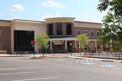
See Joseph Wheeler High School, Marietta, on the map
Directions to Joseph Wheeler High School (Marietta) with public transportation
The following transit lines have routes that pass near Joseph Wheeler High School
 Bus:
Bus:
How to get to Joseph Wheeler High School by bus?
Click on the bus route to see step by step directions with maps, line arrival times and updated time schedules.
Bus stations near Joseph Wheeler High School in Marietta
- Franklin Rd + Twin Brooks Dr,65 min walk,
Bus lines to Joseph Wheeler High School in Marietta
- 50,Marietta Transfer Center,
What are the closest stations to Joseph Wheeler High School?
The closest stations to Joseph Wheeler High School are:
- Franklin Rd + Twin Brooks Dr is 5486 yards away, 65 min walk.
Which bus line stops near Joseph Wheeler High School?
50
See Joseph Wheeler High School, Marietta, on the map
Public Transit to Joseph Wheeler High School in Marietta
Wondering how to get to Joseph Wheeler High School in Marietta, United States? Moovit helps you find the best way to get to Joseph Wheeler High School with step-by-step directions from the nearest public transit station.
Moovit provides free maps and live directions to help you navigate through your city. View schedules, routes, timetables, and find out how long does it take to get to Joseph Wheeler High School in real time.
Looking for the nearest stop or station to Joseph Wheeler High School? Check out this list of stops closest to your destination: Franklin Rd + Twin Brooks Dr.
Bus:
Want to see if there’s another route that gets you there at an earlier time? Moovit helps you find alternative routes or times. Get directions from and directions to Joseph Wheeler High School easily from the Moovit App or Website.
We make riding to Joseph Wheeler High School easy, which is why over 1.5 million users, including users in Marietta, trust Moovit as the best app for public transit. You don’t need to download an individual bus app or train app, Moovit is your all-in-one transit app that helps you find the best bus time or train time available.
For information on prices of bus and subway, costs and ride fares to Joseph Wheeler High School, please check the Moovit app.
Use the app to navigate to popular places including to the airport, hospital, stadium, grocery store, mall, coffee shop, school, college, and university.
Location: Marietta, Atlanta
Attractions near Joseph Wheeler High School
PI Inc,True Movement Association,383 Holt Rd NE,A 1 Emergency Locksmith,East Cobb Middle School,Wheeler High School,History Trailer Area @ Wheeler,Joseph E. Wheeler High School,Auto Ambassador Holding C,Property Man,380 Holt Road Northeast,East Cobb Middle School,Corky Kell Stadium at Wheeler H.S.,Edwin Crapps,Stephen's Guitar Lessons,Bulter Brothers Enterprises,English Country,Pk Industries Inc,Mej Investments Lllp,Rush Furniture 2u CoHow to get to popular attractions in Marietta with public transit
Panther Express - Turner Field Stop, Atlanta,FLiP Burger Boutique, Atlanta,Bulldogs Bar, Atlanta,GPC Shared Services, Cobb,Cobb Parkway & Windy Hill Road, Marietta,Cobb County, Marietta,American InterContinental University Atlanta (AIU), Sandy Springs,CDC Chamblee - Building 106, Chamblee,Paul Mitchell The School Esani, Alpharetta,NASCO, Sandy Springs,Cartoon Network, Atlanta,Mall of Georgia, Gwinnett,PricewaterhouseCoopers LLP, Atlanta,I-20@ Turner Hill Rd, Dekalb,GA 400: Exit 11 Windward Pkwy, Alpharetta,Northside Hospital: Labor & Delivery, Sandy Springs,Walmart Supercenter, Gwinnett,I-985: Exit 4 Buford Dr, Gwinnett,I-85 Exit 102: Beaver Ruin Rd, Gwinnett,Fulton Industrial & Camp Creek, FultonGet around Marietta by public transit!
Traveling around Marietta has never been so easy. See step by step directions as you travel to any attraction, street or major public transit station. View bus and train schedules, arrival times, service alerts and detailed routes on a map, so you know exactly how to get to anywhere in Marietta.
When traveling to any destination around Marietta use Moovit's Live Directions with Get Off Notifications to know exactly where and how far to walk, how long to wait for your line, and how many stops are left. Moovit will alert you when it's time to get off — no need to constantly re-check whether yours is the next stop.
Wondering how to use public transit in Marietta or how to pay for public transit in Marietta? Moovit public transit app can help you navigate your way with public transit easily, and at minimum cost. It includes public transit fees, ticket prices, and costs. Looking for a map of Marietta public transit lines? Moovit public transit app shows all public transit maps in Marietta with all bus or subway routes and stops on an interactive map.
Marietta has 2 transit type(s), including: bus or subway, operated by several transit agencies, including MARTA, MARTA, Metropolitan Atlanta Rapid Transit Authority, Xpress, Atlantic Station Shuttle, CobbLinc, Ride Gwinnett, Connect Douglas, Amtrak, Stinger Bus and Tech Trolley, Emory University Transportation , Panther Express, Atlanta University Center Shuttle , Rome Transit Department and FlixBus-us