Directions to Josephine's Baking Co (Boston) with public transportation
The following transit lines have routes that pass near Josephine's Baking Co
 Bus: 15, 16, 17, 28, 45.
- Train: FAIRMOUNT, FRANKLIN/FOXBORO, PROVIDENCE/STOUGHTON.
- Subway: RED LINE.
How to get to Josephine's Baking Co by bus?
Click on the bus route to see step by step directions with maps, line arrival times and updated time schedules.
From Mount Ida College, Newton
61 minFrom Heartbreak Hill, Newton
66 minFrom Newton, MA, Newton
66 minFrom Watertown Mall, Watertown Town
85 minFrom Davis Sq, Somerville
88 minFrom Georgetown, Massachusetts, Boston
64 minFrom Rental Car Center - Logan Airport, Boston
78 minFrom Belmont, MA, Belmont
86 minFrom Micro Center (Micro Elecronics), Cambridge
56 minFrom Kendall Square, Cambridge
73 min
How to get to Josephine's Baking Co by train?
Click on the train route to see step by step directions with maps, line arrival times and updated time schedules.
How to get to Josephine's Baking Co by subway?
Click on the subway route to see step by step directions with maps, line arrival times and updated time schedules.
Bus stops near Josephine's Baking Co in Boston
Train station near Josephine's Baking Co in Boston
- Uphams Corner, 11 min walk,VIEW
Subway station near Josephine's Baking Co in Boston
- Savin Hill, 24 min walk,VIEW
What are the closest stations to Josephine's Baking Co?
The closest stations to Josephine's Baking Co are:
- Columbia Rd @ Quincy St is 180 yards away, 3 min walk.
- Blue Hill Ave @ Quincy St is 330 yards away, 4 min walk.
- Uphams Corner is 866 yards away, 11 min walk.
- Savin Hill is 2021 yards away, 24 min walk.
Which bus lines stop near Josephine's Baking Co?
These bus lines stop near Josephine's Baking Co: 15, 16, 17, 28, 45.
Which train line stops near Josephine's Baking Co?
FAIRMOUNT (#1630 | South Station)
Which subway line stops near Josephine's Baking Co?
RED LINE (Ashmont/Braintree)
What’s the nearest subway station to Josephine's Baking Co in Boston?
The nearest subway station to Josephine's Baking Co in Boston is Savin Hill. It’s a 24 min walk away.
What’s the nearest train station to Josephine's Baking Co in Boston?
The nearest train station to Josephine's Baking Co in Boston is Uphams Corner. It’s a 11 min walk away.
What’s the nearest bus station to Josephine's Baking Co in Boston?
The nearest bus station to Josephine's Baking Co in Boston is Columbia Rd @ Quincy St. It’s a 3 min walk away.
What time is the first subway to Josephine's Baking Co in Boston?
The RED LINE is the first subway that goes to Josephine's Baking Co in Boston. It stops nearby at 5:21 AM.
What time is the last subway to Josephine's Baking Co in Boston?
The RED LINE is the last subway that goes to Josephine's Baking Co in Boston. It stops nearby at 1:57 AM.
What time is the first train to Josephine's Baking Co in Boston?
The FAIRMOUNT is the first train that goes to Josephine's Baking Co in Boston. It stops nearby at 4:47 AM.
What time is the last train to Josephine's Baking Co in Boston?
The FAIRMOUNT is the last train that goes to Josephine's Baking Co in Boston. It stops nearby at 12:00 AM.
What time is the first bus to Josephine's Baking Co in Boston?
The 16 is the first bus that goes to Josephine's Baking Co in Boston. It stops nearby at 4:38 AM.
What time is the last bus to Josephine's Baking Co in Boston?
The 16 is the last bus that goes to Josephine's Baking Co in Boston. It stops nearby at 1:47 AM.
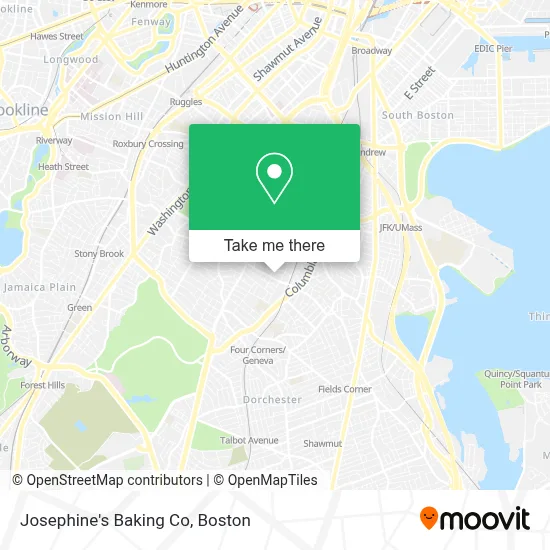
See Josephine's Baking Co, Boston, on the map
Public Transit to Josephine's Baking Co in Boston
Wondering how to get to Josephine's Baking Co in Boston? Moovit helps you find the best way to get to Josephine's Baking Co with step-by-step directions from the nearest public transit station.
Moovit provides free maps and live directions to help you navigate through your city. View schedules, routes, timetables, and find out how long does it take to get to Josephine's Baking Co in real time.
Looking for the nearest stop or station to Josephine's Baking Co? Check out this list of stops closest to your destination: Columbia Rd @ Quincy St; Blue Hill Ave @ Quincy St; Uphams Corner; Savin Hill.
Bus: 15, 16, 17, 28, 45.Train: FAIRMOUNT, FRANKLIN/FOXBORO, PROVIDENCE/STOUGHTON.Subway: RED LINE.
Want to see if there’s another route that gets you there at an earlier time? Moovit helps you find alternative routes or times. Get directions from and directions to Josephine's Baking Co easily from the Moovit App or Website.
We make riding to Josephine's Baking Co easy, which is why over 1.7 million users, including users in Boston, trust Moovit as the best app for public transit. You don’t need to download an individual bus app or train app, Moovit is your all-in-one transit app that helps you find the best bus time or train time available.
For information on prices of bus, subway and train, costs and ride fares to Josephine's Baking Co, please check the Moovit app.
Use the app to navigate to popular places including to the airport, hospital, stadium, grocery store, mall, coffee shop, school, college, and university.
Josephine's Baking Co Address: 196 Quincy St street in Boston
- Quincy Market,
- First Choice Market,
- Hartford Ct,
- Willard Basler,
- Benedict Fenwick School,
- Roxbury Prep Dorchester Campus,
- Grove Hall,
- Gentiles Record,
- Steven and Francines Locksmiths,
- Impacto Evangelistico,
- Inspired Release,
- Pine Street Inn,
- Uphams Corner Health Center,
- Cac Mt. Joy Victory Center,
- Gorgeous Lil Things,
- Gus & Gus General Contracting,
- Murphy Dennis J,
- Danube Apartments,
- Future Chefs,
- Long Distance Movers
Places Near Josephine's Baking Co (Boston)
- House Of Blues, Boston,
- Cheers, Boston,
- Castle Island, Boston,
- Boston Medical Center, Boston,
- Wang Theater, Boston,
- Massachusetts General Hospital, Boston,
- Boston Convention & Exhibition Center, Boston,
- North End, Boston,
- Prudential Center, Boston,
- Wilbur Theatre, Boston,
- Boston Children's Hospital, Boston,
- Leader Bank Pavilion (Leader Bank Pavillion), Boston,
- Faneuil Hall, Boston,
- Seaport District, Boston,
- Mgm Music Hall, Boston,
- Isabella Stewart Gardner Museum, Boston,
- Boston Common, Boston,
- Quincy Market, Boston,
- Museum Of Science, Boston,
- Td Garden, Boston
How to get to popular places in Boston with public transit
Get around Boston by public transit!
Traveling around Boston has never been so easy. See step by step directions as you travel to any attraction, street or major public transit station. View bus and train schedules, arrival times, service alerts and detailed routes on a map, so you know exactly how to get to anywhere in Boston.
When traveling to any destination around Boston use Moovit's Live Directions with Get Off Notifications to know exactly where and how far to walk, how long to wait for your line, and how many stops are left. Moovit will alert you when it's time to get off — no need to constantly re-check whether yours is the next stop.
Wondering how to use public transit in Boston or how to pay for public transit in Boston? Moovit public transit app can help you navigate your way with public transit easily, and at minimum cost. It includes public transit fees, ticket prices, and costs. Looking for a map of Boston public transit lines? Moovit public transit app shows all public transit maps in Boston with all Bus, Train, Subway and Ferry routes and stops on an interactive map.
Boston has 4 transit type(s), including: Bus, Train, Subway and Ferry, operated by several transit agencies, including MBTA, Southeastern Regional Transit Authority, MetroWest Regional Transit Authority, Rhode Island Public Transit Authority, WRTA, Lowell Regional Transit Authority, Merrimack Valley Transit, Montachusett Regional Transit Authority, Cape Cod Regional Transit Authority, Brockton Area Transit Authority, Martha's Vineyard Transit Authority, the WAVE - Nantucket Regional Transit Authority, GATRA, Cape Ann Transportation Authority and Massport