How to get to Jpa Logistica by bus?
Click on the bus route to see step by step directions with maps, line arrival times and updated time schedules.
From BRT - Estação Pontões / Barra Sul, Barra Da Tijuca
44 minFrom Campo Dos Afonsos, Campo Dos Afonsos
49 minFrom Brt Novo Leblon, Barra Da Tijuca
30 minFrom Rua Dias da Cruz, Méier
34 minFrom INCA IV, Vila Isabel
49 minFrom Madureira, Madureira
36 minFrom Avenida Marechal Fontenelle, Campo Dos Afonsos
63 minFrom Cachambi, Cachambi
35 minFrom Norte Shopping, Cachambi
30 minFrom Rua Sylvio da Rocha Pollis, Barra Da Tijuca
50 min
Bus stops near Jpa Logistica in Freguesia (Jacarepaguá)
- Garagem Viação Redentor, 3 min walk,VIEW
- Av. Ten. Cel. Muniz De Aragão | Rua Guilherme Moreira, 6 min walk,VIEW
- Avenida Tenente Coronel Muniz De Aragão | Marmoraria Mardil, 7 min walk,VIEW
- Apartamentos - Cidade De Deus (Somente Sentido Linha Amarela / Cidade De Deus), 8 min walk,VIEW
- Estr. Engenho D'Água | Caminhos Da Barra, 9 min walk,VIEW
- Avenida Tenente Coronel Muniz De Aragão, 2399, 9 min walk,VIEW
Funicular station near Jpa Logistica in Freguesia (Jacarepaguá)
- José Roiz De Aragão, 37 min walk,VIEW
Bus lines to Jpa Logistica in Freguesia (Jacarepaguá)
- 550, Gávea,VIEW
- SN 550, Cidade de Deus (Feira Livre),VIEW
- SPA 550, Rocinha,VIEW
- 558, Cidade De Deus,VIEW
- 565, Tanque ↔ Barra Da Tijuca,VIEW
- SN 565, Gávea (Feira Livre),VIEW
- 600, Saens Peña (Ⓜ️ S. Fco. Xavier),VIEW
- SN 600, Taquara (Boiúna),VIEW
- 692, Alvorada (Direto),VIEW
- 829, Gardênia Azul ↔ Freguesia,VIEW
- 932, Tanque,VIEW
- 315, Recreio - Central (BRS 5 - via Linha Amarela),VIEW
- 348, Riocentro - Candelária (Brs 5 - Via Linha Amarela),VIEW
- 352, Riocentro - Candelária (Brs 5 - Via Linha Amarela),VIEW
- 353, Gardênia Azul - Terminal Gentileza (Via Praça Seca),VIEW
- SN 353, Gardênia Azul - Terminal Gentileza (Via Praça Seca),VIEW
- 361, Recreio - Castelo (Brs 5 - Via Linha Amarela),VIEW
- 368, Riocentro - Candelária (Brs 5 - Via Maracanã),VIEW
- SN 368, Riocentro - Candelária (BRS 5 - via Maracanã),VIEW
- 410T, Coelho da Rocha - Barra da Tijuca (Via São João / Fundão),VIEW
What are the closest stations to Jpa Logistica?
The closest stations to Jpa Logistica are:
- Garagem Viação Redentor is 170 meters away, 3 min walk.
- Av. Ten. Cel. Muniz De Aragão | Rua Guilherme Moreira is 414 meters away, 6 min walk.
- Avenida Tenente Coronel Muniz De Aragão | Marmoraria Mardil is 507 meters away, 7 min walk.
- Apartamentos - Cidade De Deus (Somente Sentido Linha Amarela / Cidade De Deus) is 536 meters away, 8 min walk.
- Estr. Engenho D'Água | Caminhos Da Barra is 625 meters away, 9 min walk.
- Avenida Tenente Coronel Muniz De Aragão, 2399 is 644 meters away, 9 min walk.
- José Roiz De Aragão is 2841 meters away, 37 min walk.
Which bus lines stop near Jpa Logistica?
These bus lines stop near Jpa Logistica: 361, 565, 600, 692.
What’s the nearest bus station to Jpa Logistica in Freguesia (Jacarepaguá)?
The nearest bus station to Jpa Logistica in Freguesia (Jacarepaguá) is Garagem Viação Redentor. It’s a 3 min walk away.
What time is the first bus to Jpa Logistica in Freguesia (Jacarepaguá)?
The SN 600 is the first bus that goes to Jpa Logistica in Freguesia (Jacarepaguá). It stops nearby at 3:00 AM.
What time is the last bus to Jpa Logistica in Freguesia (Jacarepaguá)?
The 550 is the last bus that goes to Jpa Logistica in Freguesia (Jacarepaguá). It stops nearby at 4:07 AM.
What time is the first funicular to Jpa Logistica in Freguesia (Jacarepaguá)?
The IGREJA DA PENNA is the first funicular that goes to Jpa Logistica in Freguesia (Jacarepaguá). It stops nearby at 8:00 AM.
What time is the last funicular to Jpa Logistica in Freguesia (Jacarepaguá)?
The IGREJA DA PENNA is the last funicular that goes to Jpa Logistica in Freguesia (Jacarepaguá). It stops nearby at 5:00 PM.
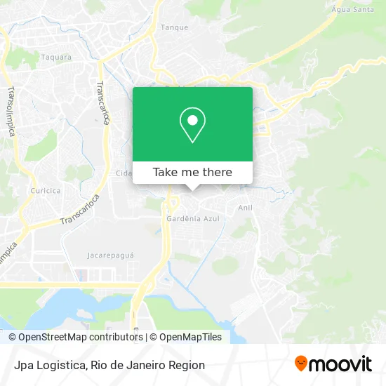
See Jpa Logistica, Freguesia (Jacarepaguá), on the map
Public Transit to Jpa Logistica in Freguesia (Jacarepaguá)
Wondering how to get to Jpa Logistica in Freguesia (Jacarepaguá)? Moovit helps you find the best way to get to Jpa Logistica with step-by-step directions from the nearest public transit station.
Moovit provides free maps and live directions to help you navigate through your city. View schedules, routes, timetables, and find out how long does it take to get to Jpa Logistica in real time.
Looking for the nearest stop or station to Jpa Logistica? Check out this list of stops closest to your destination: Garagem Viação Redentor; Av. Ten. Cel. Muniz De Aragão | Rua Guilherme Moreira; Avenida Tenente Coronel Muniz De Aragão | Marmoraria Mardil; Apartamentos - Cidade De Deus (Somente Sentido Linha Amarela / Cidade De Deus); Estr. Engenho D'Água | Caminhos Da Barra; Avenida Tenente Coronel Muniz De Aragão; José Roiz De Aragão.
Bus: 361, 565, 600, 692, 550, SN 550, SPA 550, 558, 829, 932, 315, 348, 352, 353, SN 353, 990.Funicular: IGREJA DA PENNA.
Want to see if there’s another route that gets you there at an earlier time? Moovit helps you find alternative routes or times. Get directions from and directions to Jpa Logistica easily from the Moovit App or Website.
We make riding to Jpa Logistica easy, which is why over 1.5 million users, including users in Freguesia (Jacarepaguá), trust Moovit as the best app for public transit. You don’t need to download an individual bus app or train app, Moovit is your all-in-one transit app that helps you find the best bus time or train time available.
For information on prices of bus, costs and ride fares to Jpa Logistica, please check the Moovit app.
Use the app to navigate to popular places including to the airport, hospital, stadium, grocery store, mall, coffee shop, school, college, and university.
Jpa Logistica Address: Estrada do Gabinal, 1621 Freguesia (Jacarepaguá) Rio de Janeiro-RJ 22763-153 street in Freguesia (Jacarepaguá)
- Borracheiro Gabinal,
- Estrada do Gabinal,
- Beco Do Saci,
- Estrada do Gabinal 1521,
- Espaço Mix,
- G.N.B. Industria de Baterias,
- Leke Sushi,
- Espaço Gabinal,
- Next Academy Regiao dos Lagos,
- Mate do Rio,
- Mcs Decoracoes e Tratamentos,
- Soul Web,
- Rose Vendas de Produtos e Negocios,
- R Studio,
- Mpm Empreendimentos,
- Latiffa Store,
- Cl Acessorios e Variedades,
- Redentor,
- Viacao Redentor,
- Estrada do Gabinal Próximo ao 1395
Places Near Jpa Logistica (Freguesia (Jacarepaguá))
- Shopping RioSul, Botafogo,
- Rua Licínio Cardoso, São Francisco Xavier,
- Hospital Federal Cardoso Fontes, Jacarepaguá,
- Shopping Rio Sul, Botafogo,
- Shopping Downtown, Barra Da Tijuca,
- Niterói, Niterói,
- Rua Ulysses Guimarães 16, Cidade Nova,
- Feirão De Malhas, Duque De Caxias,
- Avenida Rio Branco, Centro,
- Praia do Arpoador, Ipanema,
- Shopping Nova América, Del Castilho,
- Avenida Venezuela 134, Saúde,
- Hospital Federal Do Andaraí, Andaraí,
- Rio De Janeiro,
- Hospital Municipal Ronaldo Gazolla, Acari,
- Hospital Pedro Ernesto, Vila Isabel,
- Norte Shopping, Cachambi,
- Rodoviária Novo Rio (Rodoviária do Rio de Janeiro), Santo Cristo,
- Museu Do Amanhã, Centro,
- Feira Livre da Gloria, Glória
How to get to popular places in Rio de Janeiro Region with public transit
Get around Freguesia (Jacarepaguá) by public transit!
Traveling around Freguesia (Jacarepaguá) has never been so easy. See step by step directions as you travel to any attraction, street or major public transit station. View bus and train schedules, arrival times, service alerts and detailed routes on a map, so you know exactly how to get to anywhere in Freguesia (Jacarepaguá).
When traveling to any destination around Freguesia (Jacarepaguá) use Moovit's Live Directions with Get Off Notifications to know exactly where and how far to walk, how long to wait for your line, and how many stops are left. Moovit will alert you when it's time to get off — no need to constantly re-check whether yours is the next stop.
Wondering how to use public transit in Freguesia (Jacarepaguá) or how to pay for public transit in Freguesia (Jacarepaguá)? Moovit public transit app can help you navigate your way with public transit easily, and at minimum cost. It includes public transit fees, ticket prices, and costs. Looking for a map of Freguesia (Jacarepaguá) public transit lines? Moovit public transit app shows all public transit maps in Freguesia (Jacarepaguá) with all Bus, Train, Metro, Light Rail, Ferry, Cable Car, Gondola and Funicular routes and stops on an interactive map.
Rio de Janeiro Region has 8 transit type(s), including: Bus, Train, Metro, Light Rail, Ferry, Cable Car, Gondola and Funicular, operated by several transit agencies, including TrensRJ, Metrô Rio, VLT Carioca, Barcas Rio, BRT MOBI-Rio, Auto Viação Alpha, Auto Viação Tijuca, Gire Transportes, Transurb, Viação Nossa Senhora das Graças, Consórcio INTERSUL, Braso Lisboa (Municipal), Caprichosa Auto Ônibus, Auto Viação Três Amigos and Rodoviária Âncora Matias