Directions to Jpapts (Boston) with public transportation
The following transit lines have routes that pass near Jpapts
 Bus: 39, 35, 41, ORANGE LINE SHUTTLE, ORANGE LINE SHUTTLE.
- Train: NEEDHAM, PROVIDENCE/STOUGHTON.
- Subway: ORANGE LINE, GREEN LINE E.
How to get to Jpapts by bus?
Click on the bus route to see step by step directions with maps, line arrival times and updated time schedules.
From Wegmans, Medford
106 minFrom Hampton Inn Boston Logan Airport Chelsea, Chelsea
90 minFrom Medford, MA, Medford
96 minFrom Hatch Shell, Boston
39 minFrom Massport Bus 77 Chelsea Employee Parking, Chelsea
76 minFrom Vertex Pharmaceuticals (Fan Pier), Boston
56 minFrom TownePlace Suites Boston Logan Airport/Chelsea, Chelsea
76 minFrom Boston Landing Station, Boston
46 minFrom Harvard Square, Cambridge
48 minFrom Massport Security Badge Office, Boston
37 min
How to get to Jpapts by train?
Click on the train route to see step by step directions with maps, line arrival times and updated time schedules.
How to get to Jpapts by subway?
Click on the subway route to see step by step directions with maps, line arrival times and updated time schedules.
From Wegmans, Medford
55 minFrom Medford, MA, Medford
64 minFrom Hatch Shell, Boston
38 minFrom Massport Bus 77 Chelsea Employee Parking, Chelsea
50 minFrom Vertex Pharmaceuticals (Fan Pier), Boston
39 minFrom TownePlace Suites Boston Logan Airport/Chelsea, Chelsea
49 minFrom Boston Landing Station, Boston
70 minFrom Massport Security Badge Office, Boston
39 minFrom Harvard Square, Cambridge
45 min
Bus stops near Jpapts in Boston
Subway stations near Jpapts in Boston
Bus lines to Jpapts in Boston
- 35, Dedham Mall,VIEW
- 39, Wolcott Square Via Forest Hills,VIEW
- 41, Jfk/Umass,VIEW
- ORANGE LINE SHUTTLE, Forest Hills - Jackson Square (Shuttle),VIEW
- ORANGE LINE SHUTTLE, Forest Hills - Back Bay via Copley (Shuttle),VIEW
- ORANGE LINE SHUTTLE, Forest Hills - Ruggles,VIEW
- ORANGE LINE SHUTTLE, Forest Hills - Back Bay (Shuttle),VIEW
- ORANGE LINE SHUTTLE, Forest Hills - Copley,VIEW
- ORANGE LINE SHUTTLE, Forest Hills - Jackson Square,VIEW
- ORANGE LINE SHUTTLE, Forest Hills - Back Bay via Ruggles Busway (Shuttle),VIEW
What are the closest stations to Jpapts?
The closest stations to Jpapts are:
- Centre St Opp Beaufort Rd is 136 yards away, 2 min walk.
- Stony Brook Station - Shuttle is 447 yards away, 6 min walk.
- Green Street is 1599 yards away, 19 min walk.
- Back Of the Hill is 1804 yards away, 22 min walk.
Which bus line stops near Jpapts?
39 (Forest Hills)
Which train lines stop near Jpapts?
These train lines stop near Jpapts: NEEDHAM, PROVIDENCE/STOUGHTON.
Which subway line stops near Jpapts?
ORANGE LINE (Forest Hills)
What’s the nearest subway station to Jpapts in Boston?
The nearest subway station to Jpapts in Boston is Green Street. It’s a 19 min walk away.
What’s the nearest bus station to Jpapts in Boston?
The nearest bus station to Jpapts in Boston is Centre St Opp Beaufort Rd. It’s a 2 min walk away.
What time is the first subway to Jpapts in Boston?
The ORANGE LINE is the first subway that goes to Jpapts in Boston. It stops nearby at 5:16 AM.
What time is the last subway to Jpapts in Boston?
The GREEN LINE E is the last subway that goes to Jpapts in Boston. It stops nearby at 2:00 AM.
What time is the first bus to Jpapts in Boston?
The 39 is the first bus that goes to Jpapts in Boston. It stops nearby at 4:42 AM.
What time is the last bus to Jpapts in Boston?
The 39 is the last bus that goes to Jpapts in Boston. It stops nearby at 1:28 AM.
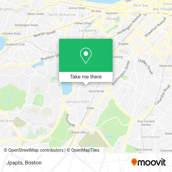
See Jpapts, Boston, on the map
Public Transit to Jpapts in Boston
Wondering how to get to Jpapts in Boston? Moovit helps you find the best way to get to Jpapts with step-by-step directions from the nearest public transit station.
Moovit provides free maps and live directions to help you navigate through your city. View schedules, routes, timetables, and find out how long does it take to get to Jpapts in real time.
Looking for the nearest stop or station to Jpapts? Check out this list of stops closest to your destination: Centre St Opp Beaufort Rd; Stony Brook Station - Shuttle; Green Street; Back Of the Hill.
Bus: 39, 35, 41, ORANGE LINE SHUTTLE, ORANGE LINE SHUTTLE, ORANGE LINE SHUTTLE, ORANGE LINE SHUTTLE, ORANGE LINE SHUTTLE.Train: NEEDHAM, PROVIDENCE/STOUGHTON.Subway: ORANGE LINE, GREEN LINE E.
Want to see if there’s another route that gets you there at an earlier time? Moovit helps you find alternative routes or times. Get directions from and directions to Jpapts easily from the Moovit App or Website.
We make riding to Jpapts easy, which is why over 1.7 million users, including users in Boston, trust Moovit as the best app for public transit. You don’t need to download an individual bus app or train app, Moovit is your all-in-one transit app that helps you find the best bus time or train time available.
For information on prices of bus, subway and train, costs and ride fares to Jpapts, please check the Moovit app.
Use the app to navigate to popular places including to the airport, hospital, stadium, grocery store, mall, coffee shop, school, college, and university.
Jpapts Address: 4 Adelaide Ter street in Boston
- Al Freshco,
- Scope HQ,
- Bloomingdales,
- Arborway Community Church,
- Body Stone and Soul,
- Hand Therapy Certified Physical Therapy,
- Jamaica Plain Chiropractic,
- Libertyx Bitcoin ATM,
- Iglesia Unidos en Cristo Acym,
- Southern Baptist Convention,
- Life Alive Organic Cafe,
- USPS Collection Box - Blue Box,
- City Sniffers Pet Services,
- Amazon Locker-Hattrick,
- Victorian Condo,
- 451 Centre St Parking,
- New England Dental Center,
- Boylston St 8th Floor Boston Ma,
- Zoey Nail Salon,
- Arbour Hospital
Places Near Jpapts (Boston)
- Leader Bank Pavilion (Leader Bank Pavillion), Boston,
- North End, Boston,
- Seaport District, Boston,
- Cheers, Boston,
- Boston Medical Center, Boston,
- Museum Of Science, Boston,
- Castle Island, Boston,
- Wilbur Theatre, Boston,
- Wang Theater, Boston,
- House Of Blues, Boston,
- Prudential Center, Boston,
- Mgm Music Hall, Boston,
- Boston Common, Boston,
- Faneuil Hall, Boston,
- Boston Children's Hospital, Boston,
- Boston Convention & Exhibition Center, Boston,
- Td Garden, Boston,
- Isabella Stewart Gardner Museum, Boston,
- Massachusetts General Hospital, Boston,
- Quincy Market, Boston
How to get to popular places in Boston with public transit
Get around Boston by public transit!
Traveling around Boston has never been so easy. See step by step directions as you travel to any attraction, street or major public transit station. View bus and train schedules, arrival times, service alerts and detailed routes on a map, so you know exactly how to get to anywhere in Boston.
When traveling to any destination around Boston use Moovit's Live Directions with Get Off Notifications to know exactly where and how far to walk, how long to wait for your line, and how many stops are left. Moovit will alert you when it's time to get off — no need to constantly re-check whether yours is the next stop.
Wondering how to use public transit in Boston or how to pay for public transit in Boston? Moovit public transit app can help you navigate your way with public transit easily, and at minimum cost. It includes public transit fees, ticket prices, and costs. Looking for a map of Boston public transit lines? Moovit public transit app shows all public transit maps in Boston with all Bus, Train, Subway and Ferry routes and stops on an interactive map.
Boston has 4 transit type(s), including: Bus, Train, Subway and Ferry, operated by several transit agencies, including MBTA, Southeastern Regional Transit Authority, MetroWest Regional Transit Authority, Rhode Island Public Transit Authority, WRTA, Lowell Regional Transit Authority, Merrimack Valley Transit, Montachusett Regional Transit Authority, Cape Cod Regional Transit Authority, Brockton Area Transit Authority, Martha's Vineyard Transit Authority, the WAVE - Nantucket Regional Transit Authority, GATRA, Cape Ann Transportation Authority and Massport