How to get to Juliet Jenkins Realtor at Leading Edge by bus?
Click on the bus route to see step by step directions with maps, line arrival times and updated time schedules.
From Wachusett mountain, Boston
73 minFrom Harvard Museum Of Natural History, Cambridge
53 minFrom Target Fenway, Boston
91 minFrom Beth Israel Deaconess Medical Center (Shapiro Garage), Boston
93 minFrom Fenway Park, Boston
85 minFrom Beth Israel Hospital, Boston
94 minFrom Sanofi-Genzyme, Waltham
112 minFrom Harvard University, Cambridge
46 minFrom Porter Square, Cambridge
64 minFrom Dana-Farber Cancer Institute, Boston
93 min
How to get to Juliet Jenkins Realtor at Leading Edge by train?
Click on the train route to see step by step directions with maps, line arrival times and updated time schedules.
Train station near Juliet Jenkins Realtor at Leading Edge in Belmont
- Waverley, 23 min walk,VIEW
What are the closest stations to Juliet Jenkins Realtor at Leading Edge?
The closest stations to Juliet Jenkins Realtor at Leading Edge are:
- Waverley is 1970 yards away, 23 min walk.
Which bus lines stop near Juliet Jenkins Realtor at Leading Edge?
These bus lines stop near Juliet Jenkins Realtor at Leading Edge: 554, 73.
Which train line stops near Juliet Jenkins Realtor at Leading Edge?
FITCHBURG (#409 | Wachusett)
What’s the nearest train station to Juliet Jenkins Realtor at Leading Edge in Belmont?
The nearest train station to Juliet Jenkins Realtor at Leading Edge in Belmont is Waverley. It’s a 23 min walk away.
What time is the first train to Juliet Jenkins Realtor at Leading Edge in Belmont?
The FITCHBURG is the first train that goes to Juliet Jenkins Realtor at Leading Edge in Belmont. It stops nearby at 5:39 AM.
What time is the last train to Juliet Jenkins Realtor at Leading Edge in Belmont?
The FITCHBURG is the last train that goes to Juliet Jenkins Realtor at Leading Edge in Belmont. It stops nearby at 12:11 AM.
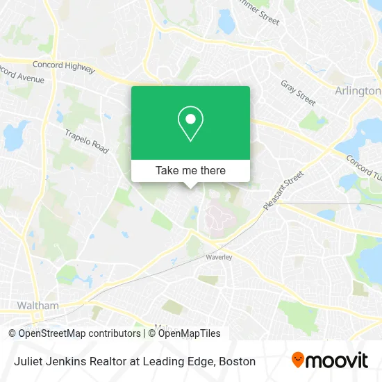
See Juliet Jenkins Realtor at Leading Edge, Belmont, on the map
Public Transit to Juliet Jenkins Realtor at Leading Edge in Belmont
Wondering how to get to Juliet Jenkins Realtor at Leading Edge in Belmont? Moovit helps you find the best way to get to Juliet Jenkins Realtor at Leading Edge with step-by-step directions from the nearest public transit station.
Moovit provides free maps and live directions to help you navigate through your city. View schedules, routes, timetables, and find out how long does it take to get to Juliet Jenkins Realtor at Leading Edge in real time.
Looking for the nearest stop or station to Juliet Jenkins Realtor at Leading Edge? Check out this list of stops closest to your destination: Waverley.
Bus: 554, 73.Train: FITCHBURG.
Want to see if there’s another route that gets you there at an earlier time? Moovit helps you find alternative routes or times. Get directions from and directions to Juliet Jenkins Realtor at Leading Edge easily from the Moovit App or Website.
We make riding to Juliet Jenkins Realtor at Leading Edge easy, which is why over 1.7 million users, including users in Belmont, trust Moovit as the best app for public transit. You don’t need to download an individual bus app or train app, Moovit is your all-in-one transit app that helps you find the best bus time or train time available.
For information on prices of bus, train and subway, costs and ride fares to Juliet Jenkins Realtor at Leading Edge, please check the Moovit app.
Use the app to navigate to popular places including to the airport, hospital, stadium, grocery store, mall, coffee shop, school, college, and university.
Juliet Jenkins Realtor at Leading Edge Address: 76 Lorimer Rd street in Belmont
- Kendall Gardens,
- Arlington School,
- McLean Hospital,
- New England Index,
- Building Maintenance & Supplies,
- Waverley Oaks Young Adult Program,
- Mls Property Information Network,
- Beaver Brook Spray Pool Park,
- M C Painting,
- Cahill Roofing,
- Waverly Oaks Playground,
- Montessori Escuela,
- Owl Hill (74m),
- BorrowLenses.com,
- The Waverley Trail,
- bp,
- Anytime Emergency Locksmith,
- Mighty Squirrel,
- Beaver Brook Reservation,
- Mike Leary at Guaranteed Rate
Places Near Juliet Jenkins Realtor at Leading Edge (Belmont)
- Faneuil Hall, Boston,
- Seaport District, Boston,
- Mgm Music Hall, Boston,
- Leader Bank Pavilion (Leader Bank Pavillion), Boston,
- North End, Boston,
- Prudential Center, Boston,
- House Of Blues, Boston,
- Isabella Stewart Gardner Museum, Boston,
- Boston Common, Boston,
- Quincy Market, Boston,
- Boston Medical Center, Boston,
- Cheers, Boston,
- Td Garden, Boston,
- Boston Children's Hospital, Boston,
- Massachusetts General Hospital, Boston,
- Castle Island, Boston,
- Wang Theater, Boston,
- Museum Of Science, Boston,
- Boston Convention & Exhibition Center, Boston,
- Wilbur Theatre, Boston
How to get to popular places in Boston with public transit
Get around Belmont by public transit!
Traveling around Belmont has never been so easy. See step by step directions as you travel to any attraction, street or major public transit station. View bus and train schedules, arrival times, service alerts and detailed routes on a map, so you know exactly how to get to anywhere in Belmont.
When traveling to any destination around Belmont use Moovit's Live Directions with Get Off Notifications to know exactly where and how far to walk, how long to wait for your line, and how many stops are left. Moovit will alert you when it's time to get off — no need to constantly re-check whether yours is the next stop.
Wondering how to use public transit in Belmont or how to pay for public transit in Belmont? Moovit public transit app can help you navigate your way with public transit easily, and at minimum cost. It includes public transit fees, ticket prices, and costs. Looking for a map of Belmont public transit lines? Moovit public transit app shows all public transit maps in Belmont with all Bus, Train, Subway and Ferry routes and stops on an interactive map.
Boston has 4 transit type(s), including: Bus, Train, Subway and Ferry, operated by several transit agencies, including MBTA, Southeastern Regional Transit Authority, MetroWest Regional Transit Authority, Rhode Island Public Transit Authority, WRTA, Lowell Regional Transit Authority, Merrimack Valley Transit, Montachusett Regional Transit Authority, Cape Cod Regional Transit Authority, Brockton Area Transit Authority, Martha's Vineyard Transit Authority, the WAVE - Nantucket Regional Transit Authority, GATRA, Cape Ann Transportation Authority and Massport