Directions to Juniper (Everett) with public transportation
The following transit lines have routes that pass near Juniper
 Bus: 104, 109, 110, 111, 112.
- Train: NEWBURYPORT/ROCKPORT.
- Subway: ORANGE LINE, BLUE LINE.
How to get to Juniper by bus?
Click on the bus route to see step by step directions with maps, line arrival times and updated time schedules.
From Emerson Colonial Theatre (Colonial Theater), Boston
47 minFrom Choi's Health Spa, Saugus
64 minFrom Homewood Suites by Hilton Boston Brookline-Longwood Medical, Brookline
95 minFrom Centre St, Boston
86 minFrom Warren St, Boston
89 minFrom 240 Mount Vernon Street, Boston
94 minFrom Hotel Hilton Boston/Woburn, Boston
83 minFrom Prometric Testing Center, Boston
70 minFrom Brattle St / Harvard Sq, Cambridge
54 minFrom COURTYARD-Boston Cambridge (Cambridge Marriott), Cambridge
69 min
How to get to Juniper by train?
Click on the train route to see step by step directions with maps, line arrival times and updated time schedules.
How to get to Juniper by subway?
Click on the subway route to see step by step directions with maps, line arrival times and updated time schedules.
From Emerson Colonial Theatre (Colonial Theater), Boston
58 minFrom Homewood Suites by Hilton Boston Brookline-Longwood Medical, Brookline
89 minFrom Centre St, Boston
70 minFrom Warren St, Boston
96 minFrom 240 Mount Vernon Street, Boston
73 minFrom Hotel Hilton Boston/Woburn, Boston
75 minFrom Prometric Testing Center, Boston
89 minFrom Brattle St / Harvard Sq, Cambridge
73 minFrom COURTYARD-Boston Cambridge (Cambridge Marriott), Cambridge
84 min
Bus stops near Juniper in Everett
Train station near Juniper in Everett
- Chelsea, 41 min walk,VIEW
Bus lines to Juniper in Everett
What are the closest stations to Juniper?
The closest stations to Juniper are:
- Everett Ave @ Carter St is 96 yards away, 2 min walk.
- Chelsea is 268 yards away, 5 min walk.
- Mason/Maxwell/Jade is 600 yards away, 8 min walk.
- Wellington is 1870 yards away, 22 min walk.
- Wood Island is 5001 yards away, 59 min walk.
Which bus lines stop near Juniper?
These bus lines stop near Juniper: 104, 109, 110, 111, 112, SL3.
Which train line stops near Juniper?
NEWBURYPORT/ROCKPORT (#125 | Newburyport)
Which subway line stops near Juniper?
ORANGE LINE (Oak Grove)
What’s the nearest subway station to Juniper in Everett?
The nearest subway station to Juniper in Everett is Wellington. It’s a 22 min walk away.
What’s the nearest bus station to Juniper in Everett?
The nearest bus station to Juniper in Everett is Everett Ave @ Carter St. It’s a 2 min walk away.
What time is the first subway to Juniper in Everett?
The BLUE LINE is the first subway that goes to Juniper in Everett. It stops nearby at 5:10 AM.
What time is the last subway to Juniper in Everett?
The BLUE LINE is the last subway that goes to Juniper in Everett. It stops nearby at 2:01 AM.
What time is the first train to Juniper in Everett?
The NEWBURYPORT/ROCKPORT is the first train that goes to Juniper in Everett. It stops nearby at 5:40 AM.
What time is the last train to Juniper in Everett?
The NEWBURYPORT/ROCKPORT is the last train that goes to Juniper in Everett. It stops nearby at 12:06 AM.
What time is the first bus to Juniper in Everett?
The SL3 is the first bus that goes to Juniper in Everett. It stops nearby at 4:43 AM.
What time is the last bus to Juniper in Everett?
The SL3 is the last bus that goes to Juniper in Everett. It stops nearby at 1:06 AM.
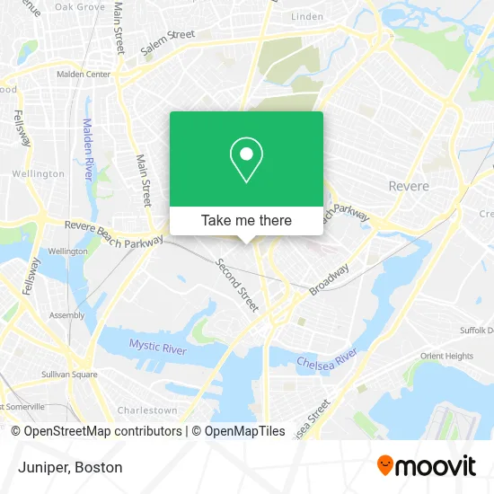
See Juniper, Everett, on the map
Public Transit to Juniper in Everett
Wondering how to get to Juniper in Everett? Moovit helps you find the best way to get to Juniper with step-by-step directions from the nearest public transit station.
Moovit provides free maps and live directions to help you navigate through your city. View schedules, routes, timetables, and find out how long does it take to get to Juniper in real time.
Looking for the nearest stop or station to Juniper? Check out this list of stops closest to your destination: Everett Ave @ Carter St; Chelsea; Mason/Maxwell/Jade; Wellington; Wood Island.
Bus: 104, 109, 110, 111, 112, SL3, LOWER MYSTIC LINK.Train: NEWBURYPORT/ROCKPORT.Subway: ORANGE LINE, BLUE LINE.
Want to see if there’s another route that gets you there at an earlier time? Moovit helps you find alternative routes or times. Get directions from and directions to Juniper easily from the Moovit App or Website.
We make riding to Juniper easy, which is why over 1.7 million users, including users in Everett, trust Moovit as the best app for public transit. You don’t need to download an individual bus app or train app, Moovit is your all-in-one transit app that helps you find the best bus time or train time available.
For information on prices of bus, subway and train, costs and ride fares to Juniper, please check the Moovit app.
Use the app to navigate to popular places including to the airport, hospital, stadium, grocery store, mall, coffee shop, school, college, and university.
Juniper Address: 201 Mill Road street in Everett
- Everett Quick to Go,
- Revere Beach Pkwy / Everett Ave,
- Panaderia Vicentina,
- Acapulco Restaurant (Acapulco Mexican Rest Y Cantina),
- Boston Harley-Davidson,
- Orange St & Revere Beach Pkwy,
- Matarazzo Tomato (Matarazzo Bros Company),
- Vietnam Veterans Memorial Swimming Pool,
- DoubleTree by Hilton Boston Logan Airport Chelsea,
- Homewood Suites by Hilton Boston Logan Airport Chelsea,
- Alaadeen Produce & Specialty Foods,
- Desimones Auto Solutions,
- Everett Public Schools,
- Envision Hotel,
- Fairfield Inn & Suites-Boston Logan,
- Fairfield Inn & Suites by Marriott Boston Logan Airport / Chelsea,
- Residence Inn by Marriott Boston Logan Airport Chelsea,
- Nelson Alvarado,
- Extra Space Storage,
- PEP Boys
Places Near Juniper (Everett)
- Seaport District, Boston,
- Boston Medical Center, Boston,
- Mgm Music Hall, Boston,
- Leader Bank Pavilion (Leader Bank Pavillion), Boston,
- Boston Convention & Exhibition Center, Boston,
- Museum Of Science, Boston,
- Castle Island, Boston,
- Boston Children's Hospital, Boston,
- Isabella Stewart Gardner Museum, Boston,
- North End, Boston,
- Boston Common, Boston,
- Wilbur Theatre, Boston,
- Wang Theater, Boston,
- Quincy Market, Boston,
- Prudential Center, Boston,
- Faneuil Hall, Boston,
- House Of Blues, Boston,
- Cheers, Boston,
- Massachusetts General Hospital, Boston,
- Td Garden, Boston
How to get to popular places in Boston with public transit
Get around Everett by public transit!
Traveling around Everett has never been so easy. See step by step directions as you travel to any attraction, street or major public transit station. View bus and train schedules, arrival times, service alerts and detailed routes on a map, so you know exactly how to get to anywhere in Everett.
When traveling to any destination around Everett use Moovit's Live Directions with Get Off Notifications to know exactly where and how far to walk, how long to wait for your line, and how many stops are left. Moovit will alert you when it's time to get off — no need to constantly re-check whether yours is the next stop.
Wondering how to use public transit in Everett or how to pay for public transit in Everett? Moovit public transit app can help you navigate your way with public transit easily, and at minimum cost. It includes public transit fees, ticket prices, and costs. Looking for a map of Everett public transit lines? Moovit public transit app shows all public transit maps in Everett with all Bus, Train, Subway and Ferry routes and stops on an interactive map.
Boston has 4 transit type(s), including: Bus, Train, Subway and Ferry, operated by several transit agencies, including MBTA, Southeastern Regional Transit Authority, MetroWest Regional Transit Authority, Rhode Island Public Transit Authority, WRTA, Lowell Regional Transit Authority, Merrimack Valley Transit, Montachusett Regional Transit Authority, Cape Cod Regional Transit Authority, Brockton Area Transit Authority, Martha's Vineyard Transit Authority, the WAVE - Nantucket Regional Transit Authority, GATRA, Cape Ann Transportation Authority and Massport