How to get to Junk Skates by bus?
Click on the bus route to see step by step directions with maps, line arrival times and updated time schedules.
Bus stops near Junk Skates in Boston
What are the closest stations to Junk Skates?
The closest stations to Junk Skates are:
- Comstock After Scituate is 50 yards away, 1 min walk.
- Cranston Industrial Park (Amflex & Comstock) is 528 yards away, 7 min walk.
Which bus line stops near Junk Skates?
19 (Walmart (Cranston))
What’s the nearest bus station to Junk Skates in Boston?
The nearest bus station to Junk Skates in Boston is Comstock After Scituate. It’s a 1 min walk away.
What time is the first bus to Junk Skates in Boston?
The 19 is the first bus that goes to Junk Skates in Boston. It stops nearby at 6:23 AM.
What time is the last bus to Junk Skates in Boston?
The 19 is the last bus that goes to Junk Skates in Boston. It stops nearby at 4:18 PM.
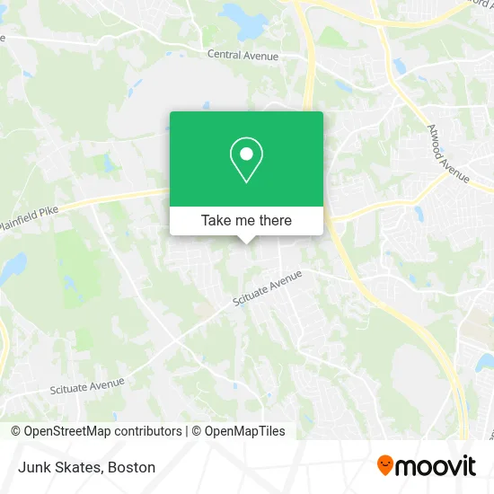
See Junk Skates, Boston, on the map
Public Transit to Junk Skates in Boston
Wondering how to get to Junk Skates in Boston? Moovit helps you find the best way to get to Junk Skates with step-by-step directions from the nearest public transit station.
Moovit provides free maps and live directions to help you navigate through your city. View schedules, routes, timetables, and find out how long does it take to get to Junk Skates in real time.
Looking for the nearest stop or station to Junk Skates? Check out this list of stops closest to your destination: Comstock After Scituate; Cranston Industrial Park (Amflex & Comstock).
Bus: 19, WM.
Want to see if there’s another route that gets you there at an earlier time? Moovit helps you find alternative routes or times. Get directions from and directions to Junk Skates easily from the Moovit App or Website.
We make riding to Junk Skates easy, which is why over 1.7 million users, including users in Boston, trust Moovit as the best app for public transit. You don’t need to download an individual bus app or train app, Moovit is your all-in-one transit app that helps you find the best bus time or train time available.
For information on prices of bus, costs and ride fares to Junk Skates, please check the Moovit app.
Use the app to navigate to popular places including to the airport, hospital, stadium, grocery store, mall, coffee shop, school, college, and university.
Junk Skates Address: 81 Western Industrial Dr street in Boston
- Technodic,
- Accel Auto LLC,
- Wishes and Warmth,
- Tradon,
- Miele's New England Realty Group,
- Michael C. Judge, Attorney at Law,
- Intl Concepts Unlimited,
- Metro Wireless,
- Saccoccio Tile N Marble,
- Accountlink Professional Accounting Services,
- Techaccess of Rhode Island,
- Empowerment Fitness and Wellness Studio,
- Modern Yoga,
- Iglesia de Cristo Casa de Jubilo - Ministerios Ebenezer Rhode Island. USA,
- Redeemed Christian Church of God - Solid Rock Tabernacle,
- K9 Connection,
- Glass America,
- The Advertising Specialty Institute,
- Salgado Locksmith,
- DUNKIN'
Places Near Junk Skates (Boston)
- Faneuil Hall, Boston,
- Wang Theater, Boston,
- Mgm Music Hall, Boston,
- Quincy Market, Boston,
- Boston Children's Hospital, Boston,
- Museum Of Science, Boston,
- Seaport District, Boston,
- Leader Bank Pavilion (Leader Bank Pavillion), Boston,
- Isabella Stewart Gardner Museum, Boston,
- House Of Blues, Boston,
- Prudential Center, Boston,
- Massachusetts General Hospital, Boston,
- North End, Boston,
- Castle Island, Boston,
- Boston Convention & Exhibition Center, Boston,
- Td Garden, Boston,
- Boston Common, Boston,
- Cheers, Boston,
- Wilbur Theatre, Boston,
- Boston Medical Center, Boston
How to get to popular places in Boston with public transit
Get around Boston by public transit!
Traveling around Boston has never been so easy. See step by step directions as you travel to any attraction, street or major public transit station. View bus and train schedules, arrival times, service alerts and detailed routes on a map, so you know exactly how to get to anywhere in Boston.
When traveling to any destination around Boston use Moovit's Live Directions with Get Off Notifications to know exactly where and how far to walk, how long to wait for your line, and how many stops are left. Moovit will alert you when it's time to get off — no need to constantly re-check whether yours is the next stop.
Wondering how to use public transit in Boston or how to pay for public transit in Boston? Moovit public transit app can help you navigate your way with public transit easily, and at minimum cost. It includes public transit fees, ticket prices, and costs. Looking for a map of Boston public transit lines? Moovit public transit app shows all public transit maps in Boston with all Bus, Train, Subway and Ferry routes and stops on an interactive map.
Boston has 4 transit type(s), including: Bus, Train, Subway and Ferry, operated by several transit agencies, including MBTA, Southeastern Regional Transit Authority, MetroWest Regional Transit Authority, Rhode Island Public Transit Authority, WRTA, Lowell Regional Transit Authority, Merrimack Valley Transit, Montachusett Regional Transit Authority, Cape Cod Regional Transit Authority, Brockton Area Transit Authority, Martha's Vineyard Transit Authority, the WAVE - Nantucket Regional Transit Authority, GATRA, Cape Ann Transportation Authority and Massport