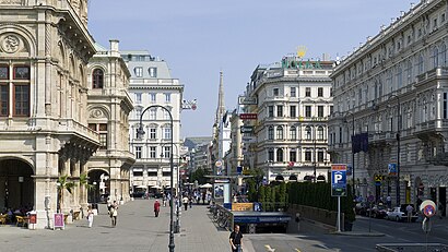
Directions to Kärntner Straße (1., Innere Stadt) with public transportation
The following transit lines have routes that pass near Kärntner Straße
How to get to Kärntner Straße by bus?
Click on the bus route to see step by step directions with maps, line arrival times and updated time schedules.
How to get to Kärntner Straße by subway?
Click on the subway route to see step by step directions with maps, line arrival times and updated time schedules.
Bus stops near Kärntner Straße in 1., Innere Stadt
- Kärntner Straße, 1 min walk,
- Oper/Karlsplatz, 3 min walk,
Light Rail stations near Kärntner Straße in 1., Innere Stadt
- Oper/Karlsplatz, 3 min walk,
Bus lines to Kärntner Straße in 1., Innere Stadt
- 2A, Schwedenplatz U,
- N71, Skodagasse,
- N75, Gasometer,
What are the closest stations to Kärntner Straße?
The closest stations to Kärntner Straße are:
- Kärntner Straße is 69 meters away, 1 min walk.
- Oper/Karlsplatz is 173 meters away, 3 min walk.
Which subway lines stop near Kärntner Straße?
These subway lines stop near Kärntner Straße: U1, U4.
Which light rail line stops near Kärntner Straße?
WLB
Which bus lines stop near Kärntner Straße?
These bus lines stop near Kärntner Straße: 2A, 59A, 5A.
What’s the nearest light rail station to Kärntner Straße in 1., Innere Stadt?
The nearest light rail station to Kärntner Straße in 1., Innere Stadt is Oper/Karlsplatz. It’s a 3 min walk away.
What’s the nearest bus stop to Kärntner Straße in 1., Innere Stadt?
The nearest bus stop to Kärntner Straße in 1., Innere Stadt is Kärntner Straße. It’s a 1 min walk away.
See Kärntner Straße, 1., Innere Stadt, on the map
Public Transit to Kärntner Straße in 1., Innere Stadt
Wondering how to get to Kärntner Straße in 1., Innere Stadt, Austria? Moovit helps you find the best way to get to Kärntner Straße with step-by-step directions from the nearest public transit station.
Moovit provides free maps and live directions to help you navigate through your city. View schedules, routes, timetables, and find out how long does it take to get to Kärntner Straße in real time.
Looking for the nearest stop or station to Kärntner Straße? Check out this list of stops closest to your destination: Kärntner Straße; Oper/Karlsplatz.
Subway: U1, U4.Light Rail: WLB.Bus: 2A, 59A, 5A, N71, N75.
Want to see if there’s another route that gets you there at an earlier time? Moovit helps you find alternative routes or times. Get directions from and directions to Kärntner Straße easily from the Moovit App or Website.
We make riding to Kärntner Straße easy, which is why over 1.5 million users, including users in 1., Innere Stadt, trust Moovit as the best app for public transit. You don’t need to download an individual bus app or train app, Moovit is your all-in-one transit app that helps you find the best bus time or train time available.
For information on prices of bus, subway and light rail, costs and ride fares to Kärntner Straße, please check the Moovit app.
Use the app to navigate to popular places including to the airport, hospital, stadium, grocery store, mall, coffee shop, school, college, and university.
Kärntner Straße Address: Philharmonikerstraße street in 1., Innere Stadt
Attractions near Kärntner Straße
Sacher Holding GmbH,Sacher (Hotel Sacher Wien),Hotel Sacher,Café Sacher Wien,Blaue Bar,Sacher,Original Sacher-Torten Handel- und Produktionsgesellschaft m.b.H.,Otel' Zakher Vena,Otel' Zakher Vena (Отель Захер Вена),Albertinaplatz / Philharmonikerstraße,Café Sacher Wien,Theater AM Kärntnertor,Philharmoniker Straße 4,Wiener Opera,Hotel Sacher Vivaldi Yildizi,Sacher Confiserie,Sacher Eck,Ciro,Erste Bank AG,Money ExchangeHow to get to popular attractions in 1., Innere Stadt with public transit
S-Bahn Zentralfriedhof, Simmering,Ottakringer Brauerei, Ottakring,Himberger Straße 2, Favoriten,Wien Billrothstraße, Döbling,Böhmischer Prater, Favoriten,Museumsquartier Wien, Neubau,Triester Straße, Favoriten,1300 Wien-Flughafen, Gemeinde Schwechat,Grinzinger Friedhof, Döbling,Donauinsel - Höhe Floridsdorfer Brücke, Brigittenau,Multiversum Schwechat, Gemeinde Schwechat,Schmetterlinghaus, 1., Innere Stadt,Gablenzgasse, Ottakring,Hietzinger Tor, Hietzing,Lugner City (Müller), Ottakring,Wallgasse 18-20, Mariahilf,Naschmarkt, 1., Innere Stadt,Ufertaverne, Donaustadt,Palais Auersperg, Josefstadt,3D Picart Museum Vienna, 1., Innere StadtGet around Austria by public transit!
Traveling around Austria has never been so easy. See step by step directions as you travel to any attraction, street or major public transit station. View bus and train schedules, arrival times, service alerts and detailed routes on a map, so you know exactly how to get to anywhere in Austria.
When traveling to any destination around Austria use Moovit's Live Directions with Get Off Notifications to know exactly where and how far to walk, how long to wait for your line, and how many stops are left. Moovit will alert you when it's time to get off — no need to constantly re-check whether yours is the next stop.
Wondering how to use public transit in Austria or how to pay for public transit in Austria? Moovit public transit app can help you navigate your way with public transit easily, and at minimum cost. It includes public transit fees, ticket prices, and costs. Looking for a map of Austria public transit lines? Moovit public transit app shows all public transit maps in Austria with all Bus, Train, Subway, Light Rail, Ferry and Funicular routes and stops on an interactive map.
Austria has 6 transit type(s), including: Bus, Train, Subway, Light Rail, Ferry and Funicular, operated by several transit agencies, including Wiener Linien GmbH & Co KG, Vienna Airport Lines, OEBB Personenverkehr AG Kundenservice, WESTbahn Management GmbH, City Air Terminal Betriebsgesellschaft m.b.H., CAT, Österreichische Postbus AG, Wiener Lokalbahnen GmbH, Graz Linien, Graz-Köflacher Bahn und Busbetrieb GmbH, Steiermarkbahn und Bus GmbH, Linz Linien GmbH, Salzburg AG (Salzburger Lokalbahn), Salzburg AG (OBus), KMG Klagenfurt Mobil GmbH