See Kópavogur on the map
Directions to Kópavogur with public transportation
The following transit lines have routes that pass near Kópavogur
 Bus:
Bus:
How to get to Kópavogur by bus?
Click on the bus route to see step by step directions with maps, line arrival times and updated time schedules.
Bus stations near Kópavogur
- Hlíðarvegur / Grænatunga,4 min walk,
- Digranesvegur / Brattabrekka,7 min walk,
Bus lines to Kópavogur
- 35,Hamraborg,
- 36,Hamraborg,
- 4,Suðurfell,
- 28,Dalaþing,
What are the closest stations to Kópavogur?
The closest stations to Kópavogur are:
- Hlíðarvegur / Grænatunga is 242 meters away, 4 min walk.
- Digranesvegur / Brattabrekka is 470 meters away, 7 min walk.
Which bus line stops near Kópavogur?
4
What’s the nearest bus stop to Kópavogur?
The nearest bus stop to Kópavogur is Hlíðarvegur / Grænatunga. It’s a 4 min walk away.
What time is the first bus to Kópavogur?
The 4 is the first bus that goes to Kópavogur. It stops nearby at 6:36 AM.
What time is the last bus to Kópavogur?
The 4 is the last bus that goes to Kópavogur. It stops nearby at 12:38 AM.
See Kópavogur on the map
Public Transportation to Kópavogur
Wondering how to get to Kópavogur, Iceland? Moovit helps you find the best way to get to Kópavogur with step-by-step directions from the nearest public transit station.
Moovit provides free maps and live directions to help you navigate through your city. View schedules, routes, timetables, and find out how long does it take to get to Kópavogur in real time.
Looking for the nearest stop or station to Kópavogur? Check out this list of stops closest to your destination: Hlíðarvegur / Grænatunga; Digranesvegur / Brattabrekka.
Bus:
Want to see if there’s another route that gets you there at an earlier time? Moovit helps you find alternative routes or times. Get directions from and directions to Kópavogur easily from the Moovit App or Website.
We make riding to Kópavogur easy, which is why over 1.5 million users, including users in Kópavogur, trust Moovit as the best app for public transit. You don’t need to download an individual bus app or train app, Moovit is your all-in-one transit app that helps you find the best bus time or train time available.
For information on prices of bus, costs and ride fares to Kópavogur, please check the Moovit app.
Use the app to navigate to popular places including to the airport, hospital, stadium, grocery store, mall, coffee shop, school, college, and university.
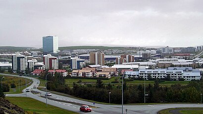
Location: Kópavogur, Ísland
Popular routes to Kópavogur
Attractions near Kópavogur
Nmk,Matsalur Mk,Mk Motuneyti,Leikskólinn Kópahvoll,Fagflísar,Pottagaldrar,ZO-ON HQ,Kvenhjolaklub Skutlur,Strætó Leið 2,Allsg,Mori,Myconceptstore.Is,Lundur,Nam ehf,Birkigrund,Art Auction For Ukrain,Rafport Ehf.,Karl K. Karlsson,Thor's Power Gym,OreindHow to get to popular attractions in Kópavogur with public transit
Reykjavík Lights Hotel, Reykjavík,Reykjavík Airport (RKV) (Reykjavíkurflugvöllur), Reykjavík,22 Hill Hotel, Reykjavík,Fjörður,Rafveituheimilið, Reykjavík,Reykjavik Art Museum / Ásmundarsafn (Listasafn Reykjavíkur / Ásmundarsafn), Reykjavík,Árbær, Reykjavík,Landspitali University Hospital, Reykjavík,Eagle Air - Flugfélagið Ernir, Reykjavík,Eyja Guldsmeden, Reykjavík,Keflavík, Reykjanesbær,National Museum of Iceland (Þjóðminjasafn Íslands), Reykjavík,Vodafonehöllin, Reykjavík,Crossfit Reykjavik, Reykjavík,Reykjavik Residence Hotel, Reykjavík,Nettó, Reykjavík,IKEA, Garðabær,Shell Skálinn Hveragerði, Hveragerði,Mjódd, Reykjavík,Solheimasandur Black Sand Beach, MýrdalshreppurGet around Kópavogur by public transit!
Traveling around Kópavogur has never been so easy. See step by step directions as you travel to any attraction, street or major public transit station. View bus and train schedules, arrival times, service alerts and detailed routes on a map, so you know exactly how to get to anywhere in Kópavogur.
When traveling to any destination around Kópavogur use Moovit's Live Directions with Get Off Notifications to know exactly where and how far to walk, how long to wait for your line, and how many stops are left. Moovit will alert you when it's time to get off — no need to constantly re-check whether yours is the next stop.
Wondering how to use public transit in Kópavogur or how to pay for public transit in Kópavogur? Moovit public transit app can help you navigate your way with public transit easily, and at minimum cost. It includes public transit fees, ticket prices, and costs. Looking for a map of Kópavogur public transit lines? Moovit public transit app shows all public transit maps in Kópavogur with all bus routes and stops on an interactive map.
Kópavogur has 1 transit type(s), including: bus, operated by several transit agencies, including Strætó bs.