See København NV, Bispebjerg, København, on the map
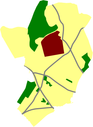
Using the 'find nearest adresses' on findvej.dk, I have manually traced the edges of the postal code. I did the tracing by having Open Street Map view on both findvej.dk and in Google Earth and thus it was easy to compare. The resulting polygon was then converted to an SVG polygon, which was then cleaned up a bit in Inkscape.
- Open Street Map data is {{Cc-by-sa-2.0}}
- Address information is released under ODIS/DGA: {{DGA map}}
Directions to København NV (Bispebjerg, København) with public transportation
The following transit lines have routes that pass near København NV
 Bus:
Bus: - Train:
How to get to København NV by bus?
Click on the bus route to see step by step directions with maps, line arrival times and updated time schedules.
How to get to København NV by train?
Click on the train route to see step by step directions with maps, line arrival times and updated time schedules.
Bus stations near København NV in Bispebjerg, København
- Nørrebro St. (Frederikssundsvej),3 min walk,
Train stations near København NV in Bispebjerg, København
- Nørrebro St.,3 min walk,
Bus lines to København NV in Bispebjerg, København
- 4A,Buddinge St.,
- 5C,Herlev Hospital,
- 250S,Bagsværd St.,
- 350S,Ballerup St.,
What are the closest stations to København NV?
The closest stations to København NV are:
- Nørrebro St. (Frederikssundsvej) is 176 meters away, 3 min walk.
- Nørrebro St. is 187 meters away, 3 min walk.
Which bus lines stop near København NV?
These bus lines stop near København NV: 350S, 4A.
Which train line stops near København NV?
F
What’s the nearest train station to København NV in Bispebjerg, København?
The nearest train station to København NV in Bispebjerg, København is Nørrebro St.. It’s a 3 min walk away.
What’s the nearest bus stop to København NV in Bispebjerg, København?
The nearest bus stop to København NV in Bispebjerg, København is Nørrebro St. (Frederikssundsvej). It’s a 3 min walk away.
See København NV, Bispebjerg, København, on the map
Using the 'find nearest adresses' on findvej.dk, I have manually traced the edges of the postal code. I did the tracing by having Open Street Map view on both findvej.dk and in Google Earth and thus it was easy to compare. The resulting polygon was then converted to an SVG polygon, which was then cleaned up a bit in Inkscape.
- Open Street Map data is {{Cc-by-sa-2.0}}
- Address information is released under ODIS/DGA: {{DGA map}}
Public Transit to København NV in Bispebjerg, København
Wondering how to get to København NV in Bispebjerg, København, Denmark? Moovit helps you find the best way to get to København NV with step-by-step directions from the nearest public transit station.
Moovit provides free maps and live directions to help you navigate through your city. View schedules, routes, timetables, and find out how long does it take to get to København NV in real time.
Looking for the nearest stop or station to København NV? Check out this list of stops closest to your destination: Nørrebro St. (Frederikssundsvej); Nørrebro St..
Bus:Train:
Want to see if there’s another route that gets you there at an earlier time? Moovit helps you find alternative routes or times. Get directions from and directions to København NV easily from the Moovit App or Website.
We make riding to København NV easy, which is why over 1.5 million users, including users in Bispebjerg, København, trust Moovit as the best app for public transit. You don’t need to download an individual bus app or train app, Moovit is your all-in-one transit app that helps you find the best bus time or train time available.
For information on prices of train and bus, costs and ride fares to København NV, please check the Moovit app.
Use the app to navigate to popular places including to the airport, hospital, stadium, grocery store, mall, coffee shop, school, college, and university.
København NV Address: Ørnevej 9, 2400 København NV, Danmark street in Bispebjerg, København
Using the 'find nearest adresses' on findvej.dk, I have manually traced the edges of the postal code. I did the tracing by having Open Street Map view on both findvej.dk and in Google Earth and thus it was easy to compare. The resulting polygon was then converted to an SVG polygon, which was then cleaned up a bit in Inkscape.
- Open Street Map data is {{Cc-by-sa-2.0}}
- Address information is released under ODIS/DGA: {{DGA map}}
Attractions near København NV
Ørnevej 6,MailMeNetwork,Telenor © i Føtex Nørrebro,Nordre Fasanvej,Fitness World København Nordre Fasanvej,Falkevej 4,Nørrebro St. (Nordre Fasanvej),Netto,Nørrebro Station,Frederikssundsvej 7,bus 350S dragør,7-Eleven,3. tv,Nørrebro st. - spor 12,Nørrebro,Bus 5C Citybus Herlev Hospital - Husum Torv - Sundbyvester Plads - Københavns Lufthavn,Glentevej 10,Nørrebro st.,Hyltebro 4,2 salHow to get to popular attractions in Bispebjerg, København with public transit
Ormslev, Århus,Finsensvej, Frederiksberg,Hvidovre Hospital Busstop, Hvidovre,Rødding, Viborg,Meny, Aalborg,Marselisborg Dyrehave, Århus,AARHUS TECH, Århus,Sønderborg, Sønderborg,Bus 10 (Rådhuspladsen - Brønshøj Torv), Frederiksberg,Sæby, Frederikshavn,Vilhelm Kiers Kollegium, Århus,Vejle Transportcenter, Vejle,Busstop - Odense Banegård Center, Odense,DSB Hovedkontor, Høje Taastrup,Svendborg, Svendborg,Høje Taastrup Station, Busholdepladsen, Høje Taastrup,Skejbyparken, Århus,Lønstrup, Hjørring,Hareskov st., Furesø,Linie 888, Abildskou, KøbenhavnGet around Bispebjerg, København by public transit!
Traveling around Bispebjerg, København has never been so easy. See step by step directions as you travel to any attraction, street or major public transit station. View bus and train schedules, arrival times, service alerts and detailed routes on a map, so you know exactly how to get to anywhere in Bispebjerg, København.
When traveling to any destination around Bispebjerg, København use Moovit's Live Directions with Get Off Notifications to know exactly where and how far to walk, how long to wait for your line, and how many stops are left. Moovit will alert you when it's time to get off — no need to constantly re-check whether yours is the next stop.
Wondering how to use public transit in Bispebjerg, København or how to pay for public transit in Bispebjerg, København? Moovit public transit app can help you navigate your way with public transit easily, and at minimum cost. It includes public transit fees, ticket prices, and costs. Looking for a map of Bispebjerg, København public transit lines? Moovit public transit app shows all public transit maps in Bispebjerg, København with all train or bus routes and stops on an interactive map.
Bispebjerg, København has 2 transit type(s), including: train or bus, operated by several transit agencies, including Metroselskabet, DSB S-tog, Lokaltog A/S, DSB S-tog, Midttrafik, Odense Letbane, DSB, NT, GoCollective, Midttrafik, Skånetrafiken, Metroselskabet, Movia, NT and Midttrafik