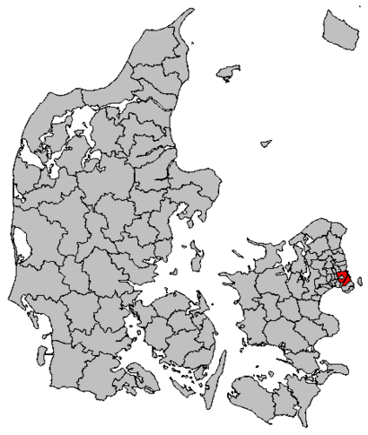
See Københavns Kommune on the map
Directions to Københavns Kommune with public transportation
The following transit lines have routes that pass near Københavns Kommune
 Bus:
Bus: - Train:
- Metro:
How to get to Københavns Kommune by bus?
Click on the bus route to see step by step directions with maps, line arrival times and updated time schedules.
How to get to Københavns Kommune by train?
Click on the train route to see step by step directions with maps, line arrival times and updated time schedules.
How to get to Københavns Kommune by metro?
Click on the metro route to see step by step directions with maps, line arrival times and updated time schedules.
Metro stations near Københavns Kommune
- Nordhavn St. (Metro),2 min walk,
- Vibenshus Runddel St. (Metro),9 min walk,
Bus stations near Københavns Kommune
- Serridslevvej (Jagtvej),3 min walk,
- Nygårdsvej (Vennemindevej),4 min walk,
- Århusgade (Østerbrogade),5 min walk,
- Nygårdsvej (Østerbrogade),6 min walk,
Train stations near Københavns Kommune
- Nordhavn St.,9 min walk,
Bus lines to Københavns Kommune
- 14,Nørreport St.,
- 12,Svanemøllen St.,
- 1A,Hellerup St.,
- 23,Klampenborg St.,
What are the closest stations to Københavns Kommune?
The closest stations to Københavns Kommune are:
- Nordhavn St. (Metro) is 79 meters away, 2 min walk.
- Serridslevvej (Jagtvej) is 202 meters away, 3 min walk.
- Nygårdsvej (Vennemindevej) is 242 meters away, 4 min walk.
- Århusgade (Østerbrogade) is 315 meters away, 5 min walk.
- Nygårdsvej (Østerbrogade) is 417 meters away, 6 min walk.
- Vibenshus Runddel St. (Metro) is 625 meters away, 9 min walk.
- Nordhavn St. is 683 meters away, 9 min walk.
Which bus lines stop near Københavns Kommune?
These bus lines stop near Københavns Kommune: 14, 1A.
Which train lines stop near Københavns Kommune?
These train lines stop near Københavns Kommune: A, B, E.
Which metro line stops near Københavns Kommune?
M3
What’s the nearest metro station to Københavns Kommune?
The nearest metro station to Københavns Kommune is Nordhavn St. (Metro). It’s a 2 min walk away.
What’s the nearest train station to Københavns Kommune?
The nearest train station to Københavns Kommune is Nordhavn St.. It’s a 9 min walk away.
What’s the nearest bus stop to Københavns Kommune?
The nearest bus stop to Københavns Kommune is Serridslevvej (Jagtvej). It’s a 3 min walk away.
What time is the first metro to Københavns Kommune?
The M3 is the first metro that goes to Københavns Kommune. It stops nearby at 3:00 AM.
What time is the last metro to Københavns Kommune?
The M3 is the last metro that goes to Københavns Kommune. It stops nearby at 3:08 AM.
What time is the first train to Københavns Kommune?
The C is the first train that goes to Københavns Kommune. It stops nearby at 5:07 AM.
What time is the last train to Københavns Kommune?
The B is the last train that goes to Københavns Kommune. It stops nearby at 12:51 AM.
What time is the first bus to Københavns Kommune?
The 1A is the first bus that goes to Københavns Kommune. It stops nearby at 3:01 AM.
What time is the last bus to Københavns Kommune?
The 1A is the last bus that goes to Københavns Kommune. It stops nearby at 3:43 AM.
See Københavns Kommune on the map
Public Transportation to Københavns Kommune
Wondering how to get to Københavns Kommune, Denmark? Moovit helps you find the best way to get to Københavns Kommune with step-by-step directions from the nearest public transit station.
Moovit provides free maps and live directions to help you navigate through your city. View schedules, routes, timetables, and find out how long does it take to get to Københavns Kommune in real time.
Looking for the nearest stop or station to Københavns Kommune? Check out this list of stops closest to your destination: Nordhavn St. (Metro); Serridslevvej (Jagtvej); Nygårdsvej (Vennemindevej); Århusgade (Østerbrogade); Nygårdsvej (Østerbrogade); Vibenshus Runddel St. (Metro); Nordhavn St..
Bus:Train:Metro:
Want to see if there’s another route that gets you there at an earlier time? Moovit helps you find alternative routes or times. Get directions from and directions to Københavns Kommune easily from the Moovit App or Website.
We make riding to Københavns Kommune easy, which is why over 1.5 million users, including users in København, trust Moovit as the best app for public transit. You don’t need to download an individual bus app or train app, Moovit is your all-in-one transit app that helps you find the best bus time or train time available.
For information on prices of bus, train and metro, costs and ride fares to Københavns Kommune, please check the Moovit app.
Use the app to navigate to popular places including to the airport, hospital, stadium, grocery store, mall, coffee shop, school, college, and university.
Københavns Kommune Address: Jagtvej 227 Østerbro, 2100 København Ø street in København
Attractions near Københavns Kommune
Borgerservice Ø,Øbro Jagtvej Bibliotek,Metro-Poul Henningsens Plads,Jagtvej,Andels.Net,First-8.Dk - Danmarks Største Hjertestarter Webshop,Østerbro Apotek,Kiosk,Galleri.Rocks/Music Qu,Restaurant Hong Cheng,Østerbrogade (Jagtvej),Dealdelight Aps,Jens Jensen It,Flügger,Poul Henningsens Plads,Vitalzone,Det Rene Brød,Advokat Torben Henriksen,Lan Aps,Vibenshus BodegaHow to get to popular attractions in København with public transit
Regionaltog (Østerport st - Ringsted st), Roskilde,Esbjerg, Esbjerg,Albertslund Bibliotek, Hovedbiblioteket, Albertslund,Gågaden, Odense,Roskilde Dyrskueplads, Roskilde,Bus 10 (Rådhuspladsen - Brønshøj Torv), Frederiksberg,Center Pubben, Hørsholm Midtpunkt, Hørsholm,Memphis Mansion, Randers,Svendborgsund Broen,Svendborg, Svendborg,Nonnesøen, Rudersdal,Kolding Sygehus, Kolding,COWI A/S, Lyngby-Taarbæk,Molslinien, Max Mols, Odsherred,Busstop Silkeborgvej / Åby Ringvej, Århus,Scandic Hotel Sønderborg, Sønderborg,Aarhus Rutebilstation, Århus,Dansk Supermarked, Århus,VIA University College Campus Aarhus C, Århus,Ingerslev Marked, ÅrhusGet around København by public transit!
Traveling around København has never been so easy. See step by step directions as you travel to any attraction, street or major public transit station. View bus and train schedules, arrival times, service alerts and detailed routes on a map, so you know exactly how to get to anywhere in København.
When traveling to any destination around København use Moovit's Live Directions with Get Off Notifications to know exactly where and how far to walk, how long to wait for your line, and how many stops are left. Moovit will alert you when it's time to get off — no need to constantly re-check whether yours is the next stop.
Wondering how to use public transit in København or how to pay for public transit in København? Moovit public transit app can help you navigate your way with public transit easily, and at minimum cost. It includes public transit fees, ticket prices, and costs. Looking for a map of København public transit lines? Moovit public transit app shows all public transit maps in København with all bus, train or metro routes and stops on an interactive map.
København has 3 transit type(s), including: bus, train or metro, operated by several transit agencies, including Metroselskabet, DSB S-tog, Lokaltog A/S, DSB S-tog, Midttrafik, Odense Letbane, DSB, NT, GoCollective, Midttrafik, Skånetrafiken, Metroselskabet, Movia, NT and Midttrafik