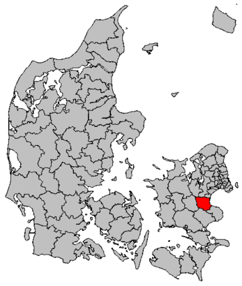
See Køge Kommune on the map
Directions to Køge Kommune with public transportation
The following transit lines have routes that pass near Køge Kommune
 Bus:
Bus: - Train:
How to get to Køge Kommune by bus?
Click on the bus route to see step by step directions with maps, line arrival times and updated time schedules.
How to get to Køge Kommune by train?
Click on the train route to see step by step directions with maps, line arrival times and updated time schedules.
Bus stations near Køge Kommune
- Køge St.,5 min walk,
- Carlsensvej (Toldbodvej),15 min walk,
Train stations near Køge Kommune
- Køge St.,6 min walk,
Bus lines to Køge Kommune
- 101A,Hastrup Fasanvej (Langelandsvej) - Køge Nord St. (Nordstjernen),
- 102A,Køge St. (Ivar Huitfeldtsvej) - Præstø (Havnevej),
- 241,Herfølge Skole (Billesborgvej) - Køge St.,
- 245R,Borup St. - Køge St.,
- 251,Køge St. Østre Banevej (Østre Banevej) - Mandehoved,
- 99N,Hårlev St. - Køge St. Østre Banevej (Østre Banevej),
- 108,Køge St. Østre Banevej (Østre Banevej) - Køge St. Østre Banevej (Østre Banevej),
- 109,Strøby Strandvejen (Strøby Bygade) - Køge St. Østre Banevej (Østre Banevej),
- 254,Køge St. Østre Banevej (Østre Banevej) - Hårlev St.,
What are the closest stations to Køge Kommune?
The closest stations to Køge Kommune are:
- Køge St. is 344 meters away, 5 min walk.
- Carlsensvej (Toldbodvej) is 1063 meters away, 15 min walk.
Which bus lines stop near Køge Kommune?
These bus lines stop near Køge Kommune: 101A, 102A, 103.
Which train lines stop near Køge Kommune?
These train lines stop near Køge Kommune: E, RE.
What’s the nearest train station to Køge Kommune?
The nearest train station to Køge Kommune is Køge St.. It’s a 6 min walk away.
What’s the nearest bus stop to Køge Kommune?
The nearest bus stop to Køge Kommune is Køge St.. It’s a 5 min walk away.
See Køge Kommune on the map
Public Transportation to Køge Kommune
Wondering how to get to Køge Kommune, Denmark? Moovit helps you find the best way to get to Køge Kommune with step-by-step directions from the nearest public transit station.
Moovit provides free maps and live directions to help you navigate through your city. View schedules, routes, timetables, and find out how long does it take to get to Køge Kommune in real time.
Looking for the nearest stop or station to Køge Kommune? Check out this list of stops closest to your destination: Køge St.; Carlsensvej (Toldbodvej).
Bus:Train:
Want to see if there’s another route that gets you there at an earlier time? Moovit helps you find alternative routes or times. Get directions from and directions to Køge Kommune easily from the Moovit App or Website.
We make riding to Køge Kommune easy, which is why over 1.5 million users, including users in Køge, trust Moovit as the best app for public transit. You don’t need to download an individual bus app or train app, Moovit is your all-in-one transit app that helps you find the best bus time or train time available.
For information on prices of bus and train, costs and ride fares to Køge Kommune, please check the Moovit app.
Use the app to navigate to popular places including to the airport, hospital, stadium, grocery store, mall, coffee shop, school, college, and university.
Køge Kommune Address: Torvet 2 street in Køge
Attractions near Køge Kommune
Bones,Siesta Prime Grill,Nordisk Film Biografer Køge,Slagteriudsalget Mad Med Mere,Sportmaster, Køge,VERO MODA,Torvet 1,Vinspecialisten Køge,Christians Minde,Køge Apotek, Torvet,Nicolai's Bageri,Køge Frimærke- & Mønthandel,Fiskemanden,Peter's Auto,Malm, Eva,Pensionistforeningen for Køge og Omegn,Danske Bank,Textilagent,La Boutique, Parfumeri,Scala, SalonHow to get to popular attractions in Køge with public transit
FMI Kapacitetsansvarlig Koncern IT (KAKI), Hvidovre,Søborg, Gladsaxe,Falkonergårdens Gymnasium og HF, Frederiksberg,Virum, Lyngby-Taarbæk,Aarhus Rutebilstation, Århus,Vallensbæk st., Vallensbæk,Kerteminde, Kerteminde,Scandic Hotel Sønderborg, Sønderborg,Gågaden, Odense,Diakonhøjskolen, Århus,Ølstykke St., Egedal,Busstop Silkeborgvej / Åby Ringvej, Århus,Hvidovre Hospital Busstop, Hvidovre,Aalborg Vestby Station, Aalborg,Skejbyparken, Århus,Lille Torv, Århus,Løkken Strand, Hjørring,Fitness dk, Odense,Nonnesøen, Rudersdal,Kolding Sygehus, KoldingGet around Køge by public transit!
Traveling around Køge has never been so easy. See step by step directions as you travel to any attraction, street or major public transit station. View bus and train schedules, arrival times, service alerts and detailed routes on a map, so you know exactly how to get to anywhere in Køge.
When traveling to any destination around Køge use Moovit's Live Directions with Get Off Notifications to know exactly where and how far to walk, how long to wait for your line, and how many stops are left. Moovit will alert you when it's time to get off — no need to constantly re-check whether yours is the next stop.
Wondering how to use public transit in Køge or how to pay for public transit in Køge? Moovit public transit app can help you navigate your way with public transit easily, and at minimum cost. It includes public transit fees, ticket prices, and costs. Looking for a map of Køge public transit lines? Moovit public transit app shows all public transit maps in Køge with all bus or train routes and stops on an interactive map.
Køge has 2 transit type(s), including: bus or train, operated by several transit agencies, including Metroselskabet, DSB S-tog, Lokaltog A/S, DSB S-tog, Midttrafik, Odense Letbane, DSB, NT, GoCollective, Midttrafik, Skånetrafiken, Metroselskabet, Movia, NT and Midttrafik