See Køge MC on the map
Directions to Køge MC with public transportation
The following transit lines have routes that pass near Køge MC
 Bus:
Bus: - Train:
How to get to Køge MC by bus?
Click on the bus route to see step by step directions with maps, line arrival times and updated time schedules.
How to get to Køge MC by train?
Click on the train route to see step by step directions with maps, line arrival times and updated time schedules.
Train stations near Køge MC
- Ølby St.,1 min walk,
- Køge Nord St.,31 min walk,
Bus stations near Køge MC
- Norsvej (Stensbjergvej),1 min walk,
- Stensbjergvej (Karlemosevej),3 min walk,
- Vamdrupvej (Ølbyvej),14 min walk,
Bus lines to Køge MC
- 101A,Ølby St.,
- 242,Ejby Fuglevænget.,
- 245R,Borup St.,
What are the closest stations to Køge MC?
The closest stations to Køge MC are:
- Ølby St. is 12 meters away, 1 min walk.
- Norsvej (Stensbjergvej) is 40 meters away, 1 min walk.
- Stensbjergvej (Karlemosevej) is 165 meters away, 3 min walk.
- Vamdrupvej (Ølbyvej) is 1067 meters away, 14 min walk.
- Køge Nord St. is 2380 meters away, 31 min walk.
Which bus lines stop near Køge MC?
These bus lines stop near Køge MC: 101A, 121, 260R.
Which train lines stop near Køge MC?
These train lines stop near Køge MC: 110R, A, RE.
What’s the nearest train station to Køge MC?
The nearest train station to Køge MC is Ølby St.. It’s a 1 min walk away.
What’s the nearest bus stop to Køge MC?
The nearest bus stop to Køge MC is Norsvej (Stensbjergvej). It’s a 1 min walk away.
What time is the first train to Køge MC?
The A is the first train that goes to Køge MC. It stops nearby at 3:03 AM.
What time is the last train to Køge MC?
The 110R is the last train that goes to Køge MC. It stops nearby at 1:48 AM.
What time is the first bus to Køge MC?
The 101A is the first bus that goes to Køge MC. It stops nearby at 3:02 AM.
What time is the last bus to Køge MC?
The 245R is the last bus that goes to Køge MC. It stops nearby at 12:45 AM.
See Køge MC on the map
Public Transportation to Køge MC
Wondering how to get to Køge MC, Denmark? Moovit helps you find the best way to get to Køge MC with step-by-step directions from the nearest public transit station.
Moovit provides free maps and live directions to help you navigate through your city. View schedules, routes, timetables, and find out how long does it take to get to Køge MC in real time.
Looking for the nearest stop or station to Køge MC? Check out this list of stops closest to your destination: Ølby St.; Norsvej (Stensbjergvej); Stensbjergvej (Karlemosevej); Vamdrupvej (Ølbyvej); Køge Nord St..
Bus:Train:
Want to see if there’s another route that gets you there at an earlier time? Moovit helps you find alternative routes or times. Get directions from and directions to Køge MC easily from the Moovit App or Website.
We make riding to Køge MC easy, which is why over 1.5 million users, including users in Køge, trust Moovit as the best app for public transit. You don’t need to download an individual bus app or train app, Moovit is your all-in-one transit app that helps you find the best bus time or train time available.
For information on prices of bus and train, costs and ride fares to Køge MC, please check the Moovit app.
Use the app to navigate to popular places including to the airport, hospital, stadium, grocery store, mall, coffee shop, school, college, and university.
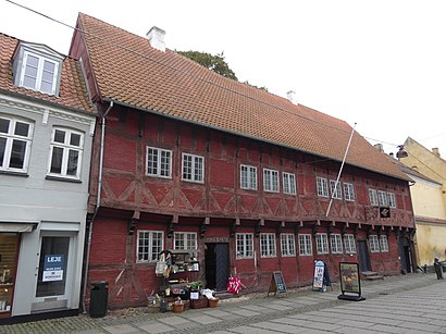
Køge MC Address: Falkevej 38 4600 Køge street in Køge
Køge Museum is a local history museum in Køge, Denmark.Wiki
Attractions near Køge MC
Køge Mc & Båd-Center V / Kim Kristiansen,Ejendomsselskabet Grønnevej Køge Syd Aps,Jacobil A/S,Avis Biludlejning,Autolandet Aps,AVIS-Afhentning,Norsvej (Stensbjergvej),Anders Iversen,J. Christensen Transport & Entreprenørforretning Aps,New Zento Collection Aps,Gitte Kristensen,Din Autoreparatør,Petersen Trading Aps,Vending Service Aps,Koeges Glarmester,Køge el-Service Aps,Rapco Aps,Køge Auto-Elektric Aps,Ørnevej Holding ApS,B.L. Ejendomsservice A/SHow to get to popular attractions in Køge with public transit
Kerteminde, Kerteminde,Center Pubben, Hørsholm Midtpunkt, Hørsholm,Hornbæk, Helsingør,Vigerslev Alle Station, København,Degnemosen, København,FMI Kapacitetsansvarlig Koncern IT (KAKI), Hvidovre,Åmarken Station, Hvidovre,Hotel Propellen Billund, Billund,Jersie st., Solrød,Scandic Hotel Sønderborg, Sønderborg,Munkebjerg Hotel & Casino, Vejle,Vejle Transportcenter, Vejle,Memphis Mansion, Randers,Slagelse, Slagelse,COWI A/S, Lyngby-Taarbæk,Skejbyparken, Århus,Matematisk Kantine, Aarhus Universitet, Århus,Fisketorvet, København,Regionaltog (Østerport st - Ringsted st), Roskilde,Rødding, ViborgGet around Køge by public transit!
Traveling around Køge has never been so easy. See step by step directions as you travel to any attraction, street or major public transit station. View bus and train schedules, arrival times, service alerts and detailed routes on a map, so you know exactly how to get to anywhere in Køge.
When traveling to any destination around Køge use Moovit's Live Directions with Get Off Notifications to know exactly where and how far to walk, how long to wait for your line, and how many stops are left. Moovit will alert you when it's time to get off — no need to constantly re-check whether yours is the next stop.
Wondering how to use public transit in Køge or how to pay for public transit in Køge? Moovit public transit app can help you navigate your way with public transit easily, and at minimum cost. It includes public transit fees, ticket prices, and costs. Looking for a map of Køge public transit lines? Moovit public transit app shows all public transit maps in Køge with all bus or train routes and stops on an interactive map.
Køge has 2 transit type(s), including: bus or train, operated by several transit agencies, including Metroselskabet, DSB S-tog, Lokaltog A/S, DSB S-tog, Midttrafik, Odense Letbane, DSB, NT, GoCollective, Midttrafik, Skånetrafiken, Metroselskabet, Movia, NT and Midttrafik